EP0446902A2 - Automatic travelling apparatus - Google Patents
Automatic travelling apparatus Download PDFInfo
- Publication number
- EP0446902A2 EP0446902A2 EP91103852A EP91103852A EP0446902A2 EP 0446902 A2 EP0446902 A2 EP 0446902A2 EP 91103852 A EP91103852 A EP 91103852A EP 91103852 A EP91103852 A EP 91103852A EP 0446902 A2 EP0446902 A2 EP 0446902A2
- Authority
- EP
- European Patent Office
- Prior art keywords
- vehicle
- image
- target course
- steering
- area
- Prior art date
- Legal status (The legal status is an assumption and is not a legal conclusion. Google has not performed a legal analysis and makes no representation as to the accuracy of the status listed.)
- Granted
Links
Images


Classifications
-
- G—PHYSICS
- G05—CONTROLLING; REGULATING
- G05D—SYSTEMS FOR CONTROLLING OR REGULATING NON-ELECTRIC VARIABLES
- G05D1/00—Control of position, course or altitude of land, water, air, or space vehicles, e.g. automatic pilot
- G05D1/02—Control of position or course in two dimensions
- G05D1/021—Control of position or course in two dimensions specially adapted to land vehicles
- G05D1/0212—Control of position or course in two dimensions specially adapted to land vehicles with means for defining a desired trajectory
-
- G—PHYSICS
- G05—CONTROLLING; REGULATING
- G05D—SYSTEMS FOR CONTROLLING OR REGULATING NON-ELECTRIC VARIABLES
- G05D1/00—Control of position, course or altitude of land, water, air, or space vehicles, e.g. automatic pilot
- G05D1/02—Control of position or course in two dimensions
- G05D1/021—Control of position or course in two dimensions specially adapted to land vehicles
- G05D1/0231—Control of position or course in two dimensions specially adapted to land vehicles using optical position detecting means
- G05D1/0246—Control of position or course in two dimensions specially adapted to land vehicles using optical position detecting means using a video camera in combination with image processing means
Definitions
- the present invention relates to an automatic travelling apparatus capable of finding out a permissible travelling area for the purpose of permitting a vehicle to automatically run on a road.
- the automatic travelling apparatus disclosed in the Japanese laid open patent publication No. 199610-88 is intended to continuously take an image of an area ahead of a vehicle in its running direction by an image pick-up device attached to the vehicle; make sampling of the image thus taken and data processing for extracting therefrom continuous line segments such as road edges; determine a a permissible travelling area ahead of the vehicle on the basis of the extracted continuous line segments; set a target course in the determined permissible travelling area; estimate a steering amount necessary for following the target course on the basis of the currently detected running condition of the vehicle; and steer the vehicle to follow the target course with reference to the steering amount.
- the steering control may be more accurate as the sampling period i.e., steering control cycle is shorter.
- the time required for processing each image and finally determining a permissible travelling area is fairly longer in comparison with the processing time for steering vehicle to follow the target course set in the permissible travelling area.
- the image processing time is 500 milliseconds whereas the processing time for steering control is 10 milliseconds.
- the vehicle may travel enough to produce a deviation of its actual position with respect to the determined permissible travelling area, i.e., higher running speed brings larger deviation, causing a considerable decrease in accuracy of the steering control.
- the present invention was made to provide an automatic travelling apparatus which is capable of renewing the vehicle position relative to the permissible travelling area, which is given for the current control cycle, on the basis of its actual running condition and also of resetting the corresponding target course in the permissible travelling area in respect to the renewed position for the purpose of apparently shortening a control cycle time and thereby minimizing a deviation of the actual position of the vehicle with respect to the permissible travelling area even if the image processing time is extended.
- Fig. 1 is a block diagram showing a structure of an automatic travelling apparatus embodying the present invention.
- Fig. 2 shows a line segment of a road obtained on the basis of processing an image taken by a video camera.
- Fig. 3 shows an image obtained by projective transformation of the image shown in Fig. 2.
- Fig. 4 shows an example of a target course set in a permissible area within a road width.
- Figs. 5 (a) and 5 (b) show target courses set on a road which a vehicle is to travel at a low speed (a) and a high speed (b) respectively.
- Fig. 6 shows a relationship between a target course and a presumed course.
- Fig. 7 shows a relationship between a vehicle's steering angle and its turning radius.
- Fig. 8 shows a travelling state of a vehicle in a permissible travelling area.
- Fig. 9 (a) shows a position and a running direction of a vehicle in a permissible travelling area at a certain time.
- Fig. 9 (b) shows a state obtained by coordinate transformation of a permissible travelling area in relation to a position and a running direction of a vehicle in a permissible travelling area.
- Fig. 10 shows a line segment in the X-Y coordinates.
- Fig. 11 shows a point on the p- ⁇ point coordinates obtained by the Hough conversion of the line segment shown in Fig. 10.
- Fig. 12 shows timings of processings in one control cycle.
- Fig. 13 shows a flow chart of image processing.
- Fig. 14 shows a flow chart of updating the vehicle position during image sampling.
- 1 is an image pick-up device, 2 an image processor, 3 a means for determining a permissible travelling area, 4 a means for setting a target course, 5 a controlling means, 6 a running speed sensor, 7 a Yaw rate sensor, 8 a steering angle sensor, 9 a steering controller, 10 a steering drive, 11 a vehicle.
- Characters RA, RA' denote permissible travelling areas and characters OC, OC' denote target courses.
- an automatic travelling apparatus comprises: an image pick-up device 1 such as a video camera attached to a vehicle for continuously picking up subsequent images of ground ahead of the vehicle; means 2 for processing the images taken by the image pick-up device 1 to extract therefrom segments of continuous lines such as road edges and the like; means 3 for determining, on the basis of the obtained continuous line segments, a permissible travelling area such as a road in the direction in which the vehicle is to travel; means 4 for setting a target course in the permissible travelling area thus determined; means 5 for determining the instantaneous running condition of the vehicle on the basis of an output signal from a speed sensor 6 representing the vehicle's running speed "v", an output signal from a jaw rate sensor 7 representing the yaw rate " ⁇ " and an output signal from a steering angle sensor 8 representing the tire angle " ⁇ " which varies with the steering of the vehicle, and for estimating, on an image pick-up device 1 such as a video camera attached to a vehicle for continuously picking up subsequent images of ground ahead of the vehicle; means 2 for processing the images
- microcomputer aided control is used in place of means 2, 3, 4 and 5, and means 9 can be included in the microcomputer aided control, if occasions demand.
- the extraction of continuous line segments such as road edges from the takeb image in the image processing means 2 can be made as follows: First, each image supplied from the image pick-up device 1 is subjected to differentiation process for detection of the road edges. Then, an automatic threshold setting circuit in the image processing means 2 sets an optimum threshold value in consideration of the degree of shade of the road edge image information just processed. The road edge image will be subjected to binary transformation.
- the images may be subjected to binary transformation, and then the binary data may be subjected to differentiation.
- binary transformation poly-digitization may be performed to express some shade details of image.
- Digitalized image information will be subjected to the Hough conversion to convert the X-Y linear coordinates to the corresponding p- ⁇ point coordinates, thus eliminating isolated points and plotting to provide a continuous line segments of the road edges as shown in Fig. 2.
- ⁇ stands for an angle formed between the X-axis and a perpendicular from the origin of the X-Y coordinates to a line segment
- ⁇ stands for the length of the normal line.
- the line L in the X-Y coordinates in Fig. 10 is expressed as the point 01 in the ⁇ - ⁇ point coordinates in Fig. 11.
- edge tracing may be performed on the basis of binary-coded image information to obtain a continuous road edge.
- the Hough conversion, edge tracing and other appropriate processings may be performed simultaneously, and then synthetic judgement may be made on the results of these processings to obtain a precise road edge information. More accurate road edge information may be taken out when the above-mentioned image processings are made with developing an input image area as the vehicle travels.
- the image taken by a video camera represents a perspective view.
- the perspective road edge image as shown in Fig. 2 can be converted to non-perspective road edge image as shown in Fig. 3 according to the known projective conversion process.
- the permissible travelling area determining means 3 has a projective conversion characteristics set in consideration of the perspective characteristics of associated video cameras.
- the permissible travelling area determining means 3 can determine, on the basis of the non-perspective road image obtained by projective conversion, for instance, an area between the continuous road edges E1 and E2 shown in Fig. 4 as a permissible travelling area RA in the X-Y coordinates wherein the Y-axis corresponds to the direction in which the image is pictured by the image pick-up device 1, i.e., the vehicle travels.
- a current or instantaneous position of the vehicle 11 is indicated at a point "P"
- the video camera of the image pick-up device 1 is mounted at a predetermined position on the vehicle whereat the point "P" may appear at the center lower point of the display screen as the origin of the X-Y coordinates.
- the target course setting means 4 will select a course most appropriate for running in the permissible travelling area, and will set the so selected course as a target course to follow.
- the course may be determined in consideration of the road contour and the running speed of the vehicle to meet the instantaneous travelling condition of the vehicle.
- the course may be basically determined in the width of the road as follows: In case that the target course setting means 4 finds that the width of the road is above a predetermined extent, and that vehicles must keep to the left, a target course OC will be set a given constant distance "w" (for instance, 1.5 meters) apart from the left edge of the road, as shown in Fig. 4.
- a target course will be set along the center line (not shown) of the road.
- the coordinates of the target course are stored in the memories of the target course setting means 4 and are continuously renewed as the vehicle is running.
- the divisions of the X-Y coordinates for the permissible travelling area and the target course are selected in compliance with the magnification of the video camera of the image pick-up device 1.
- the target course setting means 4 finds that the running speed measured by the speed sensor 6 is below a predetermined speed, the target course OC will be set in conformity with the road contour as seen from Fig. 4.
- a target course OC of reduced curvature is set so as to reduce the lateral force which is applied to the vehicle.
- the control means 5 After setting a target course in the road, the control means 5 will estimate a steering amount to permit the vehicle to follow the target course as follows: When the steering amount relates to a steering angle of the vehicle, the control means 5 presumes a course which the vehicle will run along on the basis of the currently detected running condition; calculates a deviation of the presumed running course from the target course; determines an amount of steering angle to be corrected for bringing the vehicle to follow the target course; and then makes the steering control of the vehicle according to the steering amount, i.e., the steering angle for correction.
- the steering amount i.e., the steering angle for correction.
- the position whereto the vehicle will attain is presumed as a point on the X-Y coordinates having the Y-axis representing the running direction of the vehicle and the lateral deviation of the presumed point from the point of target position is measured to finally determine therefrom a corresponding amount of steering angle to be corrected.
- the positive sign of yaw rate T represents that the presumed course AC turns to the left whereas the negative sign indicates the presumed course turning to the right.
- ⁇ T e X 2v / L2 (4)
- the steering control means 9 In response to the steering amount ⁇ ' given from the control means 5 the steering control means 9 issues a drive command to the steering drive 10 which in turn steers the vehicle toward the target course OC.
- the automatic travelling apparatus further includes means for renewing the vehicle position relative to the permissible travelling area currently fixed for a current control cycle on the basis of the instantaneous running condition of the vehicle, and means for resetting the target course for the renewed vehicle position in relation to the currently fixed permissible travelling area, and may determine a steering amount for permitting the vehicle to follow the the reset target course.
- control means 5 shown in Fig. 1.
- OC designates a target course set at an initial stage of the control cycle.
- ⁇ L v ⁇ ⁇ t (11)
- the target course for the renewed position Pn (Xn, Yn) of the vehicle is reset in respect to the permissible travelling area RA, a steering amount is also estimated with respect to the reset target course so as to steer the vehicle toward the target course.
- a new X'-Y' coordinate system in which the Y'-axis stands for the axis of running direction of the vehicle 11 at the renewed position Pn is formed, and then coordinate transformation of every points of the permissible travelling area RA' and the target course OC'is carried out in such a way that the renewed point Pn (Xn, Yn) in the X-Y coordinates may be placed to the origin Po' (X', Y').
- a steering amount for permitting the vehicle 11 to follow the target course OC' is determined with reference to the X'-Y' coordinates in the same manner as mentioned above, and the steering control will be performed with reference to said renewed steering amount.
- the steering amount for permitting the vehicle to follow the target course OC initially set in the permissible travelling area RA was estimated from the variable data as afore mentioned.
- the vehicle 11 in case of steering the vehicle 11 from the initial position Po with the initially estimated steering amount for a relatively long time of the control cycle the vehicle may progressively deviate from the target course OC due to the error included in the steering amount estimation.
- the present invention provides such a possibility that in one control cycle a target course OC' can be reset in a permissible travelling area RA' viewed from the vehicle's present position Pn to be successively renewed at intervals of relatively shorter period and be treated in preference to the preceding and, therefore, the steering control of the vehicle 11 can be carried out with a higher accuracy according to the steering amount newly estimated for the reset target course. Since the interval between renewals of the steering amount is relatively short, the error of estimation may have no practical influence to the steering control.
- the target course it is also possible to optimally change the target course with a change of the vehicle running speed in one control cycle in case the target course is set in a permissible travelling area depending on the vehicle's running speed as shown in Figs. 5(a) and 5(b).
- Fig. 12 is a timing chart showing each processing timing in one control cycle.
- Fig. 13 shows a flow of image processing
- Fig. 14 shows a flow of renewing the vehicle position during the image processing.
- the automatic travelling apparatus offers such an advantage that in each steering control cycle comprising steps - sampling an image of an area ahead of a running vehicle (said image being taken by the image pick-up means attached to the vehicle); processing sampled data and extracting therefrom continuous line segments; determining a permissible travelling area ahead of the vehicle on the basis of the continuous line segments extracted; setting a target course in the permissible travelling area thus determined; detecting the instantaneous running condition of the vehicle; estimating, on the basis of the instantaneous running condition, a steering amount to permit the vehicle to follow the target course; and steering the vehicle with reference to the steering amount, it can renew, on the basis of the instantaneous running condition during a period of image sampling, the preceding position of the vehicle in the determined permissible travelling area and reset a target course in the permissible travelling area in relation to the renewed position, thereby the image sampling period, i.e., the steering control cycle can be shortened apparently to increase the steering control accuracy and
- an automatic travelling apparatus which is capable of taking an image of an area ahead of a vehicle by an image pick-up means attached to the vehicle; sampling and processing the image data to extract therefrom continuous line segments; determining a permissible travelling area ahead of the vehicle on the basis of the continuous line segments extracted; setting a target course in the permissible travelling area thus determined; detecting the instantaneous running condition of the vehicle; estimating, on the basis of the instantaneous running condition, a steering amount to permit the vehicle to follow the target course; and steering the vehicle with reference to the steering amount, and furthermore of renewing, on the basis of the instantaneous running condition during a period of image sampling, the preceding position of the vehicle in the permissible travelling area and reset a target course in the permissible travelling area in relation to the renewed position.
Abstract
Description
- The present invention relates to an automatic travelling apparatus capable of finding out a permissible travelling area for the purpose of permitting a vehicle to automatically run on a road.
- Recently, there has been developed such an automatic travelling apparatus which is capable of finding out a permissible travelling area, setting a target course thereon and steering a vehicle to run along the target course.
- The automatic travelling apparatus disclosed in the Japanese laid open patent publication No. 199610-88 is intended to continuously take an image of an area ahead of a vehicle in its running direction by an image pick-up device attached to the vehicle; make sampling of the image thus taken and data processing for extracting therefrom continuous line segments such as road edges; determine a a permissible travelling area ahead of the vehicle on the basis of the extracted continuous line segments; set a target course in the determined permissible travelling area; estimate a steering amount necessary for following the target course on the basis of the currently detected running condition of the vehicle; and steer the vehicle to follow the target course with reference to the steering amount.
- Since the above-mentioned automatic travelling apparatus performs the steering control of the vehicle at an interval of image sampling period and with reference to the steering amount necessary for following the target course, which is estimated from the present running condition, the steering control may be more accurate as the sampling period i.e., steering control cycle is shorter.
- However, in case that each image data processing, from image data sampling to determination of a permissible travelling area for each control cycle, is performed by a microcomputer or like means, it may take rather long time because an image of an ground area ahead of the vehicle may be complicated and includes a large amount of information to be processed. Therefore, saving of the control cycle time may be imited.
- The time required for processing each image and finally determining a permissible travelling area is fairly longer in comparison with the processing time for steering vehicle to follow the target course set in the permissible travelling area. For example, the image processing time is 500 milliseconds whereas the processing time for steering control is 10 milliseconds.
- If the image processing time is extended, the vehicle may travel enough to produce a deviation of its actual position with respect to the determined permissible travelling area, i.e., higher running speed brings larger deviation, causing a considerable decrease in accuracy of the steering control.
- In view of the foregoing, the present invention was made to provide an automatic travelling apparatus which is capable of renewing the vehicle position relative to the permissible travelling area, which is given for the current control cycle, on the basis of its actual running condition and also of resetting the corresponding target course in the permissible travelling area in respect to the renewed position for the purpose of apparently shortening a control cycle time and thereby minimizing a deviation of the actual position of the vehicle with respect to the permissible travelling area even if the image processing time is extended.
- Fig. 1 is a block diagram showing a structure of an automatic travelling apparatus embodying the present invention.
- Fig. 2 shows a line segment of a road obtained on the basis of processing an image taken by a video camera.
- Fig. 3 shows an image obtained by projective transformation of the image shown in Fig. 2.
- Fig. 4 shows an example of a target course set in a permissible area within a road width.
- Figs. 5 (a) and 5 (b) show target courses set on a road which a vehicle is to travel at a low speed (a) and a high speed (b) respectively.
- Fig. 6 shows a relationship between a target course and a presumed course.
- Fig. 7 shows a relationship between a vehicle's steering angle and its turning radius.
- Fig. 8 shows a travelling state of a vehicle in a permissible travelling area.
- Fig. 9 (a) shows a position and a running direction of a vehicle in a permissible travelling area at a certain time.
- Fig. 9 (b) shows a state obtained by coordinate transformation of a permissible travelling area in relation to a position and a running direction of a vehicle in a permissible travelling area.
- Fig. 10 shows a line segment in the X-Y coordinates.
- Fig. 11 shows a point on the p-Θ point coordinates obtained by the Hough conversion of the line segment shown in Fig. 10.
- Fig. 12 shows timings of processings in one control cycle.
- Fig. 13 shows a flow chart of image processing.
- Fig. 14 shows a flow chart of updating the vehicle position during image sampling.
- In the drawings, 1 is an image pick-up device, 2 an image processor, 3 a means for determining a permissible travelling area, 4 a means for setting a target course, 5 a controlling means, 6 a running speed sensor, 7 a Yaw rate sensor, 8 a steering angle sensor, 9 a steering controller,
10 a steering drive, 11 a vehicle. Characters RA, RA' denote permissible travelling areas and characters OC, OC' denote target courses. - Referring now to the drawings, a preferred embodiment of the present invention will be described in detail as follows:
It will be observed from Fig. 1 that an automatic travelling apparatus according to the present invention comprises: an image pick-updevice 1 such as a video camera attached to a vehicle for continuously picking up subsequent images of ground ahead of the vehicle; means 2 for processing the images taken by the image pick-updevice 1 to extract therefrom segments of continuous lines such as road edges and the like; means 3 for determining, on the basis of the obtained continuous line segments, a permissible travelling area such as a road in the direction in which the vehicle is to travel; means 4 for setting a target course in the permissible travelling area thus determined; means 5 for determining the instantaneous running condition of the vehicle on the basis of an output signal from a speed sensor 6 representing the vehicle's running speed "v", an output signal from a jaw rate sensor 7 representing the yaw rate "τ" and an output signal from a steering angle sensor 8 representing the tire angle "δ" which varies with the steering of the vehicle, and for estimating, on the basis of the instantaneous running condition, a steering amount to permit the vehicle to follow the target course; and means 9 (and a steering drive 10) for steering the vehicle with reference to the steering amount. - Actually, a microcomputer aided control is used in place of
means - The extraction of continuous line segments such as road edges from the takeb image in the image processing means 2 can be made as follows:
First, each image supplied from the image pick-up device 1 is subjected to differentiation process for detection of the road edges. Then, an automatic threshold setting circuit in the image processing means 2 sets an optimum threshold value in consideration of the degree of shade of the road edge image information just processed. The road edge image will be subjected to binary transformation. - Alternately, first, the images may be subjected to binary transformation, and then the binary data may be subjected to differentiation. In place of binary transformation poly-digitization may be performed to express some shade details of image.
- Digitalized image information will be subjected to the Hough conversion to convert the X-Y linear coordinates to the corresponding p-Θ point coordinates, thus eliminating isolated points and plotting to provide a continuous line segments of the road edges as shown in Fig. 2.
- Θ stands for an angle formed between the X-axis and a perpendicular from the origin of the X-Y coordinates to a line segment, whereas ρ stands for the length of the normal line. For instance, the line L in the X-Y coordinates in Fig. 10 is expressed as the
point 01 in the ρ-Θ point coordinates in Fig. 11. - On that occasion, edge tracing may be performed on the basis of binary-coded image information to obtain a continuous road edge. The Hough conversion, edge tracing and other appropriate processings may be performed simultaneously, and then synthetic judgement may be made on the results of these processings to obtain a precise road edge information. More accurate road edge information may be taken out when the above-mentioned image processings are made with developing an input image area as the vehicle travels.
- The image taken by a video camera represents a perspective view. The perspective road edge image as shown in Fig. 2 can be converted to non-perspective road edge image as shown in Fig. 3 according to the known projective conversion process.
- The permissible travelling area determining means 3 has a projective conversion characteristics set in consideration of the perspective characteristics of associated video cameras.
- The permissible travelling area determining means 3 can determine, on the basis of the non-perspective road image obtained by projective conversion, for instance, an area between the continuous road edges E1 and E2 shown in Fig. 4 as a permissible travelling area RA in the X-Y coordinates wherein the Y-axis corresponds to the direction in which the image is pictured by the image pick-
up device 1, i.e., the vehicle travels. - In Fig. 4, a current or instantaneous position of the
vehicle 11 is indicated at a point "P", and the video camera of the image pick-up device 1 is mounted at a predetermined position on the vehicle whereat the point "P" may appear at the center lower point of the display screen as the origin of the X-Y coordinates. - After a permissible travelling area is determined by the permissible travelling area determining means 3, the target course setting means 4 will select a course most appropriate for running in the permissible travelling area, and will set the so selected course as a target course to follow.
- Preferably, the course may be determined in consideration of the road contour and the running speed of the vehicle to meet the instantaneous travelling condition of the vehicle. However, the course may be basically determined in the width of the road as follows:
In case that the target course setting means 4 finds that the width of the road is above a predetermined extent, and that vehicles must keep to the left, a target course OC will be set a given constant distance "w" (for instance, 1.5 meters) apart from the left edge of the road, as shown in Fig. 4. - In case that the width of the road is below the predetermined extent, a target course will be set along the center line (not shown) of the road.
- The coordinates of the target course are stored in the memories of the target course setting means 4 and are continuously renewed as the vehicle is running. The divisions of the X-Y coordinates for the permissible travelling area and the target course are selected in compliance with the magnification of the video camera of the image pick-
up device 1. - In Fig. 4, the trace of the vehicle from "P" to "0" represents the course actually followed by the vehicle under the control of the control means 5 until the vehicle has come to the target course OC at the
point 0. - According to the present invention, it is also possible to set a target course in consideration of the running condition of the vehicle as follows:
In case that the target course setting means 4 finds that the running speed measured by the speed sensor 6 is below a predetermined speed, the target course OC will be set in conformity with the road contour as seen from Fig. 4. - When the running speed of the vehicle is higher than a predetermined speed, and when the vehicle is running a curved road as shown in Fig. 5(b), a target course OC of reduced curvature is set so as to reduce the lateral force which is applied to the vehicle.
- After setting a target course in the road, the control means 5 will estimate a steering amount to permit the vehicle to follow the target course as follows:
When the steering amount relates to a steering angle of the vehicle, the control means 5 presumes a course which the vehicle will run along on the basis of the currently detected running condition; calculates a deviation of the presumed running course from the target course; determines an amount of steering angle to be corrected for bringing the vehicle to follow the target course; and then makes the steering control of the vehicle according to the steering amount, i.e., the steering angle for correction. - In practice, for example, the position whereto the vehicle will attain is presumed as a point on the X-Y coordinates having the Y-axis representing the running direction of the vehicle and the lateral deviation of the presumed point from the point of target position is measured to finally determine therefrom a corresponding amount of steering angle to be corrected.
- Now it is assumed that a
vehicle 11 at Point "P" is controlled to get on the target course OC. - First, the distance L (m) (L= v x T) on the Y-axis which the vehicle can run in T seconds will be determined on the basis of the vehicle's running speed v (m/s) which is determined by the speed sensor. Then, the lateral deviation xℓ from Point "C" (on which the vehicle would be in T seconds if it travelled straight along the Y-axis by the distance L) to the target course OC will be estimated.
- Second, the course AC which the vehicle is supposed to follow will be estimated from the yaw rate T (rad/sec), and then the lateral deviation xm from Point "C" to the presumed course AC will be estimated by the following equation:


where R stands for a radius of the presumed course AC. - When R >> v X tm, we obtain

- From Equations (1) and (2)

- The positive sign of yaw rate T represents that the presumed course AC turns to the left whereas the negative sign indicates the presumed course turning to the right.
- The yaw rate ΔT to which the yaw rate of the vehicle is to be corrected will be determined from the following equation:

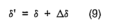
- Then, on the basis of the tire angle δ detected at Point "P" by the steering angle sensor 8, the steering amount δ' for permitting the vehicle to get on the target course OC can be determined as follows:
Referring to Fig. 7, when R >> ℓ, the following equation can be obtained:

- From equations (2) and (5) we can derive

where ℓ stands for a wheelbase. According to the equation (6) the tire angle Δδ for correction in accordance with the yaw rate Δτ to be corrected can be given by the following equation:

In consideration of an usual equation of steering angle in relation to the running speed, i.e., substituting ℓ=(1+Kv²) into the equation (7), we can obtain

where "K" is a constant which is determined both from the tyre characteristics and the vehicle characteristics. - Therefore, a steering amount δ' for permitting the vehicle to get on the target course can be obtained by the following equation:
- In response to the steering amount δ' given from the control means 5 the steering control means 9 issues a drive command to the
steering drive 10 which in turn steers the vehicle toward the target course OC. - The above-mentioned processing operations will be repeated at intervals of a specified control cycle including the time required for operations, thereby the steering control of the vehicle may be continuously performed to permit the vehicle to follow the target course OC set in the permissible travelling area which is successively renewable at every control cycle.
- The automatic travelling apparatus according to the present invention further includes means for renewing the vehicle position relative to the permissible travelling area currently fixed for a current control cycle on the basis of the instantaneous running condition of the vehicle, and means for resetting the target course for the renewed vehicle position in relation to the currently fixed permissible travelling area, and may determine a steering amount for permitting the vehicle to follow the the reset target course.
- The above-mentioned means is practically included in the control means 5 shown in Fig. 1.
- In case that a permissible travelling area RA is established for one control cycle in the X-Y coordinates and a
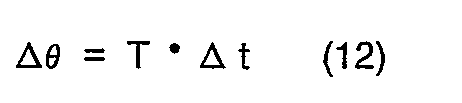
vehicle 11 is positioned at Point P (Xo, Yo), i.e., at the origin of the X-Y coordinates at the beginning of said control cycle as shown in Fig. 8, the vehicle position Pn (Xn, Yn) (n =1, 2, 3, ...) in X-Y coordinates, which varies with time as the vehicle runs, is estimated from the running speed "v" and the yaw rate "τ" (i.e. angular velocity increment in yawing direction) which are detected respectively by a running speed sensor 6 and a yaw rate sensor 7 at an interval of an unit time Δt preset shorter than the image processing time, and thereby said position may be renewed successively in relation to the permissible travelling area RA. In Fig. 8, "OC" designates a target course set at an initial stage of the control cycle.
where ΔL is a distance which the vehicle travels for an unit time and can be determined by the following equation:

Δϑ (= ϑn - ϑn-1) is an change of the vehicle running direction for the unit time, which is determined by the detected value of yaw rate τ as follows:
- The target course for the renewed position Pn (Xn, Yn) of the vehicle is reset in respect to the permissible travelling area RA, a steering amount is also estimated with respect to the reset target course so as to steer the vehicle toward the target course.
- As shown in Figs. 9(a) and 9(b), a new X'-Y' coordinate system in which the Y'-axis stands for the axis of running direction of the
vehicle 11 at the renewed position Pn is formed, and then coordinate transformation of every points of the permissible travelling area RA' and the target course OC'is carried out in such a way that the renewed point Pn (Xn, Yn) in the X-Y coordinates may be placed to the origin Po' (X', Y'). - Namely, every points shown in Fig. 9(a) are shifted respectively by (-ΔL·cosΔϑ, -ΔL·sinΔϑ) and the permissible travelling area pattern RA and the target course pattern OC are turned respectively by -Δϑ, with the result that the axis of the vehicle running direction coincides with the Y'-axis of the X'-Y' coordinates and the
vehicle 11 is positioned at the origin of said coordinates. - Then, a steering amount for permitting the
vehicle 11 to follow the target course OC' is determined with reference to the X'-Y' coordinates in the same manner as mentioned above, and the steering control will be performed with reference to said renewed steering amount. - The steering amount for permitting the vehicle to follow the target course OC initially set in the permissible travelling area RA was estimated from the variable data as afore mentioned.
- Accordingly, in case of steering the
vehicle 11 from the initial position Po with the initially estimated steering amount for a relatively long time of the control cycle the vehicle may progressively deviate from the target course OC due to the error included in the steering amount estimation. - The present invention provides such a possibility that in one control cycle a target course OC' can be reset in a permissible travelling area RA' viewed from the vehicle's present position Pn to be successively renewed at intervals of relatively shorter period and be treated in preference to the preceding and, therefore, the steering control of the
vehicle 11 can be carried out with a higher accuracy according to the steering amount newly estimated for the reset target course. Since the interval between renewals of the steering amount is relatively short, the error of estimation may have no practical influence to the steering control. - According to the present invention, it is also possible to optimally change the target course with a change of the vehicle running speed in one control cycle in case the target course is set in a permissible travelling area depending on the vehicle's running speed as shown in Figs. 5(a) and 5(b).
- Fig. 12 is a timing chart showing each processing timing in one control cycle.
- Fig. 13 shows a flow of image processing, and Fig. 14 shows a flow of renewing the vehicle position during the image processing.
- As be apparent from the foregoing description, the automatic travelling apparatus according to the present invention offers such an advantage that in each steering control cycle comprising steps - sampling an image of an area ahead of a running vehicle (said image being taken by the image pick-up means attached to the vehicle); processing sampled data and extracting therefrom continuous line segments; determining a permissible travelling area ahead of the vehicle on the basis of the continuous line segments extracted; setting a target course in the permissible travelling area thus determined; detecting the instantaneous running condition of the vehicle; estimating, on the basis of the instantaneous running condition, a steering amount to permit the vehicle to follow the target course; and steering the vehicle with reference to the steering amount, it can renew, on the basis of the instantaneous running condition during a period of image sampling, the preceding position of the vehicle in the determined permissible travelling area and reset a target course in the permissible travelling area in relation to the renewed position, thereby the image sampling period, i.e., the steering control cycle can be shortened apparently to increase the steering control accuracy and furthermore the steering control can be carried out at constant intervals irrespective of possible variations ofimage processing period.
- The invention as described above can be summarized as follows:
Disclosed is an automatic travelling apparatus which is capable of taking an image of an area ahead of a vehicle by an image pick-up means attached to the vehicle; sampling and processing the image data to extract therefrom continuous line segments; determining a permissible travelling area ahead of the vehicle on the basis of the continuous line segments extracted; setting a target course in the permissible travelling area thus determined; detecting the instantaneous running condition of the vehicle; estimating, on the basis of the instantaneous running condition, a steering amount to permit the vehicle to follow the target course; and steering the vehicle with reference to the steering amount, and furthermore of renewing, on the basis of the instantaneous running condition during a period of image sampling, the preceding position of the vehicle in the permissible travelling area and reset a target course in the permissible travelling area in relation to the renewed position.
Claims (4)
- An automatic travelling apparatus comprising:
means for picking-up an image of an area ahead of a running vehicle by an image pick-up device attached to the vehicle;
means for sampling the image taken by the image pick-up means, processing sampled data and extracting therefrom continuous line segments;
means for determining a permissible travelling area ahead of the vehicle on the basis of the continuous line segments extracted;
means for setting a target course in the permissible travelling area thus determined;
means for detecting the instantaneous running condition of the vehicle;
means for estimating, on the basis of the instantaneous running condition, a steering amount to permit the vehicle to follow the target course; and
means for steering the vehicle with reference to the steering amount,
characterized in that means for renewing, on the basis of the instantaneous running condition during a period of image sampling, the preceding position of the vehicle in the currently recognized permissible travelling area and means for resetting a target course in the permissible travelling area in relation to the renewed position are provided. - An automatic travelling apparatus as claimed in claim 1, characterized in that the instantaneous running condition of the vehicle is represented by its yaw rate and a running speed.
- An automatic travelling apparatus as claimed in claim 1, characterized in that the steering amount is a steering angle.
- Each and every novel feature or novel combination of features disclosed in the specification and the drawing.
Applications Claiming Priority (2)
| Application Number | Priority Date | Filing Date | Title |
|---|---|---|---|
| JP2064586A JP2835764B2 (en) | 1990-03-15 | 1990-03-15 | Automatic traveling device |
| JP64586/90 | 1990-03-15 |
Publications (3)
| Publication Number | Publication Date |
|---|---|
| EP0446902A2 true EP0446902A2 (en) | 1991-09-18 |
| EP0446902A3 EP0446902A3 (en) | 1992-09-02 |
| EP0446902B1 EP0446902B1 (en) | 1996-03-06 |
Family
ID=13262501
Family Applications (1)
| Application Number | Title | Priority Date | Filing Date |
|---|---|---|---|
| EP91103852A Expired - Lifetime EP0446902B1 (en) | 1990-03-15 | 1991-03-13 | Automatic travelling apparatus |
Country Status (4)
| Country | Link |
|---|---|
| US (1) | US5367457A (en) |
| EP (1) | EP0446902B1 (en) |
| JP (1) | JP2835764B2 (en) |
| DE (1) | DE69117549T2 (en) |
Cited By (1)
| Publication number | Priority date | Publication date | Assignee | Title |
|---|---|---|---|---|
| EP1400391A2 (en) * | 2002-09-18 | 2004-03-24 | Fuji Jukogyo Kabushiki Kaisha | Vehicle surroundings monitoring apparatus and traveling control system incorporating the apparatus |
Families Citing this family (30)
| Publication number | Priority date | Publication date | Assignee | Title |
|---|---|---|---|---|
| JP3183966B2 (en) * | 1992-04-20 | 2001-07-09 | マツダ株式会社 | Vehicle travel control device |
| US6822563B2 (en) | 1997-09-22 | 2004-11-23 | Donnelly Corporation | Vehicle imaging system with accessory control |
| US5877897A (en) | 1993-02-26 | 1999-03-02 | Donnelly Corporation | Automatic rearview mirror, vehicle lighting control and vehicle interior monitoring system using a photosensor array |
| US5638116A (en) | 1993-09-08 | 1997-06-10 | Sumitomo Electric Industries, Ltd. | Object recognition apparatus and method |
| JP3259475B2 (en) * | 1993-10-27 | 2002-02-25 | ミノルタ株式会社 | Distance measuring device |
| DE4415736C2 (en) * | 1994-05-04 | 2002-11-14 | Siemens Ag | Collision avoidance method using a steering angle field for an autonomous mobile unit |
| US6891563B2 (en) | 1996-05-22 | 2005-05-10 | Donnelly Corporation | Vehicular vision system |
| US5887268A (en) * | 1995-10-31 | 1999-03-23 | Honda Giken Kogyo Kabushiki Kaisha | Automatically driven motor vehicle |
| US7655894B2 (en) | 1996-03-25 | 2010-02-02 | Donnelly Corporation | Vehicular image sensing system |
| JPH1031799A (en) * | 1996-07-15 | 1998-02-03 | Toyota Motor Corp | Automatic traveling controller |
| US6686951B1 (en) | 2000-02-28 | 2004-02-03 | Case, Llc | Crop row segmentation by K-means clustering for a vision guidance system |
| US6278918B1 (en) | 2000-02-28 | 2001-08-21 | Case Corporation | Region of interest selection for a vision guidance system |
| US6490539B1 (en) | 2000-02-28 | 2002-12-03 | Case Corporation | Region of interest selection for varying distances between crop rows for a vision guidance system |
| US6285930B1 (en) | 2000-02-28 | 2001-09-04 | Case Corporation | Tracking improvement for a vision guidance system |
| JP4231910B2 (en) * | 2000-04-25 | 2009-03-04 | 日産自動車株式会社 | Lane keeping device |
| US6385515B1 (en) | 2000-06-15 | 2002-05-07 | Case Corporation | Trajectory path planner for a vision guidance system |
| US6445983B1 (en) | 2000-07-07 | 2002-09-03 | Case Corporation | Sensor-fusion navigator for automated guidance of off-road vehicles |
| JP3760827B2 (en) * | 2001-09-28 | 2006-03-29 | 日産自動車株式会社 | Lane departure prevention device |
| US7038577B2 (en) | 2002-05-03 | 2006-05-02 | Donnelly Corporation | Object detection system for vehicle |
| US7742845B2 (en) * | 2002-07-22 | 2010-06-22 | California Institute Of Technology | Multi-agent autonomous system and method |
| US6990406B2 (en) * | 2002-07-22 | 2006-01-24 | California Institute Of Technology | Multi-agent autonomous system |
| JP3979339B2 (en) * | 2003-05-12 | 2007-09-19 | 日産自動車株式会社 | Lane departure prevention device |
| US7526103B2 (en) | 2004-04-15 | 2009-04-28 | Donnelly Corporation | Imaging system for vehicle |
| DE102004030997B4 (en) | 2004-06-26 | 2022-01-27 | Bayerische Motoren Werke Aktiengesellschaft | Driver assistance system for high-speed driving |
| US7881496B2 (en) | 2004-09-30 | 2011-02-01 | Donnelly Corporation | Vision system for vehicle |
| US7684916B2 (en) * | 2005-07-01 | 2010-03-23 | Deere & Company | Method and system for vehicular guidance using a crop image |
| US7792622B2 (en) * | 2005-07-01 | 2010-09-07 | Deere & Company | Method and system for vehicular guidance using a crop image |
| WO2008024639A2 (en) | 2006-08-11 | 2008-02-28 | Donnelly Corporation | Automatic headlamp control system |
| JP2016222180A (en) * | 2015-06-02 | 2016-12-28 | 富士重工業株式会社 | Vehicle steering control device |
| JP6772944B2 (en) * | 2017-04-19 | 2020-10-21 | トヨタ自動車株式会社 | Autonomous driving system |
Citations (6)
| Publication number | Priority date | Publication date | Assignee | Title |
|---|---|---|---|---|
| DE3541969A1 (en) * | 1985-11-25 | 1986-05-22 | Joerg Moebius | Method for measuring transversal deviation (perpendicular distance between vehicle and set course) and relative yawing angle (angle between longitudinal axis of vehicle and tangent to the set course) of a vehicle |
| EP0230480A1 (en) * | 1985-12-06 | 1987-08-05 | Theo Jogchum Poelstra | Procedure for setting up and keeping up to date datafiles for road traffic |
| DE3626208A1 (en) * | 1986-08-02 | 1988-02-04 | Froeschle Ernst | Method and device for quickly determining the distance from the edge displacement of two or more video frames |
| DE3820589A1 (en) * | 1987-06-17 | 1989-01-05 | Nissan Motor | Control system for a self-steered motor vehicle or the like |
| EP0366350A2 (en) * | 1988-10-25 | 1990-05-02 | Tennant Company | Guiding an unmanned vehicle by reference to overhead features |
| US4942538A (en) * | 1988-01-05 | 1990-07-17 | Spar Aerospace Limited | Telerobotic tracker |
Family Cites Families (7)
| Publication number | Priority date | Publication date | Assignee | Title |
|---|---|---|---|---|
| JPS62155140A (en) * | 1985-12-27 | 1987-07-10 | Aisin Warner Ltd | Road image input system for controlling vehicle |
| JPS63314618A (en) * | 1987-06-17 | 1988-12-22 | Nissan Motor Co Ltd | Controller for self-traveling vehicle |
| US5172315A (en) * | 1988-08-10 | 1992-12-15 | Honda Giken Kogyo Kabushiki Kaisha | Automatic travelling apparatus and method |
| JP2660727B2 (en) * | 1988-08-10 | 1997-10-08 | 本田技研工業株式会社 | Automatic traveling device |
| JP2669031B2 (en) * | 1989-02-28 | 1997-10-27 | 日産自動車株式会社 | Autonomous vehicles |
| US4970653A (en) * | 1989-04-06 | 1990-11-13 | General Motors Corporation | Vision method of detecting lane boundaries and obstacles |
| JP2583641B2 (en) * | 1990-05-18 | 1997-02-19 | 日産自動車株式会社 | Travel control method |
-
1990
- 1990-03-15 JP JP2064586A patent/JP2835764B2/en not_active Expired - Lifetime
-
1991
- 1991-03-13 EP EP91103852A patent/EP0446902B1/en not_active Expired - Lifetime
- 1991-03-13 DE DE69117549T patent/DE69117549T2/en not_active Expired - Fee Related
-
1993
- 1993-06-01 US US08/071,222 patent/US5367457A/en not_active Expired - Lifetime
Patent Citations (6)
| Publication number | Priority date | Publication date | Assignee | Title |
|---|---|---|---|---|
| DE3541969A1 (en) * | 1985-11-25 | 1986-05-22 | Joerg Moebius | Method for measuring transversal deviation (perpendicular distance between vehicle and set course) and relative yawing angle (angle between longitudinal axis of vehicle and tangent to the set course) of a vehicle |
| EP0230480A1 (en) * | 1985-12-06 | 1987-08-05 | Theo Jogchum Poelstra | Procedure for setting up and keeping up to date datafiles for road traffic |
| DE3626208A1 (en) * | 1986-08-02 | 1988-02-04 | Froeschle Ernst | Method and device for quickly determining the distance from the edge displacement of two or more video frames |
| DE3820589A1 (en) * | 1987-06-17 | 1989-01-05 | Nissan Motor | Control system for a self-steered motor vehicle or the like |
| US4942538A (en) * | 1988-01-05 | 1990-07-17 | Spar Aerospace Limited | Telerobotic tracker |
| EP0366350A2 (en) * | 1988-10-25 | 1990-05-02 | Tennant Company | Guiding an unmanned vehicle by reference to overhead features |
Cited By (2)
| Publication number | Priority date | Publication date | Assignee | Title |
|---|---|---|---|---|
| EP1400391A2 (en) * | 2002-09-18 | 2004-03-24 | Fuji Jukogyo Kabushiki Kaisha | Vehicle surroundings monitoring apparatus and traveling control system incorporating the apparatus |
| EP1400391A3 (en) * | 2002-09-18 | 2006-08-30 | Fuji Jukogyo Kabushiki Kaisha | Vehicle surroundings monitoring apparatus and traveling control system incorporating the apparatus |
Also Published As
| Publication number | Publication date |
|---|---|
| EP0446902A3 (en) | 1992-09-02 |
| US5367457A (en) | 1994-11-22 |
| DE69117549D1 (en) | 1996-04-11 |
| JP2835764B2 (en) | 1998-12-14 |
| JPH03265007A (en) | 1991-11-26 |
| DE69117549T2 (en) | 1996-07-18 |
| EP0446902B1 (en) | 1996-03-06 |
Similar Documents
| Publication | Publication Date | Title |
|---|---|---|
| EP0446902A2 (en) | Automatic travelling apparatus | |
| EP0448059B1 (en) | Automatic travelling apparatus | |
| EP0446903A2 (en) | Automatic travelling apparatus | |
| EP0354561B1 (en) | Automatic travelling apparatus and method | |
| EP0810569B1 (en) | Lane detection sensor and navigation system employing the same | |
| US5170165A (en) | Apparatus for displaying travel path | |
| US6489887B2 (en) | Lane-keep assisting system for vehicle | |
| US6748302B2 (en) | Lane tracking control system for vehicle | |
| US5172315A (en) | Automatic travelling apparatus and method | |
| US5172317A (en) | Automatic travelling apparatus | |
| US4963864A (en) | Apparatus for displaying travel path | |
| EP1221642B1 (en) | Lane recognition system for vehicle | |
| EP0329405B1 (en) | Apparatus for displaying current location | |
| JPH11160078A (en) | System for estimating condition of traveling road | |
| EP0354562A2 (en) | Automatic travelling apparatus | |
| EP0448060A2 (en) | Automatic travelling apparatus | |
| JPH06225308A (en) | Running course detector | |
| JP3352216B2 (en) | Roadway recognition device | |
| JP2707761B2 (en) | Vehicle state quantity measurement device | |
| JP2923664B2 (en) | Automatic traveling device | |
| JP2657549B2 (en) | Current position display device of moving object | |
| CN115588299B (en) | Unmanned vehicle trajectory control system and method | |
| JPH04184603A (en) | Guide line detecting device | |
| JP2923667B2 (en) | Automatic traveling device | |
| JP2577095Y2 (en) | Body guidance system for automatic guided vehicles |
Legal Events
| Date | Code | Title | Description |
|---|---|---|---|
| PUAI | Public reference made under article 153(3) epc to a published international application that has entered the european phase |
Free format text: ORIGINAL CODE: 0009012 |
|
| AK | Designated contracting states |
Kind code of ref document: A2 Designated state(s): DE FR GB |
|
| PUAL | Search report despatched |
Free format text: ORIGINAL CODE: 0009013 |
|
| AK | Designated contracting states |
Kind code of ref document: A3 Designated state(s): DE FR GB |
|
| 17P | Request for examination filed |
Effective date: 19920925 |
|
| 17Q | First examination report despatched |
Effective date: 19940719 |
|
| GRAA | (expected) grant |
Free format text: ORIGINAL CODE: 0009210 |
|
| AK | Designated contracting states |
Kind code of ref document: B1 Designated state(s): DE FR GB |
|
| REF | Corresponds to: |
Ref document number: 69117549 Country of ref document: DE Date of ref document: 19960411 |
|
| ET | Fr: translation filed | ||
| PLBE | No opposition filed within time limit |
Free format text: ORIGINAL CODE: 0009261 |
|
| STAA | Information on the status of an ep patent application or granted ep patent |
Free format text: STATUS: NO OPPOSITION FILED WITHIN TIME LIMIT |
|
| 26N | No opposition filed | ||
| REG | Reference to a national code |
Ref country code: GB Ref legal event code: IF02 |
|
| PGFP | Annual fee paid to national office [announced via postgrant information from national office to epo] |
Ref country code: GB Payment date: 20070307 Year of fee payment: 17 |
|
| PGFP | Annual fee paid to national office [announced via postgrant information from national office to epo] |
Ref country code: FR Payment date: 20070308 Year of fee payment: 17 |
|
| PGFP | Annual fee paid to national office [announced via postgrant information from national office to epo] |
Ref country code: DE Payment date: 20080306 Year of fee payment: 18 |
|
| GBPC | Gb: european patent ceased through non-payment of renewal fee |
Effective date: 20080313 |
|
| REG | Reference to a national code |
Ref country code: FR Ref legal event code: ST Effective date: 20081125 |
|
| PG25 | Lapsed in a contracting state [announced via postgrant information from national office to epo] |
Ref country code: FR Free format text: LAPSE BECAUSE OF NON-PAYMENT OF DUE FEES Effective date: 20080331 |
|
| PG25 | Lapsed in a contracting state [announced via postgrant information from national office to epo] |
Ref country code: GB Free format text: LAPSE BECAUSE OF NON-PAYMENT OF DUE FEES Effective date: 20080313 |
|
| PG25 | Lapsed in a contracting state [announced via postgrant information from national office to epo] |
Ref country code: DE Free format text: LAPSE BECAUSE OF NON-PAYMENT OF DUE FEES Effective date: 20091001 |