US8102312B2 - Method and system for processing positioning signals based on predetermined message data segment - Google Patents
Method and system for processing positioning signals based on predetermined message data segment Download PDFInfo
- Publication number
- US8102312B2 US8102312B2 US12/637,466 US63746609A US8102312B2 US 8102312 B2 US8102312 B2 US 8102312B2 US 63746609 A US63746609 A US 63746609A US 8102312 B2 US8102312 B2 US 8102312B2
- Authority
- US
- United States
- Prior art keywords
- ranging receiver
- time
- satellite
- receiver
- signal
- Prior art date
- Legal status (The legal status is an assumption and is not a legal conclusion. Google has not performed a legal analysis and makes no representation as to the accuracy of the status listed.)
- Expired - Fee Related
Links
- 238000000034 method Methods 0.000 title claims abstract description 279
- 238000012545 processing Methods 0.000 title claims description 44
- 230000010354 integration Effects 0.000 claims description 11
- 239000000523 sample Substances 0.000 description 101
- PCHJSUWPFVWCPO-UHFFFAOYSA-N gold Chemical compound [Au] PCHJSUWPFVWCPO-UHFFFAOYSA-N 0.000 description 43
- 229910052737 gold Inorganic materials 0.000 description 43
- 239000010931 gold Substances 0.000 description 43
- 230000008569 process Effects 0.000 description 40
- 238000010586 diagram Methods 0.000 description 36
- 238000004891 communication Methods 0.000 description 32
- 238000000605 extraction Methods 0.000 description 30
- 239000000969 carrier Substances 0.000 description 28
- 230000015654 memory Effects 0.000 description 24
- 238000007670 refining Methods 0.000 description 23
- 230000000875 corresponding effect Effects 0.000 description 22
- 230000006870 function Effects 0.000 description 15
- 239000012634 fragment Substances 0.000 description 14
- 238000005070 sampling Methods 0.000 description 14
- 230000008901 benefit Effects 0.000 description 13
- 230000036961 partial effect Effects 0.000 description 13
- 238000012937 correction Methods 0.000 description 12
- 238000004364 calculation method Methods 0.000 description 10
- 230000005540 biological transmission Effects 0.000 description 9
- 230000007704 transition Effects 0.000 description 9
- 230000004044 response Effects 0.000 description 8
- 238000004458 analytical method Methods 0.000 description 7
- 230000001413 cellular effect Effects 0.000 description 7
- 238000005259 measurement Methods 0.000 description 7
- 230000010339 dilation Effects 0.000 description 6
- 230000000977 initiatory effect Effects 0.000 description 6
- 230000037361 pathway Effects 0.000 description 6
- 230000002829 reductive effect Effects 0.000 description 6
- 230000001360 synchronised effect Effects 0.000 description 6
- 230000015572 biosynthetic process Effects 0.000 description 5
- 238000006243 chemical reaction Methods 0.000 description 5
- 238000001514 detection method Methods 0.000 description 5
- 230000002596 correlated effect Effects 0.000 description 4
- 230000035945 sensitivity Effects 0.000 description 4
- 238000003491 array Methods 0.000 description 3
- 230000010267 cellular communication Effects 0.000 description 3
- 230000008859 change Effects 0.000 description 3
- 238000001914 filtration Methods 0.000 description 3
- 239000000243 solution Substances 0.000 description 3
- 238000012935 Averaging Methods 0.000 description 2
- 230000035508 accumulation Effects 0.000 description 2
- 238000009825 accumulation Methods 0.000 description 2
- 230000003321 amplification Effects 0.000 description 2
- 239000000919 ceramic Substances 0.000 description 2
- 230000001010 compromised effect Effects 0.000 description 2
- 239000013078 crystal Substances 0.000 description 2
- 230000003247 decreasing effect Effects 0.000 description 2
- 230000000670 limiting effect Effects 0.000 description 2
- 239000011159 matrix material Substances 0.000 description 2
- 238000012986 modification Methods 0.000 description 2
- 230000004048 modification Effects 0.000 description 2
- 238000003199 nucleic acid amplification method Methods 0.000 description 2
- 238000001228 spectrum Methods 0.000 description 2
- 238000012360 testing method Methods 0.000 description 2
- 230000008878 coupling Effects 0.000 description 1
- 238000010168 coupling process Methods 0.000 description 1
- 238000005859 coupling reaction Methods 0.000 description 1
- 238000010790 dilution Methods 0.000 description 1
- 239000012895 dilution Substances 0.000 description 1
- 238000005516 engineering process Methods 0.000 description 1
- 239000000284 extract Substances 0.000 description 1
- -1 i.e. Substances 0.000 description 1
- 230000006872 improvement Effects 0.000 description 1
- 238000004519 manufacturing process Methods 0.000 description 1
- 230000005055 memory storage Effects 0.000 description 1
- 238000003672 processing method Methods 0.000 description 1
- 238000000926 separation method Methods 0.000 description 1
- 238000000638 solvent extraction Methods 0.000 description 1
- 230000003595 spectral effect Effects 0.000 description 1
- 238000010183 spectrum analysis Methods 0.000 description 1
- 230000036962 time dependent Effects 0.000 description 1
- 238000012546 transfer Methods 0.000 description 1
- 230000003936 working memory Effects 0.000 description 1
Images


Classifications
-
- G—PHYSICS
- G01—MEASURING; TESTING
- G01S—RADIO DIRECTION-FINDING; RADIO NAVIGATION; DETERMINING DISTANCE OR VELOCITY BY USE OF RADIO WAVES; LOCATING OR PRESENCE-DETECTING BY USE OF THE REFLECTION OR RERADIATION OF RADIO WAVES; ANALOGOUS ARRANGEMENTS USING OTHER WAVES
- G01S19/00—Satellite radio beacon positioning systems; Determining position, velocity or attitude using signals transmitted by such systems
- G01S19/01—Satellite radio beacon positioning systems transmitting time-stamped messages, e.g. GPS [Global Positioning System], GLONASS [Global Orbiting Navigation Satellite System] or GALILEO
- G01S19/13—Receivers
- G01S19/24—Acquisition or tracking or demodulation of signals transmitted by the system
- G01S19/29—Acquisition or tracking or demodulation of signals transmitted by the system carrier including Doppler, related
-
- G—PHYSICS
- G01—MEASURING; TESTING
- G01S—RADIO DIRECTION-FINDING; RADIO NAVIGATION; DETERMINING DISTANCE OR VELOCITY BY USE OF RADIO WAVES; LOCATING OR PRESENCE-DETECTING BY USE OF THE REFLECTION OR RERADIATION OF RADIO WAVES; ANALOGOUS ARRANGEMENTS USING OTHER WAVES
- G01S19/00—Satellite radio beacon positioning systems; Determining position, velocity or attitude using signals transmitted by such systems
- G01S19/01—Satellite radio beacon positioning systems transmitting time-stamped messages, e.g. GPS [Global Positioning System], GLONASS [Global Orbiting Navigation Satellite System] or GALILEO
- G01S19/03—Cooperating elements; Interaction or communication between different cooperating elements or between cooperating elements and receivers
- G01S19/05—Cooperating elements; Interaction or communication between different cooperating elements or between cooperating elements and receivers providing aiding data
-
- G—PHYSICS
- G01—MEASURING; TESTING
- G01S—RADIO DIRECTION-FINDING; RADIO NAVIGATION; DETERMINING DISTANCE OR VELOCITY BY USE OF RADIO WAVES; LOCATING OR PRESENCE-DETECTING BY USE OF THE REFLECTION OR RERADIATION OF RADIO WAVES; ANALOGOUS ARRANGEMENTS USING OTHER WAVES
- G01S19/00—Satellite radio beacon positioning systems; Determining position, velocity or attitude using signals transmitted by such systems
- G01S19/01—Satellite radio beacon positioning systems transmitting time-stamped messages, e.g. GPS [Global Positioning System], GLONASS [Global Orbiting Navigation Satellite System] or GALILEO
- G01S19/13—Receivers
- G01S19/23—Testing, monitoring, correcting or calibrating of receiver elements
- G01S19/235—Calibration of receiver components
-
- G—PHYSICS
- G01—MEASURING; TESTING
- G01S—RADIO DIRECTION-FINDING; RADIO NAVIGATION; DETERMINING DISTANCE OR VELOCITY BY USE OF RADIO WAVES; LOCATING OR PRESENCE-DETECTING BY USE OF THE REFLECTION OR RERADIATION OF RADIO WAVES; ANALOGOUS ARRANGEMENTS USING OTHER WAVES
- G01S19/00—Satellite radio beacon positioning systems; Determining position, velocity or attitude using signals transmitted by such systems
- G01S19/01—Satellite radio beacon positioning systems transmitting time-stamped messages, e.g. GPS [Global Positioning System], GLONASS [Global Orbiting Navigation Satellite System] or GALILEO
- G01S19/13—Receivers
- G01S19/24—Acquisition or tracking or demodulation of signals transmitted by the system
- G01S19/25—Acquisition or tracking or demodulation of signals transmitted by the system involving aiding data received from a cooperating element, e.g. assisted GPS
- G01S19/254—Acquisition or tracking or demodulation of signals transmitted by the system involving aiding data received from a cooperating element, e.g. assisted GPS relating to Doppler shift of satellite signals
-
- G—PHYSICS
- G01—MEASURING; TESTING
- G01S—RADIO DIRECTION-FINDING; RADIO NAVIGATION; DETERMINING DISTANCE OR VELOCITY BY USE OF RADIO WAVES; LOCATING OR PRESENCE-DETECTING BY USE OF THE REFLECTION OR RERADIATION OF RADIO WAVES; ANALOGOUS ARRANGEMENTS USING OTHER WAVES
- G01S19/00—Satellite radio beacon positioning systems; Determining position, velocity or attitude using signals transmitted by such systems
- G01S19/01—Satellite radio beacon positioning systems transmitting time-stamped messages, e.g. GPS [Global Positioning System], GLONASS [Global Orbiting Navigation Satellite System] or GALILEO
- G01S19/13—Receivers
- G01S19/24—Acquisition or tracking or demodulation of signals transmitted by the system
- G01S19/25—Acquisition or tracking or demodulation of signals transmitted by the system involving aiding data received from a cooperating element, e.g. assisted GPS
- G01S19/256—Acquisition or tracking or demodulation of signals transmitted by the system involving aiding data received from a cooperating element, e.g. assisted GPS relating to timing, e.g. time of week, code phase, timing offset
-
- G—PHYSICS
- G01—MEASURING; TESTING
- G01S—RADIO DIRECTION-FINDING; RADIO NAVIGATION; DETERMINING DISTANCE OR VELOCITY BY USE OF RADIO WAVES; LOCATING OR PRESENCE-DETECTING BY USE OF THE REFLECTION OR RERADIATION OF RADIO WAVES; ANALOGOUS ARRANGEMENTS USING OTHER WAVES
- G01S5/00—Position-fixing by co-ordinating two or more direction or position line determinations; Position-fixing by co-ordinating two or more distance determinations
- G01S5/0009—Transmission of position information to remote stations
- G01S5/0018—Transmission from mobile station to base station
-
- G—PHYSICS
- G01—MEASURING; TESTING
- G01S—RADIO DIRECTION-FINDING; RADIO NAVIGATION; DETERMINING DISTANCE OR VELOCITY BY USE OF RADIO WAVES; LOCATING OR PRESENCE-DETECTING BY USE OF THE REFLECTION OR RERADIATION OF RADIO WAVES; ANALOGOUS ARRANGEMENTS USING OTHER WAVES
- G01S5/00—Position-fixing by co-ordinating two or more direction or position line determinations; Position-fixing by co-ordinating two or more distance determinations
- G01S5/0009—Transmission of position information to remote stations
- G01S5/0045—Transmission from base station to mobile station
- G01S5/0063—Transmission from base station to mobile station of measured values, i.e. measurement on base station and position calculation on mobile
-
- G—PHYSICS
- G01—MEASURING; TESTING
- G01S—RADIO DIRECTION-FINDING; RADIO NAVIGATION; DETERMINING DISTANCE OR VELOCITY BY USE OF RADIO WAVES; LOCATING OR PRESENCE-DETECTING BY USE OF THE REFLECTION OR RERADIATION OF RADIO WAVES; ANALOGOUS ARRANGEMENTS USING OTHER WAVES
- G01S19/00—Satellite radio beacon positioning systems; Determining position, velocity or attitude using signals transmitted by such systems
- G01S19/01—Satellite radio beacon positioning systems transmitting time-stamped messages, e.g. GPS [Global Positioning System], GLONASS [Global Orbiting Navigation Satellite System] or GALILEO
- G01S19/03—Cooperating elements; Interaction or communication between different cooperating elements or between cooperating elements and receivers
- G01S19/09—Cooperating elements; Interaction or communication between different cooperating elements or between cooperating elements and receivers providing processing capability normally carried out by the receiver
-
- G—PHYSICS
- G01—MEASURING; TESTING
- G01S—RADIO DIRECTION-FINDING; RADIO NAVIGATION; DETERMINING DISTANCE OR VELOCITY BY USE OF RADIO WAVES; LOCATING OR PRESENCE-DETECTING BY USE OF THE REFLECTION OR RERADIATION OF RADIO WAVES; ANALOGOUS ARRANGEMENTS USING OTHER WAVES
- G01S19/00—Satellite radio beacon positioning systems; Determining position, velocity or attitude using signals transmitted by such systems
- G01S19/01—Satellite radio beacon positioning systems transmitting time-stamped messages, e.g. GPS [Global Positioning System], GLONASS [Global Orbiting Navigation Satellite System] or GALILEO
- G01S19/13—Receivers
- G01S19/14—Receivers specially adapted for specific applications
- G01S19/17—Emergency applications
-
- G—PHYSICS
- G01—MEASURING; TESTING
- G01S—RADIO DIRECTION-FINDING; RADIO NAVIGATION; DETERMINING DISTANCE OR VELOCITY BY USE OF RADIO WAVES; LOCATING OR PRESENCE-DETECTING BY USE OF THE REFLECTION OR RERADIATION OF RADIO WAVES; ANALOGOUS ARRANGEMENTS USING OTHER WAVES
- G01S19/00—Satellite radio beacon positioning systems; Determining position, velocity or attitude using signals transmitted by such systems
- G01S19/01—Satellite radio beacon positioning systems transmitting time-stamped messages, e.g. GPS [Global Positioning System], GLONASS [Global Orbiting Navigation Satellite System] or GALILEO
- G01S19/13—Receivers
- G01S19/24—Acquisition or tracking or demodulation of signals transmitted by the system
- G01S19/25—Acquisition or tracking or demodulation of signals transmitted by the system involving aiding data received from a cooperating element, e.g. assisted GPS
- G01S19/258—Acquisition or tracking or demodulation of signals transmitted by the system involving aiding data received from a cooperating element, e.g. assisted GPS relating to the satellite constellation, e.g. almanac, ephemeris data, lists of satellites in view
-
- G—PHYSICS
- G01—MEASURING; TESTING
- G01S—RADIO DIRECTION-FINDING; RADIO NAVIGATION; DETERMINING DISTANCE OR VELOCITY BY USE OF RADIO WAVES; LOCATING OR PRESENCE-DETECTING BY USE OF THE REFLECTION OR RERADIATION OF RADIO WAVES; ANALOGOUS ARRANGEMENTS USING OTHER WAVES
- G01S19/00—Satellite radio beacon positioning systems; Determining position, velocity or attitude using signals transmitted by such systems
- G01S19/01—Satellite radio beacon positioning systems transmitting time-stamped messages, e.g. GPS [Global Positioning System], GLONASS [Global Orbiting Navigation Satellite System] or GALILEO
- G01S19/13—Receivers
- G01S19/34—Power consumption
-
- G—PHYSICS
- G01—MEASURING; TESTING
- G01S—RADIO DIRECTION-FINDING; RADIO NAVIGATION; DETERMINING DISTANCE OR VELOCITY BY USE OF RADIO WAVES; LOCATING OR PRESENCE-DETECTING BY USE OF THE REFLECTION OR RERADIATION OF RADIO WAVES; ANALOGOUS ARRANGEMENTS USING OTHER WAVES
- G01S19/00—Satellite radio beacon positioning systems; Determining position, velocity or attitude using signals transmitted by such systems
- G01S19/01—Satellite radio beacon positioning systems transmitting time-stamped messages, e.g. GPS [Global Positioning System], GLONASS [Global Orbiting Navigation Satellite System] or GALILEO
- G01S19/13—Receivers
- G01S19/35—Constructional details or hardware or software details of the signal processing chain
-
- G—PHYSICS
- G01—MEASURING; TESTING
- G01S—RADIO DIRECTION-FINDING; RADIO NAVIGATION; DETERMINING DISTANCE OR VELOCITY BY USE OF RADIO WAVES; LOCATING OR PRESENCE-DETECTING BY USE OF THE REFLECTION OR RERADIATION OF RADIO WAVES; ANALOGOUS ARRANGEMENTS USING OTHER WAVES
- G01S2205/00—Position-fixing by co-ordinating two or more direction or position line determinations; Position-fixing by co-ordinating two or more distance determinations
- G01S2205/001—Transmission of position information to remote stations
- G01S2205/008—Transmission of position information to remote stations using a mobile telephone network
Definitions
- This invention relates generally to the field of geolocation and more particularly to a method and system for processing positioning signals based on a predetermined message data segment.
- a typical geolocation function utilizes a course acquisition (C/A) code, or Gold code, which is received repeatedly from GPS satellites, in order to determine position.
- C/A course acquisition
- the Gold code comprises satellite message data that is modulated on top of the Gold code signal by inverting the phase according to the message data.
- the spectral density level of a signal from a GPS satellite received at a conventional GPS receiver with a direct line-of-sight to the satellite is significantly less than the thermal noise level of the conventional GPS receiver.
- the satellite signals are received at wireless devices being operated with obstructed views of the sky and thus obstructed line-of-sight, the satellite signals are weakened even further. Consequently, the obstructed signal levels from satellites are generally well below the threshold at which receivers may receive reliable message data signals from the satellites.
- Recent solutions to the problem of receiving weakened positioning signals provide for partitioning the geolocation processing functions such that some of these functions are performed at the unknown location which is to be determined and other functions are performed at a location with an unobstructed view of the signal source.
- one of these methods using a satellite signal source, provides for measuring all the satellite signal parameters, including the Doppler shift for each satellite signal, at unobstructed receivers located near the unknown location.
- the unobstructed receivers then send pertinent data to the unknown location to allow pseudorange estimation to be completed at the unknown location.
- Disadvantages associated with this example include a relatively expensive requirement of integration of the network of such receivers with the wireless carrier network that provides a link between the unknown location and the unobstructed receivers.
- this solution restricts the joint operation of the unknown location and the unobstructed receivers in performing the geolocation processing functions to only those carrier networks that are so integrated.
- the present invention provides a method and system for processing positioning signals based on a predetermined message data segment.
- a positioning signal is any signal that may be used, either alone or in conjunction with other signals, for the purpose of determining the location of an object.
- a positioning signal is an identification code that is unique to and/or uniquely identifies the transmitter and that is repeated by the transmitter. In one embodiment, the positioning signal may have a fixed transmission time duration or epoch duration.
- a predetermined message data segment is any combination of known bits contained within the carrier signal. Bits are known when the value, modulation, sign or other characteristic of the bit, or the manner by which the modulation, sign or characteristic is changed, is constant, may be predicted and/or may be otherwise determined based on a known calculation or logic, before the signal sample that is comprised of such bits is stacked during processing or without decoding the signal.
- the known bits may be or may not be contiguous.
- the predetermined message data segment may have one or more message data bit sequences each having one or more contiguous known bits.
- the known bits may be contained in the carrier signal by a biphase modulation. It is understood that the positioning signals may be transmitted by any suitable types of fixed or mobile transmitters, including satellite transmitters such as the global positioning system (GPS) satellites, or terrestrial transmitters.
- GPS global positioning system
- This invention may substantially eliminate or reduce disadvantages and problems associated with previous systems and methods.
- the time to estimate a pseudorange from received positioning signals is reduced, while the processing gain is increased to facilitate rapid detection of positioning signals while limiting the consumption of energy.
- a method for processing positioning signals in a ranging receiver in a stand-alone mode may determine a geolocation of an object by collecting a positioning signal including a predefined message data segment. A time of arrival of the predefined message data bit segment may be determined in the positioning signal. Information based on the time of arrival may be provided for determining the geolocation of the object.
- a plurality of positioning signals each including a predefined message data segment may be collected.
- the time of arrival of the predetermined message data segment in each of the positioning signals may be determined.
- a time difference of arrival may be determined based on the times of arrival.
- information based on the time difference of arrival may be provided for determination of the geolocation of the object.
- the method may include collecting samples from positioning signals received at the ranging receiver from a plurality of satellites.
- the samples comprise message data modulation.
- the method selects a predetermined segment of the message data to be identified in the samples to be collected, and creates a replica of that predetermined segment.
- the identification code for each satellite comprises a Gold code which repeats every epoch of one millisecond.
- a pre-determined carrier frequency offset (CFO) is selected from a plurality of directly extracted CFOs or from CFOs determined by geometric methods or by other means. The samples, or replicas of the Gold codes for the satellites, are compensated for the selected CFO.
- a section of the samples is selected that is equal in length to the predetermined segment.
- the message data modulation is modified in the selected section of the samples corresponding to the sequence of the biphase modulation of the predetermined segment.
- the samples are stacked for each satellite.
- the Gold code associated with each satellite is correlated to generate a time sequence for the satellite.
- a determination is made regarding whether an adequate correlation peak exists in each pseudorange time sequence.
- the method is repeated with different sections of the samples, and may be repeated with different CFOs and Gold codes in order to identify correlation peaks.
- a pseudorange, range or time-of-arrival are determined for the ranging receiver based on the correlation peaks when an adequate correlation peak exists in each time sequence.
- the samples may, in one embodiment, be pseudorange samples.
- Technical advantages of one or more embodiments of the present invention may include providing an improved method for processing positioning signals in a stand-alone mode.
- the time required to obtain pseudorange estimates from weakened positioning signals is reduced and the processing gain available in any sample segment used to obtain pseudorange information is increased.
- the pseudorange, range or time-of-arrival estimation may be accomplished without performing a time-consuming search through the Doppler frequencies and satellite codes.
- a geolocation processor may supply, to a receiver, current fragments of message data that were transmitted during the time the receiver was collecting signal samples. This is possible because the geolocation processor and the receiver are able to exchange time-of-day synchronizing information. As a result, the modulation for the message data may be removed from the samples being processed by the receiver. Accordingly, the available processing gain that can be achieved from a signal averaging process may be increased.
- technical advantages of one or more embodiments of the present invention may also include an ability either to obtain greater sensitivity in a given amount of signal processing time or to significantly reduce the amount of processing time to reach a particular level of sensitivity.
- a dynamic process may be used that acquires and processes only the amount of signal necessary to achieve reliable detection. This reduces both the processing time and the amount of intermediate-result memory storage required during signal processing.
- Yet another technical advantage of one or more embodiments of the present invention may include the removal of a requirement to integrate a geolocation processing system with the wireless carrier network that provides a communication link between the ranging receiver and an assisting function.
- a wireless carrier or plain old telephone system network may be eliminated.
- support from a carrier's network may not be required to determine a coarse position estimation.
- a support network of nearby reference receivers, or its equivalent would not be required to provide Doppler-shift compensation or Doppler-shift search assistance.
- An end-to-end frequency-calibration embodiment in the wireless communication link between the receiver and the geolocation processor to allow making use of the Doppler-shift would also not be required.
- Yet another technical advantage of one or more embodiments of the present invention may include the ability to determine the time-of-arrival (TOA) at the ranging receiver of specific segments of the message data having precisely known transmission times from the satellite.
- the TOA corresponds to the propagation time of the signal from the satellite and the range between the satellite and the ranging receiver.
- the range of the satellite may be represented by the measurement of the propagation time (or “delay”) of the GPS signal from the satellite to the receiver and comprises: (a) a whole number of milliseconds (epochs); plus (b) a fraction of an epoch (referred to as the pseudorange value), which is typically determined to a precision of about 100 nanoseconds or less (equivalent to a location precision of about 100 feet or less).
- the conventional GPS receiver cannot determine a location, and therefore cannot be used to determine a location in open space.
- the TOA measurement in the present invention contains an error equal to the error in the clock of the ranging receiver.
- the difference between such values known as the time difference of arrival (TDOA)
- TDOA time difference of arrival
- the TDOA values may be used, along with conventional TDOA techniques and algorithms to determine the geolocation of the ranging receiver without “whole number ambiguity” phenomena that may be encountered when using pseudorange values in conventional GPS processing methods.
- Yet another technical advantage of one or more embodiments of the present invention includes the absence of the necessity to precisely synchronize the clock of the ranging receiver with the satellites clocks.
- Yet another technical advantage of one or more embodiments of the present invention may include the ability to recalibrate the ranging receiver clock and synchronize it with GPS time.
- Yet another technical advantage of one or more embodiments of the present invention may include the ability to utilize information obtained, when a correlation peak is obtained for the first satellite, to reduce the processing required to determine the correlation peaks for other in-view satellites, thereby decreasing the amount of time for a location estimate.
- technical advantages of one or more embodiments of the present invention may include reduced memory use, power consumption and network loading, increased sensitivity, decreased amount of time for a location estimate, and greater privacy for customers.
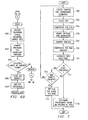
- FIG. 1 is a block diagram illustrating a geolocation system operable to process positioning signals in accordance with one embodiment of the present invention
- FIG. 2 is a block diagram illustrating the ranging receiver of FIG. 1 in accordance with one embodiment of the present invention
- FIG. 3 is a block diagram illustrating the ranging receiver of FIG. 1 in accordance with another embodiment of the present invention.
- FIG. 4 is a flow diagram illustrating a method for obtaining a calibration location estimate for the ranging receiver of FIG. 1 , 2 or 3 in accordance with one embodiment of the present invention
- FIG. 5 is a flow diagram illustrating a method for obtaining a location estimate based on a non-initial trigger for the ranging receiver of FIG. 1 , 2 or 3 in accordance with one embodiment of the present invention
- FIGS. 6A and 6B are flow diagrams illustrating a direct extraction method for determining carrier frequency offset in the methods of FIGS. 4 and 5 in accordance with one embodiment of the present invention
- FIG. 7 is a flow diagram illustrating a method for determining pseudorange in the ranging receiver of FIG. 1 , 2 or 3 in a stand-alone mode in accordance with one embodiment of the present invention
- FIGS. 8A and 8B are flow diagrams illustrating a method for aligning message data to determine a pseudorange in the ranging receiver of FIG. 1 , 2 or 3 in a stand-alone mode in accordance with one embodiment of the present invention
- FIGS. 9A and 9B are block diagrams illustrating a system for generating sub-stacks and stacks to determine coarse satellite message data alignment in the system of FIG. 1 in accordance with one embodiment of the present invention
- FIG. 10 is a block diagram illustrating a system for refining satellite message data alignment in the system of FIG. 1 in accordance with one embodiment of the present invention
- FIG. 11 is a flow diagram illustrating a method for aligning message data in the ranging receiver of FIG. 1 , 2 or 3 in accordance with one embodiment of the present invention
- FIG. 12 is a flow diagram illustrating a method for predicting satellite message data received in positioning signals at the ranging receiver of FIG. 1 , 2 or 3 in accordance with one embodiment of the present invention
- FIGS. 13A , 13 B and 13 C are flow diagrams illustrating a method for determining a pseudorange in the ranging receiver of FIG. 1 , 2 or 3 in a geometric mode in accordance with one embodiment of the present invention
- FIG. 14 is a flow diagram illustrating a method for determining geolocation in the ranging receiver of FIG. 1 , 2 or 3 with matching assistance in accordance with one embodiment of the present invention
- FIG. 15 is a flow diagram illustrating a method for determining geolocation in the geolocation processor of FIG. 1 by providing matching assistance in accordance with one embodiment of the present invention.
- FIGS. 16A-B are a flow diagram illustrating a method for determining geolocation in the ranging receiver of FIG. 1 , 2 or 3 by aligning predetermined message data bit sequences with corresponding segments of the received signal in order to determine pseudorange, range or time-of arrival in the ranging receiver, in accordance with one embodiment of the present invention.
- FIG. 1 is a block diagram illustrating a remote geolocation system 10 in accordance with one embodiment of the present invention.
- the system 10 may comprise a global positioning system (GPS), a global navigation satellite system (GLONASS), or other suitable navigation system.
- GPS global positioning system
- GLONASS global navigation satellite system
- the system 10 comprises a plurality of positioning signal transmitters 12 and at least one ranging receiver 14 .
- the positioning signal transmitters 12 are operable to transmit positioning signals
- each ranging receiver 14 is operable to receive the positioning signals and to perform geolocation processing functions in order to determine a pseudorange estimate for the ranging receiver 14 based on the received signals.
- each means every one of at least a subset of the identified items.
- the positioning signal transmitters 12 comprise satellites 12 .
- “satellites” means conventional satellites, pseudolites, or other suitable positioning signal transmitters.
- a location estimate may be determined for the ranging receiver 14 based in part on the pseudorange estimate.
- a location estimate provides a location for the ranging receiver 14 that is accurate to within 10 to 50 meters or other suitable distance.
- a location estimate may be determined when the ranging receiver 14 is receiving weakened positioning signals, such as signals weakened by obstructions.
- Weakened positioning signals comprise signals that are received from the satellites 12 at levels that result in insufficient information being received by the ranging receiver 14 , in the absence of other satellite signals or other sources of information, to determine a location estimate but sufficient information being received to estimate a pseudorange for the ranging receiver 14 .
- weakened positioning signals comprise signals compromised up to 16 dB below “clear view”, or unobstructed, signal levels.
- weakened positioning signals comprise signals compromised up to 30 dB below “clear view” signal levels.
- the system 10 also comprises a wireless device 16 and a service center 18 which may be coupled to each other through a wireless carrier network 20 and the plain old telephone system (POTS) network 22 .
- POTS plain old telephone system
- the system 10 comprises a geolocation processor 24 , which may be coupled to the service center 18 either directly or indirectly, such as through a network or other suitable form of indirect communication and may be coupled through the service center 18 to the wireless device 16 .
- the illustrated embodiment includes one service center 18 and one geolocation processor 24 , it will be understood that the system 10 may comprise any suitable number of the components 18 and 24 without departing from the scope of the present invention and that functionality of the system 10 may be otherwise suitably distributed or combined. It will be further understood that a single geolocation processor 24 may be coupled to a plurality of service centers 18 without departing from the scope of the present invention.
- the wireless device 16 may be coupled to the ranging receiver 14 , which may comprise push buttons 30 , or other suitable interfaces, for user operation such as to initiate a location estimating process for the ranging receiver 14 .
- the wireless device 16 is operable to provide a communication link between the ranging receiver 14 and a service center 18 via the wireless carrier network 20 and the POTS network 22 and to provide a communication link between the ranging receiver 14 and a geolocation processor 24 via the service center 18 .
- the wireless device 16 may comprise a cellular telephone, a wireless Personal Digital Assistant, a two-way or response pager, a private or commercial vehicle tracking system, an “On-Star” type motorist service network, a private or commercial wireless data network (or a device in such a network), or any other suitable device capable of providing a data-link between the ranging receiver 14 and the geolocation processor 24 .
- the wireless device 16 may be coupled to the ranging receiver 14 in any suitable fashion.
- the wireless device 16 and the ranging receiver 14 may be coupled together by a cable 32 .
- the ranging receiver 14 may be located near the wireless device 16 and linked to the wireless device 16 by a low-powered short-range wireless link, such as those provided by the Blue-Tooth protocols.
- the ranging receiver 14 may also be coupled to the body of the wireless device 16 as a “stick-on” attachment, or the ranging receiver 14 may be built into a receptacle such that the wireless device 16 is in electrical contact with the ranging receiver 14 when the wireless device 16 is inserted into the receptacle.
- the ranging receiver 14 may be integrated with the wireless device 16 .
- the wireless device 16 is operable to process communication at a minimum of two frequencies, one frequency for receiving signals to be processed by the wireless device 16 independently of the functionality of the ranging receiver 14 , such as cellular signals for a wireless device 16 comprising a cellular telephone, and a second frequency for receiving positioning signals.
- the wireless device 16 is also operable to digitize samples at a rate corresponding to the rate at which the ranging receiver 14 may process samples in accordance with the present invention.
- the wireless device 16 may be operable to digitize samples at a rate of at least 2.048 Megasamples/second at a quantizer resolution of a minimum of two bits.
- the wireless device 16 may include additional memory, as compared to a wireless device 16 not coupled to a ranging receiver 14 , in order to store samples for processing during pseudorange estimation.
- the service center 18 may comprise a Public Safety Access Point (PSAP), a Vehicle Dispatch Application, or other suitable entity capable of facilitating geolocation processing for the ranging receiver 14 by coupling the ranging receiver 14 to the geolocation processor 24 .
- PSAP Public Safety Access Point
- Vehicle Dispatch Application or other suitable entity capable of facilitating geolocation processing for the ranging receiver 14 by coupling the ranging receiver 14 to the geolocation processor 24 .
- the service center 18 is also operable to manage the detection, routing and switching of voice traffic that may be associated with the geolocation determination process.
- the service center 18 includes a rack 45 of modems 40 , a switch 42 , and at least one telephone handset 44 .
- Each modem 40 may include a Location Services Protocol modem or other suitable modem and is operable to provide a communication link between the service center 18 and the ranging receiver 14 associated with the wireless device 16 through the POTS network 22 and the wireless carrier network 20 .
- the modem 40 or other communication link such as an Ethernet, may also provide a link between the service center 18 and the geolocation processor 24 .
- Each modem 40 is also operable to route voice communication to the switch 42 and data communication to the geolocation processor 24 .
- the switch 42 is operable to route voice communication from a modem 40 to a telephone handset 44 and from a telephone handset 44 to a modem 40 .
- the telephone handset 44 allows an operator at the service center 18 to interact with a user of the wireless device 16 through voice communication provided through a modem 40 .
- the geolocation processor 24 is operable to identify the satellites 12 by matching the differences between pairs of carrier frequency offsets measured at the ranging receiver 14 with the differences between pairs of Doppler shift estimates made of satellites in view at particular locations on the Earth's surface, to accurately calibrate a real-time clock in the ranging receiver 14 , to track satellite message data from the satellites 12 and bit transition times in the satellite message data to provide fragments of the satellite message data from the identified satellites 12 to the ranging receiver 14 , to convert a pseudorange estimate from the ranging receiver 14 into a geolocation of the ranging receiver 14 , and to provide the geolocation to a requester such as the ranging receiver 14 or PSAP operator.
- the ranging receiver 14 may alternatively perform operations that are operable by the geolocation processor 24 without departing from the scope of the present invention.
- the geolocation processor 24 comprises a workstation 46 and a receiver 48 .
- the workstation 46 is operable to perform geolocation processing functions.
- the workstation 46 is also operable to obtain current ephemeris, time, and other suitable satellite message data from the receiver 48 .
- Ephemeris data may comprise trajectory data received from one or more satellites 12 that allows positions of satellites in the satellite constellation to be predicted.
- the receiver 48 may comprise a GPS receiver or other suitable receiver operable to receive positioning signals from the satellites 12 .
- the wireless carrier network 20 may be operable to coordinate location management, authentication, service management, subscriber management, and any other suitable functions for a plurality of wireless devices 16 .
- the wireless network 20 may comprise a public land mobile network or other suitable network operable to provide communication between the wireless devices 16 and the POTS network 22 .
- the POTS network 22 may be coupled to the wireless carrier network 20 and to the service center 18 through communication links 50 .
- the communication links 50 may be any type of communication link capable of supporting data transfer.
- each of the communication links 50 may comprise, alone or in combination, Integrated Services Digital Network, Asymmetric Digital Subscriber Line, T1 or T3 communication lines, hard-wire lines, telephone lines or wireless communication. It will be understood that the communication links 50 may comprise other suitable types of data communication links.
- the communication links 50 may also connect to a plurality of intermediate servers between the POTS network 22 and both the wireless carrier network 20 and the service center 18 .
- the system 10 may also comprise one or more remote receivers 60 , service requesters 62 and/or application servers 64 which may be coupled to the geolocation processor 24 through a data network 66 .
- the remote receiver 60 may comprise a GPS receiver or other suitable receiver operable to receive positioning signals from the satellites 12 . Data derived from these positioning signals may then be provided to the geolocation processor through the data network 66 .
- the system 10 comprises three remote receivers 60 spaced around the Earth such that, at any given time, the three remote receivers 60 may receive ephemeris data from each satellite in the constellation.
- the service requester 62 may comprise a location information requester that is operable to generate a request for a location estimate for a particular ranging receiver 14 and to provide the request to the application server 64 through the data network 66 .
- the application server 64 may comprise a location-based server or other suitable server that is operable to receive the request generated by the service requester 62 and to process the request.
- the application server 64 is operable to provide the request to the geolocation processor 24 through the data network 66 , prompting the geolocation processor 24 to initiate a location estimating process for the ranging receiver 14 identified by the service requester 62 in the request.
- the application server 64 is operable to receive a resulting location estimate from the geolocation processor 24 through the data network 66 and to provide the location estimate to the service requester 62 through the data network 66 .
- the data network 66 may comprise a public switched telephone network, an integrated services digital network, a local area network, a wide area network, a global computer network, such as the Internet or other dedicated switched network, or other communication system or combination of communication systems at one or more locations. According to one embodiment, any of the networks 20 , 22 and 66 may share a same physical implementation with one or both of the other networks 20 , 22 and 66 .
- the workstation 46 may be operable to regularly re-compute the pattern of Doppler frequency shifts of satellites 12 based on the changing satellite positions for use in satellite identification by Doppler frequency shift differences, as described in more detail below.
- the workstation 46 is also operable to track the satellite message data modulated on top of the Gold code ranging signal transmitted by each of the satellites 12 and to track the transition times of the satellite message data bit boundaries.
- the satellites 12 comprise satellites of a navigational satellite constellation that are in view of the ranging receiver 14 and/or other receivers 48 and 60 at a particular time and that are operable to transmit positioning signals, such as navigation and ranging signals. It will be understood that the in-view satellites 12 of the satellite constellation continually change due to orbital movement of the satellites and rotational movement of the Earth. According to one embodiment, the system 10 comprises at least four satellites 12 at any particular time.
- the ranging receiver 14 , the service center 18 , and the geolocation processor 24 may comprise logic encoded in media.
- the logic comprises functional instructions for carrying out program tasks.
- the media comprises computer disks or other computer-readable media, application-specific integrated circuits, field-programmable gate arrays, digital signal processors, other suitable specific or general-purpose processors, transmission media or other suitable media in which logic may be encoded and utilized.
- the service center 18 provides data communication between the ranging receiver 14 and the geolocation processor 24 to allow the ranging receiver 14 to generate a pseudorange estimate and the geolocation processor 24 to generate a geolocation.
- the service center 18 provides voice communication between a user of the wireless device 16 and an operator at the service center 18 .
- the service center 18 may manage emergency services, vehicle-dispatching services, or other suitable services which utilize geolocation processing to locate wireless devices 16 .
- An operator at the service center 18 monitors and manages emergency calls, communications with vehicles via wireless devices 16 , or other suitable communications.
- the receiver 48 receives positioning signals from the satellites 12 and processes these signals.
- the workstation 46 determines the location of a wireless device 16 based on the signals received at the receiver and based on information exchanged with the ranging receiver 14 via the wireless device 16 and the service center 18 .
- the telephone handset 44 allows an operator at service center 18 to call the wireless device 16 or to respond to an incoming call from the wireless device 16 . Calls to the wireless device 16 may also be initiated by the workstation 46 via a modem 40 .
- Each modem 40 provides data exchange capability with the ranging receiver 14 via the wireless device 16 over the same voice channel used by a caller to speak to the operator at the service center 18 .
- each modem 40 also provides time-exchange facility with the ranging receiver 14 over the voice channel.
- the process may begin by an exchange of time signals between the ranging receiver 14 and the geolocation processor 24 to establish a real time at the ranging receiver 14 .
- This time is used to coordinate the use of further time-critical information to be exchanged between the ranging receiver 14 and the geolocation processor 24 .
- the ranging receiver 14 may begin collecting and decimating satellite signal samples received from the satellites 12 for a carrier frequency estimating process. It will be understood that, in accordance with one embodiment of the present invention, the ranging receiver 14 may be operable to determine real time for geolocation processing from the positioning signals without exchanging time signals with the geolocation processor 24 .
- a direct method for quickly estimating the received carrier frequency for each of the satellites 12 may be used.
- this method uses signal squaring to remove the biphase modulation and uses narrow-band filtering to reduce the noise.
- at least two bits per signal sample and a final stage of down-conversion to near baseband by a heterodyne step are used.
- the received carrier frequency estimates include the down-conversion frequency uncertainty due to local oscillator manufacturing tolerances, thermal drift and/or other conditions, thereby providing a substantially exact frequency that may be applied to compensate for the Doppler frequency shift and these other errors, even over the long periods of signal averaging needed to reach the required sensitivity for successful signal detection.
- this direct determination of the received carrier frequencies to high resolution allows the identity of satellites 12 contributing the specific pattern of Doppler-frequency differences, which are equal to the carrier frequency offset (CFO) differences, to be determined by a pattern match between the Doppler differences computed for the current positions of the satellites in the constellation and target matching patches on the surface of the Earth.
- This may be accomplished by sending the CFO results to the geolocation processor 24 as soon as they are determined by the ranging receiver 14 , along with the time corresponding to the beginning of the collection of the signal samples from which the CFOs were determined.
- the ranging receiver 14 then continues collecting and storing samples of the signal that are suitable for estimating pseudorange.
- the geolocation processor 24 identifies the satellites 12 that are in view at the unknown location and, for each of these satellites 12 , extracts that portion of the satellite message data that is being transmitted during sample collection.
- the geolocation processor 24 may also identify the actual Doppler-shift frequency to be used in the time-dilation correction, as described in FIG. 13C . Time-dilation is proportional to the total accumulated Doppler frequency shift.
- the geolocation processor 24 then transmits to the ranging receiver 14 a satellite ID for each identified satellite 12 to enable rapid computation of pseudorange without searching through Doppler frequencies and satellite codes and transmits the satellite message data fragment to enable removal of the data modulation from the signals so that linear summation may be performed for increased processing gain.
- the ranging receiver 14 begins processing the signals for the pseudorange content.
- FIG. 2 is a block diagram illustrating the ranging receiver 14 in accordance with one embodiment of the present invention.
- the ranging receiver 14 is a mobile device that may be easily transported from one location to another.
- the ranging receiver 14 is coupled to a wireless device 16 that comprises a digital cellular telephone.
- the wireless device 16 may comprise any suitable device capable of wireless communication.
- the ranging receiver 14 comprises an antenna 202 that is capable of receiving positioning signals.
- the antenna 202 comprises a GPS antenna that is capable of receiving GPS signals.
- the antenna 202 may comprise a circularly polarized ceramic patch antenna or other suitable antenna.
- the antenna 202 is coupled to a filter and low-noise amplifier 204 .
- the filter and low-noise amplifier 204 is operable to limit bandwidth to approximately 2 MHz (centered at 1575.42 MHz).
- the filter and low-noise amplifier 204 may be operable to limit bandwidth to approximately 1 MHz or to another suitable bandwidth less than 2 MHz.
- the signal-to-noise ratio may be improved as compared to a signal with a bandwidth of approximately 2 MHz. For example, for the embodiment in which the bandwidth is limited to approximately 1 MHz, a gain of about 3 dB made be obtained with a loss of about 50% of the noise and only about 10% of the signal.
- the filter and low-noise amplifier 204 is coupled to a down-converter 206 .
- the down-converter 206 is operable to down-convert the signal to baseband.
- the down-converter is operable to down-convert the signal using multiple stages of amplification, filtering and super-heterodyning.
- the down-converter 206 may comprise a radio frequency/intermediate frequency (RF/IF) down-converter or other suitable down-converter.
- RF/IF radio frequency/intermediate frequency
- An automatic gain control 208 is coupled to the down-converter 206 and to an amplifier 210 .
- the automatic gain control 208 controls the stages of amplification for the down-converter 206 .
- the amplifier 210 which is also coupled to the down-converter 206 , amplifies the signal from the down-converter 206 based on a control signal from the automatic gain control 208 .
- An analog-to-digital converter 212 is coupled to the amplifier 210 and to the automatic gain control 208 .
- the analog-to-digital converter 212 comprises a symmetrical multi-bit quantizer that is operable to digitize analog signals from the down-converter 206 .
- the analog-to-digital converter 212 is symmetrical in order to reduce the generation of unnecessary harmonic products that may cause alias products in the band of the desired signal.
- the analog-to-digital converter 212 may digitize the signals at a minimum of 2.048 Megasamples/second and at a quantizer resolution of a minimum of two bits.
- the analog-to-digital converter 212 may digitize the signals at a minimum of 4.096 or 8.192 Megasamples/second, in order to improve pseudorange timing resolution, and then further into four or more bits, in-phase and quadrature-phase (I/Q) samples, in order to improve both frequency and amplitude resolution and to reduce the generation of harmonic products due to the inherent non-linearity of the quantizing process.
- Symmetry may be ensured by biasing the quantizer levels such that zero crossing takes place in the center of the first quantizer level, allowing equal statistical representation of the signal in the positive and negative segments. This is especially useful for small numbers of bits of resolution.
- An output of the analog-to-digital converter 212 controls the automatic gain control 208 , which feeds back to the amplifier 210 and the down-converter 206 as described above. This may be used to ensure that, on average, the quantized signal reaches maximum quartile less than 30% of the time, which is consistent with the expected statistics of noise-like signals. However, it will be understood that this output of the analog-to-digital converter 212 may be used to ensure that the quantized signal reaches maximum quartile less than any suitable percentage of the time.
- the ranging receiver 14 also comprises a local oscillator and timing generator 214 that is coupled to the down-converter 206 and to the analog-to-digital converter 212 .
- the local oscillator and timing generator 214 may comprise a temperature-compensated crystal oscillator (TCXO), a digitally-compensated crystal oscillator (DCXO), or other suitable oscillator operable to drive a digital device.
- TCXO temperature-compensated crystal oscillator
- DCXO digitally-compensated crystal oscillator
- Various timing signals may be derived from the local oscillator and timing generator 214 , such as frequencies for the various stages of down-conversion for the down-converter 206 , the sampling clock for the analog-to-digital converter 212 , and other suitable timing signals.
- a signal sample memory 216 is coupled to the analog-to-digital converter 212 .
- the signal sample memory 216 is operable to temporarily store digital signal samples from the analog-to-digital converter 212 .
- the signal sample memory 216 may comprise a random access memory (RAM) or other suitable data store.
- the ranging receiver 14 also comprises a digital signal processor 218 that is coupled to the signal sample memory 216 .
- the digital signal processor 218 comprises a processor operable to process stored instructions.
- the digital signal processor 218 may comprise a Motorola DSP 56654 manufactured by MOTOROLA, INC. of Schaumburg, Ill., a Texas Instruments TMS 320VCSSIO manufactured by TEXAS INSTRUMENTS of Dallas, Tex., an ADSP 21161 SHARC DSP manufactured by ANALOG DEVICES of Norwood, Mass., or other suitable processor.
- a receiver memory 220 is coupled to the digital signal processor 218 .
- the receiver memory 220 is operable to store instructions and other data for the digital signal processor 218 .
- the receiver memory 220 may comprise a plurality of program and working memories, which may comprise any suitable combination of read-only memories (ROMs), RAMs, and other suitable data stores. It will be understood that the receiver memory 220 may also comprise the signal sample memory 216 .
- a modem function 222 is coupled to the digital signal processor 218 and is operable to provide an interface through which communication may be provided between the digital signal processor 218 and the wireless device 16 and ultimately with a geolocation processor 24 through the wireless carrier network 20 , the POTS network 22 , and a service center 18 .
- Signal lines 224 and 226 couple the wireless device 16 to the modem function 222 and to the digital signal processor 218 .
- the signal lines 224 and 226 are coupled to an external component 228 of the wireless device.
- the signal lines 224 and 226 may be otherwise coupled to the wireless device 16 based on which embodiment of the ranging receiver 14 is implemented, as described above in connection with FIG. 1 .
- the signal lines 224 and 226 may comprise internal connections within the wireless device which need not be coupled to an external component 228 .
- the ranging receiver 14 also comprises power management circuitry 230 that is coupled to the digital signal processor 218 .
- the power management circuitry 230 may comprise one or more batteries or other suitable power sources.
- the power management circuitry 230 is operable to provide power to the ranging receiver 14 and to control the availability of power on the basis of control signals on the signal lines 224 and 226 from the wireless device 16 and/or other suitable control signals.
- the ranging receiver 14 also comprises a real-time clock 232 that is operable to be calibrated to a remote clock across a wireless link or based on satellite message data.
- FIG. 3 is a block diagram illustrating the ranging receiver 14 in accordance with another embodiment of the present invention.
- an integrated device 250 comprises the function of a ranging receiver 14 integrated with a wireless device 16 that comprises a digital cellular telephone.
- the wireless device 16 may comprise any suitable device capable of wireless communication.
- the integrated device 250 comprises an antenna 252 that is capable of receiving positioning signals.
- the antenna 252 comprises a GPS antenna that is capable of receiving GPS signals from the satellites 12 .
- the antenna 252 may comprise a circularly polarized ceramic patch antenna or other suitable antenna.
- the integrated device 250 also comprises an antenna 254 that is operable to communicate with a base station 256 .
- the antenna 254 is capable of receiving and transmitting cellular communication signals.
- the antenna 252 is coupled to a positioning signal (“PS”) preselect filter 260 , and the antenna 254 is coupled to a cellular signal preselect filter 262 .
- PS positioning signal
- the output from each of the filters 260 and 262 is coupled to a signal selection switch 264 .
- the signal selection switch 264 is operable to select either the positioning signals or the cellular communication signals for processing by the integrated device 250 .
- the output of the signal selection switch 264 which corresponds to the output of the filter 260 or 262 selected by the switch 264 , is coupled to additional cell phone circuitry 266 .
- the additional cell phone circuitry 266 is operable to process positioning signals as described above in connection with FIG. 2 and to process cellular communication signals in a manner similar to a standard wireless device 16 without an integrated ranging receiver 14 .
- FIG. 4 is a flow diagram illustrating a method for obtaining an initial calibration location estimate based on an initial trigger for the ranging receiver 14 in accordance with one embodiment of the present invention. The method begins at step 400 where the ranging receiver 14 detects an initial trigger.
- a trigger may comprise a request generated by the wireless device 16 automatically, a request generated by a user of the wireless device 16 such as by pushing a button 30 on the ranging receiver 14 , a request from an external source such as the Internet, a geolocation processor 24 or other suitable external source, or any other suitable trigger.
- the initial trigger detected in step 400 may comprise, for example, a trigger that is automatically generated in response to turning on the wireless device 16 that is coupled to the ranging receiver 14 .
- the initial trigger may comprise a trigger that is automatically generated after a previous initial trigger was followed by an unsuccessful attempt to obtain a calibration location estimate.
- the superframe comprises 25 frames, each of which further comprises five subframes.
- the superframe comprises 37,500 bits, which are transmitted from the satellites 12 at 50 bits per second.
- Each of the 25 frames comprises a 1500-bit message that includes timing, identification, and ephemeris data, along with portions of the constellation's almanac data and various telemetry, checksum, and counterwords for each satellite 12 .
- the method follows the Expired branch from decisional step 402 to step 404 .
- the superframe may be considered expired if the superframe is greater than 96 hours old. However, it will be understood that the superframe may be considered expired based on another suitable amount of time or other suitable criteria without departing from the scope of the present invention.
- the ranging receiver 14 downloads the superframe from the satellites 12 or from the geolocation processor 24 .
- the method follows the Not Current branch from decisional step 402 to step 406 .
- the superframe may be considered not current if the superframe is between 4 and 96 hours old. However, it will be understood that the superframe may be considered not current based on another suitable amount of time or other suitable criteria without departing from the scope of the present invention.
- the ranging receiver 14 downloads an update to the superframe from the satellites 12 or from the geolocation processor 24 .
- Any data obtained from the geolocation processor 24 in steps 404 or 406 may be obtained over the voice channel using the modems 40 or via an alternate pathway using, for example, a control channel for the wireless carrier network 20 or other suitable data pathway.
- the method follows the Current branch from decisional step 402 to decisional step 408 . Also, after a superframe has been downloaded in step 404 or an update has been downloaded in step 406 , the method continues to decisional step 408 .
- the superframe may be considered current if the superframe is less than 4 hours old. However, it will be understood that the superframe may be considered current based on another suitable amount of time or other suitable criteria without departing from the scope of the present invention.
- a fresh calibration location estimate comprises a location estimate that has been performed within the past ten minutes.
- a calibration location estimate may be considered fresh after any suitable period of time or based on other suitable criteria without departing from the scope of the present invention.
- the method follows the No branch from decisional step 408 to step 410 .
- the location circuitry of the ranging receiver 14 is turned on.
- the power management circuitry 230 may provide full power to each of the components 204 , 206 , 208 , 210 , 212 , 214 , 216 , 218 , 220 and 222 .
- the ranging receiver 14 begins collecting samples for CFO extraction and attempts to perform CFO extraction based on the collected samples.
- the ranging receiver 14 enters a stand-alone mode for pseudorange estimation.
- the ranging receiver 14 estimates pseudorange. According to one embodiment, the ranging receiver 14 estimates pseudorange in accordance with the method of FIGS. 7 and 8 .
- the real-time clock 232 for the ranging receiver 14 is calibrated, or synchronized, to a standardized time of day (TOD), such as GPS time, across the wireless link or to the TOD information received in the positioning signals.
- TOD time of day
- the real-time clock 232 keeps track of real time so that the timing of events in the ranging receiver 14 , such as message data bit transition times, can be accurately tracked. From step 422 , the method continues to step 424 .
- step 420 if the real-time clock 232 has the current time, the method follows the Yes branch from decisional step 420 to step 424 .
- step 424 the ranging receiver 14 performs a calibration location estimate.
- the ranging receiver 14 determines its receiver bias based on geometric and measured data.
- the geometric data may comprise satellite message data, approximate location data and/or other suitable data useful for estimating Doppler frequency shift.
- the approximate location data may comprise a previous location estimate, such as a calibration location estimate, or general location information provided by an external source, such as a cell site identification provided by a PSAP or an estimate provided by a user of the wireless device 16 .
- the ranging receiver 14 determines its receiver bias by first determining the actual Doppler frequency shift for the satellite signals being processed based on the geometric data from each satellite 12 .
- the ranging receiver 14 Based on the actual Doppler frequency shifts (estimated from the geometric data) and the measured CFOs, the ranging receiver 14 calculates the receiver frequency bias for the ranging receiver 14 , which is stored for future use. At step 428 , the ranging receiver 14 reverts to the low-power standby condition and waits for another trigger.
- the ranging receiver 14 sets a timer for a recalibration trigger.
- a recalibration trigger will be generated in step 434 to prompt the ranging receiver 14 to perform another location estimate.
- the method then returns to step 430 where the timer is reset for another recalibration trigger. In this way, the location estimate may be automatically updated periodically.
- the specified amount of time corresponding to the timer set in step 430 is approximately 10 minutes.
- the specified amount of time may be any suitable length of time without departing from the scope of the present invention.
- the specified amount of time may vary based on comparing consecutive location estimates.
- the specified amount of time may be reduced when consecutive location estimates indicate that the ranging receiver 14 is moving at greater than a certain velocity and may be increased when consecutive location estimates indicate that the ranging receiver 14 is moving at less than a certain velocity.
- the method follows the No branch from decisional step 414 to step 440 .
- the ranging receiver 14 sets a timer for an initial trigger.
- a specified amount of time is approximately 10 minutes.
- the specified amount of time may be any suitable length of time without departing from the scope of the present invention.
- step 408 if a fresh calibration location estimate is determined to be available, the method follows the Yes branch from decisional step 408 to step 430 where the timer is set for a recalibration trigger as described above. In this way, the calibration location estimate may be updated automatically after the specified period of time.
- FIG. 5 is a flow diagram illustrating a method for obtaining a location estimate based on a non-initial trigger for the ranging receiver 14 in accordance with one embodiment of the present invention. The method begins at step 500 where the ranging receiver 14 detects a non-initial trigger.
- the non-initial trigger may comprise a recalibration trigger that is automatically generated by the ranging receiver 14 periodically based on a timer.
- the timer for the recalibration trigger may be automatically reset to trigger another location estimate after a specified amount of time has passed.
- the non-initial trigger may also comprise a trigger that is generated by a user of the wireless device 16 pushing a button 30 on the ranging receiver 14 , generated by a service requester 62 , or based on any other suitable request.
- the superframe may be considered expired if the superframe is greater than 96 hours old. However, it will be understood that the superframe may be considered expired based on another suitable amount of time or other suitable criteria without departing from the scope of the present invention.
- the ranging receiver 14 downloads the superframe from the satellites 12 or from the geolocation processor 24 .
- the method follows the Not Current branch from decisional step 502 to step 506 .
- the superframe may be considered not current if the superframe is between 4 and 96 hours old. However, it will be understood that the superframe may be considered not current based on another suitable amount of time or other suitable criteria without departing from the scope of the present invention.
- the ranging receiver 14 downloads an update to the superframe from the satellites 12 or from the geolocation processor 24 .
- Any data obtained from the geolocation processor 24 in steps 504 or 506 may be obtained over the voice channel using the modems 40 or via an alternate pathway using, for example, a control channel for the wireless carrier network 20 or other suitable data pathway.
- the method follows the Current branch from decisional step 502 to step 508 . Also, after a superframe has been downloaded in step 504 or an update has been downloaded in step 506 , the method continues to step 508 .
- the superframe may be considered current if the superframe is less than 4 hours old. However, it will be understood that the superframe may be considered current based on another suitable amount of time or other suitable criteria without departing from the scope of the present invention.
- the location circuitry of the ranging receiver 14 is turned on.
- the ranging receiver 14 begins collecting samples for CFO extraction and attempts to perform CFO extraction based on the collected samples.
- the ranging receiver enters the stand-alone mode for pseudorange estimation.
- the ranging receiver 14 estimates pseudorange. According to one embodiment, the ranging receiver 14 estimates pseudorange in accordance with the method of FIGS. 7 and 8 .
- the real-time clock 232 for the ranging receiver 14 is calibrated, or synchronized, to a remote clock across the wireless link or based on TOD information in the positioning signals. Once calibrated, the real-time clock 232 keeps track of real time so that the timing of events in the ranging receiver 14 , such as message bit transition times, can be accurately tracked. From step 520 , the method continues to step 522 .
- step 518 if the real-time clock 232 has the current time, the method follows the Yes branch from decisional step 518 to step 522 .
- step 522 the ranging receiver 14 performs the location estimate.
- the ranging receiver 14 determines its receiver bias based on geometric data.
- the geometric data may comprise satellite message data, approximate location data and/or other suitable data useful for estimating CFO for compensation during pseudorange processing in the geometric mode.
- the approximate location data may comprise a previous location estimate, such as a calibration location estimate, or general location information provided by an external source, such as a cell site identification provided by a PSAP or an estimate provided by a user of the wireless device 16 .
- the ranging receiver 14 determines its receiver bias by first calculating the actual Doppler frequency shift for each of the satellite signals being received based on the geometric data for each satellite 12 and the most recent location estimate.
- the ranging receiver 14 calculates the difference between the actual measured CFOs and the calculated Doppler shifts to determine the frequency bias for the ranging receiver 14 , which is stored for future use. From step 524 , the method continues to step 526 .
- the method follows the No branch from decisional step 512 to step 528 .
- the ranging receiver 14 enters the geometric mode.
- the ranging receiver 14 enters the stand-alone mode in order to determine a pseudorange.
- the ranging receiver 14 enters the geometric mode in order to determine a pseudorange.
- the ranging receiver 14 enters the geometric mode if attempted CFO extraction is unsuccessful within a pre-defined period of time.
- the pre-defined period of time may comprise approximately 1 to 30 seconds or any other suitable period of time.
- the ranging receiver 14 obtains geometric data for the location estimating process.
- to obtain data means to retrieve or receive data from a local memory store or from a remote device.
- the geometric data comprises satellite message data and approximate location data.
- the approximate location data may comprise a previous location estimate, such as a calibration location estimate, or general location information provided by an external source, such as a cell site identification provided by a PSAP or an estimate provided by a user of the wireless device 16 .
- the ranging receiver 14 estimates the CFO for each satellite 12 .
- these CFOs are estimated by summing the Doppler frequency shifts (which may be determined based on the geometric data) and the receiver frequency bias (which was previously determined during the calibration process).
- the ranging receiver 14 obtains message data fragments from the geolocation processor 24 or from the results of the method for predicting satellite message data described in FIG. 12 or other suitable prediction method.
- the ranging receiver 14 estimates pseudorange. According to one embodiment, the ranging receiver 14 estimates pseudorange in accordance with the method of FIGS. 13A , 13 B and 13 C.
- the ranging receiver 14 performs the location estimate.
- step 526 the method continues to step 526 where the ranging receiver 14 stores the location estimate, receiver bias and current time.
- the ranging receiver 14 reverts to the low-power standby condition.
- decisional step 542 a determination is made regarding whether the trigger detected in step 500 was a recalibration trigger. If the trigger was not a recalibration trigger, the method follows the No branch from decisional step 542 to step 544 .
- the ranging receiver 14 sends the location estimate to the requester who generated the trigger, at which point the method comes to an end. However, if the trigger was determined to be a recalibration trigger in decisional step 542 , the method follows the Yes branch from decisional step 542 and comes to an end.
- FIGS. 6A and 6B are flow diagrams illustrating a method for direct CFO extraction in the system 10 in accordance with one embodiment of the present invention.
- the method begins at step 600 where the location circuitry of the ranging receiver 14 is turned on.
- a decimated output matrix, DM, of dimension (P, W) with element pointer p,w, is initialized and the decimated output pointer, p, is initialized to 1.
- sample sizes S 1 and S 2 are initialized, a maximum number of samples, MAX, is initialized to S 1 , and a sample number, s, is set to 1. Also at step 604 , a rate correction indicator, RC, is set to 0.
- the sample size S 1 is set to correspond to a sampled duration of approximately one second and the sample size S 2 is set to correspond to a sampled duration between approximately 5 and 100 seconds.
- the sample sizes may be set to any suitable number without departing from the scope of the present invention.
- a number W of rate estimates, R is initialized and w is set to a value of one.
- the number of estimates is selected to ensure that the error range between estimates is less than 0.1 Hz/second, but any other suitable error range may be used. For an error range of less than 0.1 Hz/second, the number of estimates is selected as the rate range divided by the error range between estimates.
- a decimation counter is initialized.
- the decimation counter is initialized to a decimation rate, DR, that corresponds to the rate at which the samples will be decimated.
- the signal may be sampled directly to result in down-conversion to baseband at these sampling rates or at higher rates to produce results that may be easily converted to I/Q samples.
- the decimation rate may be chosen to yield a signal with at least a 20 kHz bandwidth, thereby allowing for the maximum range of the CFOs and the doubling in frequency caused by the squaring step.
- the decimation rate (DR) may be chosen to be approximately 100.
- the ranging receiver 14 collects a new signal sample.
- the ranging receiver 14 increments the sample counter, s.
- the ranging receiver 14 squares the signal sample in order to recover the original carrier on which the biphase Gold code is modulated and to double its original frequency.
- the ranging receiver 14 adds the squared sample value to an accumulator. According to one embodiment, the squared sample is multiplied by a filtering coefficient identified by the decimation counter before being added to the accumulator.
- the ranging receiver 14 decrements the decimation counter.
- rate correction is applied when RC equals 1 and is not applied when RC equals 0.
- rate correction may be applied based on any suitable vales for RC or based on other suitable criteria without departing from the scope of the present invention.
- w is set to a value of one.
- the ranging receiver 14 gets the w th Doppler correction.
- the ranging receiver 14 computes a pointer to a table of sine and cosine values. These tabular values are used to implement multiplication of the samples by the phase rotation vector e ⁇ j ⁇ t , i.e., cos( ⁇ t) ⁇ j ⁇ sin( ⁇ t), where j represents the square root of ⁇ 1 and ⁇ is the frequency term 2 ⁇ (D w +R w t), where D w is the current, or w th , Doppler shift and R w is the current, or w th , Doppler rate.
- D w Since D w is unknown, it is set to zero, and since the estimate producing the largest response will identify the appropriate rate R w , D w will come out of the spectral analysis of each of the W rate-compensated arrays as the CFO.
- the ranging receiver 14 complex multiplies the complex decimated sample (I/Q sampling) accumulated at step 614 by the w th complex Doppler correction.
- the ranging receiver 14 stores the results of the complex multiplication at a location identified by p,w in the decimated output matrix in the signal sample memory 216 .
- the ranging receiver 14 increments w.
- step 620 if RC does not equal 1, the method follows the No branch from decisional step 620 to step 634 .
- step 634 the value in the accumulator described in step 614 is stored at a location identified by p,w in the signal sample memory 216 .
- step 632 the ranging receiver 14 increments p. From step 632 , the method continues to decisional step 635 .
- the ranging receiver 14 attempts to find significant carriers in the sample sets. According to one embodiment, the ranging receiver 14 attempts to find significant carriers in accordance with the method of FIG. 6B . While the ranging receiver is attempting to find significant carriers, the method continues to decisional step 640 .
- FIG. 6B is a flow diagram illustrating a method for attempting to find significant carriers in the method of FIG. 6A in accordance with one embodiment of the present invention.
- the method begins at step 650 where the decimated sample sets stored in the signal sample memory 216 , each of which corresponds to a Doppler-rate compensation estimate, are Fourier-transformed into the frequency domain.
- the spectrum of each set is searched for significant carriers, i.e., carriers that are sufficiently above a noise-background threshold.
- a carrier is sufficiently above the noise-background threshold when the carrier is at least 6 dB above the noise-background threshold.
- a carrier may be sufficiently above the noise-background threshold when the carrier is any suitable level above the noise-background threshold.
- the six highest peaks are identified as possible carriers and the 20 next highest peaks are averaged to establish a noise-background threshold.
- the possible carriers may be confirmed as carriers that are sufficiently above the noise-background threshold when the carriers are at least four times, or the equivalent of 6 dB, higher than the threshold. It will be understood that the noise-background threshold may be otherwise suitably determined without departing from the scope of the present invention.
- the carriers may be considered to be sufficiently above the noise-background threshold when the carriers are at any suitable level above the threshold.
- the specified minimum number is four.
- the specified minimum number may be greater than four since the availability of more pseudorange estimates improves the quality or confidence level of a location estimate.
- any suitable number of significant carriers may be specified.
- the method follows the Yes branch from decisional step 654 to step 656 .
- the ranging receiver 14 stores the CFO results.
- the direct CFO extraction of the method of FIG. 6A is ended due to the successful attempt to find significant carriers. In this way, CFOs can be extracted from approximately one second of signal sample processing from signals obstructed up to approximately 10 dB of attenuation or can be extracted from approximately 10 seconds of signal sample processing from signals obstructed up to approximately 15 dB of attenuation.
- decisional step 654 if the specified number of significant carriers have not been found, the method follows the No branch from decisional step 654 and returns to the method of FIG. 6A for the continuation of direct CFO extraction.
- FIG. 7 is a flow diagram illustrating a method for determining a pseudorange in the ranging receiver 14 in the stand-alone mode in accordance with one embodiment of the present invention.
- the method begins at step 700 where the ranging receiver 14 begins to collect samples for pseudorange estimation from the signals received from the satellites 12 .
- the ranging receiver 14 selects one of the CFOs determined from the direct CFO extraction process of FIG. 6 for the satellites 12 .
- the ranging receiver 14 begins to process the pseudorange samples by compensating the samples for the selected CFO.
- the ranging receiver 14 removes satellite message data modulation from the pseudorange samples by multiplying out the biphase message data modulation, as described in more detail below in connection with FIGS. 8A and 8B .
- the ranging receiver 14 linearly combines, or stacks, the samples into a single epoch duration result for each satellite 12 .
- the ranging receiver 14 compensates for time dilation.
- the ranging receiver 14 correlates the Gold codes for the satellites 12 to give the pseudoranges from those satellites 12 .
- the ranging receiver 14 correlates the Gold codes by Fourier transform means. For this embodiment, each CFO-compensated stack of samples which has been Fourier-transformed is multiplied by the Fourier transform of the time-reversed series of the Gold code for a satellite 12 (sampled at the same rate as the pseudorange samples and stored in memory 216 or 220 ). The product is then inverse-Fourier transformed to yield the pseudorange time sequence.
- a correlation peak is sufficiently above the noise-background threshold when the correlation peak is at least 6 dB above the noise-background threshold.
- a correlation peak may be sufficiently above the noise-background threshold when the correlation peak is any suitable level above the noise-background threshold. If such a peak does not exist for any of the pseudorange time sequences, the method follows the No branch from decisional step 714 to decisional step 716 .
- the maximum number of combined samples is based on a corresponding amount of sampling time for a location estimate that is approximately 1 to 30 seconds.
- the maximum number of combined samples may be any suitable number.
- the method follows the Yes branch from decisional step 716 to step 717 where a flag is set to indicate that the signal is too weak, at which point the method comes to an end.
- the method follows the No branch from decisional step 716 and returns to step 700 to process more samples to be combined with previously compensated and stacked samples for pseudorange estimation.
- a pseudorange is determined based on the correlation peak, after which the method comes to an end.
- a multi-path correcting centroid calculation is applied to determine a substantially exact location of the center of each of the peaks based on techniques that compensate for the distortion of each peak's shape by the presence of multi-path signals occurring near the correlation peak.
- a useable pseudorange may be determined based on approximately 0.1 seconds worth of received signal samples comprising a minimum carrier-to-noise density ratio of approximately 20 dB.
- FIGS. 8A and 8B are flow diagrams illustrating a method for aligning message data to determine a pseudorange in the ranging receiver 14 in a stand-alone mode in accordance with one embodiment of the present invention.
- the method of FIG. 8A begins with the availability of a specified number of identified significant carriers, each having a CFO. According to one embodiment, the carriers are identified through the direct CFO extraction process described above in connection with FIGS. 6A and 6B .
- a pointer-step increment For each of the CFOs, a pointer-step increment, g(m), is generated at step 800 .
- This pointer-step increment is used to increment a pointer that indexes a table of sine and cosine trigonometric values to be used for frequency compensation by complex-vector rotation.
- the magnitude of the increment is proportional to the frequency to be compensated.
- the table can be restricted to one quadrant of values.
- a number of epochs per sub-stack, P is initialized and its counter, p, is set to a value of one.
- P is initialized to a value of four or five.
- a number of sub-stacks per analysis, Q is initialized and its counter, q, is set to a value of one.
- Q is initialized to a value of 60/P, or twelve for the embodiment in which P is initialized to a value of five.
- a number of samples per epoch, K is initialized, and a samples per epoch counter, k, is set to a value of one.
- a number of carriers, M is initialized and a signal sample counter, i, is set to a value of one.
- M is initialized to a value of four, five, or six, based on the specified number of significant carriers available, as described above.
- a carrier counter, m is set to a value of one.
- the ranging receiver 14 gets a signal sample.
- the ranging receiver 14 gets the m th CFO compensation term for the i th sample.
- the ranging receiver 14 complex multiplies the sample by the CFO compensation term.
- the ranging receiver 14 accumulates the result of the complex multiplication at a location identified by k,q (i.e., position k in sub-stack q) in an m th array.
- the ranging receiver 14 increments m.
- the method of FIG. 8B begins at step 844 where the ranging receiver 14 sets k, p, q and a sub-stacks per bit counter, r, all to a value of one and initializes a number of sub-stacks per data bit, R.
- R is initialized to a value of 20/P.
- the ranging receiver 14 sets m to a value of one.
- the ranging receiver 14 adds the value at the location identified by k,q of the m th array to the value at the location identified by k,r of the m th array.
- the ranging receiver 14 adds the value at the location identified by of the m th array to the value at the location identified by k,r+R of the m th array.
- the ranging receiver 14 increments m.
- the ranging receiver 14 sets p to a value of one.
- the ranging receiver 14 increments r.
- the ranging receiver 14 sets both r and k to a value of one.
- the ranging receiver 14 sets m to a value of one.
- the ranging receiver 14 adds the value at the location identified by k,r of the m th array to the value at the location identified by k,r of an m th sum stack and to the value at the location identified by k,r+R of an m th difference stack.
- the ranging receiver 14 adds the value at the location identified by k,r+R of the m th array to the value at the location identified by k,r of the m th sum stack.
- the ranging receiver 14 subtracts the value at the location identified by k,r + R of the m th array from the value at the location identified by k,r + R of the m th difference stack.
- the ranging receiver 14 increments m.
- the ranging receiver 14 correlates each sum stack (evaluating the same-signed data bits) and difference stack (evaluating the different-signed data bits) with the corresponding Gold codes to obtain pseudorange peaks and stores the peak values and their polarities in an output array at locations (m,r).
- the ranging receiver 14 increments r.
- the ranging receiver 14 evaluates the results of the pseudorange correlations stored in step 892 in order to determine the quality of the message data alignment obtained during the current iteration. Based on the maxima of the results, the ranging receiver 14 determines the alignment, and based on the sign of the maxima, the ranging receiver 14 determines the polarity of the corresponding message data bit. At this point, stacks have been generated and used to determine coarse message data alignment, as described in more detail below in connection with FIGS. 9A and 9B .
- FIGS. 9A and 9B are block diagrams illustrating a system 900 for generating accumulated sub-stacks and stacks of CFO-compensated samples and for finding which of the alignments of those stacks with the message data bits produces the largest pseudorange estimates in accordance with one embodiment of the present invention.
- the ranging receiver 14 may remove the satellite message data from the received Gold code signal by multiplying the Gold code by negative one ( ⁇ 1) where the bits of the satellite message data result in the Gold code being inverted. Multiple signals may then be added together to improve the signal-to-noise ratio. In this way, processing gain may be increased as compared to a signal that is squared in order to remove the satellite message data.
- the system 900 comprises a data stream 902 that represents the signal being received at the ranging receiver 14 from the satellites 12 .
- each message data bit comprises 20 epochs of the Gold code.
- a portion of a first message data bit 902 a is followed by a second message data bit 902 b , a third message data bit 902 c and a fourth message data bit 902 d .
- the data stream 902 comprises a plurality of epochs 912 that are received at the ranging receiver 14 from the satellites 12 .
- Each epoch 912 has a duration of one complete cycle of the signal's Gold code modulation.
- each epoch 912 may include 2,048 signal samples for the first sampling rate.
- the ranging receiver 14 combines a plurality of sample epochs 912 into a plurality of sub-stacks 914 .
- the number of epochs per data bit is 20, and each sub-stack 914 comprises five epochs 912 .
- the ranging receiver 14 then further combines the sub-stacks 914 into a plurality of stacks 916 .
- each stack 916 comprises four sub-stacks 914 .
- each sub-stack 914 could comprise four epochs 912 and each stack 916 could comprise five sub-stacks 914 . It will be understood that other suitable numbers of epochs 912 may be included in each sub-stack 914 and other suitable numbers of sub-stacks 914 may be included in each stack 916 without departing from the scope of the present invention.
- the ranging receiver 14 then identifies pairs of stacks 916 such that each pair comprises adjacent epochs 912 of the data stream 902 .
- the pair 916 a comprises stack S 1 , which includes the first 20 epochs 912 of the data stream 902
- stack S 7 which includes the second 20 epochs 912 of the data stream 902 .
- the ranging receiver 14 forms both the sum and difference values in each of the stacks 916 .
- the message data alignment may then be determined based on the largest pseudorange peak values for each sum and difference pair.
- the polarities of the largest pseudorange peak values indicate the signs for the corresponding message data bit pairs. Knowledge of whether the sum or difference provided the pseudorange peak value may be used to determine the order of the data bit-pair (e.g., “01” or “10” for difference and “00” or “11” for sum).
- FIG. 9B is a block diagram illustrating a portion of the system 900 in greater detail in accordance with one embodiment of the present invention.
- the illustrated system 900 comprises a plurality of epochs 912 a to 912 e that comprise signal samples that are representative of the Gold code chips for the signal received from a satellite 12 at the ranging receiver 14 .
- the ranging receiver 14 begins at an arbitrary time to accumulate samples of the signal for a satellite 12 in accumulators 918 .
- “coarse” alignment means alignment to within 2.5 epochs 912 , which arises from the choice of epochs 912 per sub-stack 914 .
- the number of accumulators 918 corresponds to the number of samples in an epoch 912 .
- the system 900 comprises 2,048 accumulators 918 .
- the signal is accumulated in an accumulator 918 .
- the sampling rate was a sample per chip and synchronous with its position in the Gold code epoch and if the ranging receiver 14 begins to accumulate samples of the Gold code with the 733 rd chip of the Gold code
- the sample representing the 733 rd chip of the Gold code would be accumulated in the A 1 accumulator 918
- the sample representative of the 734 th chip of the Gold code would be accumulated in the A 2 accumulator 918
- the sample representing the 732 nd chip of the Gold code accumulated in the A n accumulator 918 .
- the next epoch of samples 912 is similarly accumulated such that each accumulator 918 accumulates the sample representing the same chip of the Gold code.
- the samples representing the first chip of each epoch 912 are accumulated with the same algebraic sign, and so on for all the samples in the epochs 912 representing the current message data bit.
- the sign of the next message bit changes, the sign of all the signal samples representing the new message data bit are inverted and, when accumulated, diminish the previously accumulated sums.
- each accumulator 918 accumulates samples for five epochs 912 .
- the accumulators 918 may accumulate samples for any suitable number of epochs 912 without departing from the scope of the present invention.
- the resulting values in the accumulators 918 are saved into a sub-stack 914 , such as the sub-stacks 914 labeled A through M in the illustrated embodiment.
- the accumulators 918 may then be cleared and begin accumulating samples for the next five epochs 912 to be combined into the next sub-stack 914 .
- each sub-stack 914 comprises a combination of five epochs 912 .
- the sub-stacks 914 may comprise any suitable number of epochs 912 based on the number of epochs 912 accumulated in the accumulators 918 without departing from the scope of the present invention.
- each stack 916 comprises four sub-stacks 914 .
- each stack 916 comprises 20 epochs 912 . This corresponds to the length of a bit of satellite message data, which is 20 epochs 912 .
- the stacks 916 may comprise any suitable number of sub-stacks 914 without departing from the scope of the present invention.
- the stacks 916 are grouped into pairs of stacks 916 representing adjacent data bits.
- the pair 916 a comprises stack S 1 (comprising sub-stacks A, B, C and D) and stack S 7 (comprising sub-stacks E, F, G and H).
- the pair 916 b comprises stack S 2 (comprising sub-stacks B, C, D and E) and stack S 8 (comprising sub-stacks F, G, H and I).
- the sub-stacks 914 may be combined into twelve stacks 916 , or six pairs of stacks 916 .
- the stacks 916 in each pair are added and subtracted and the sum and difference arrays are evaluated for pseudorange peaks.
- the values of Stack S 1 and Stack S 7 are added together and subtracted from each other, while the values of Stack S 2 and Stack S 8 are added together and subtracted from each other, and so on for each of the six pairs of stacks 916 .
- FIG. 10 is a block diagram illustrating a system 920 for refining satellite message data alignment in the system 10 in accordance with one embodiment of the present invention.
- the illustrated system 920 comprises two partial stacks 922 (derived from the coarse alignment method described in connection with FIG. 9 above) separated by two refining epochs 924 (each refining epoch 924 comprising two epochs 912 ) with two refining epochs 924 both before and after the partial stacks 922 .
- the choice of five epochs per sub-stack in the coarse alignment as described above provided an alignment of within 5/2 or 2.5 epochs 912
- the choice of two refining epochs 924 in this illustration tests the alignment further by two refining epochs 924 and moves the alignment within 0.5 epochs 912 , which is referred to herein as a “refined” alignment.
- This system 920 reduces computational load as compared to the system 900 by using epoch sums for the refining epochs 924 on the edges of the partial stacks 922 .
- each partial stack 922 comprises 16 epochs 912 and each refining epoch 924 comprises two epochs 912 .
- a stack 916 comprises a partial stack 922 and two refining epochs 924 .
- a stack 916 may comprise the partial stack 922 a with the refining epochs 924 of U and V, V and W, or W and X.
- the corresponding stack 916 for a pair of stacks 916 may comprise the partial stack 922 b with the refining epochs 924 of W and X, X and Y, or Y and Z.
- the ranging receiver 14 synchronously accumulates samples of the signal from satellites 12 in the accumulators 918 as described above in connection with FIG. 9B .
- the number of epochs 912 accumulated in each accumulator 918 may correspond to the number of epochs 912 in a partial stack 922 or a refining epoch 924 .
- the system 920 comprises accumulations of 16 epochs 912 for the partial stacks 922 and two epochs 912 for the refining epochs 924 .
- the number of epoch sums is reduced as compared to the number used in the system 900 .
- summing each of the six refining epochs 924 results in six sums.
- the stacks may be shifted by adding and subtracting the epoch sums for the refining epochs 924 , which results in an additional five sums for a total of eleven sums.
- either two or three epoch sums may be used to shift the stacks 916 earlier or later by two epochs 912 .
- the sub-stacks 914 and stacks 916 of satellite signal samples can be accumulated as described in FIGS. 8A and 8B above, and the coarse alignment can be determined as described in FIGS. 9A and 9B above.
- the refining epochs 924 may be formed from the original samples 902 in storage. Then subtracting the refining epochs 924 from the aligned stacks 916 may form the partial stacks 922 .
- a pair of stacks 916 may comprise a first stack 916 (with the partial stack 922 a and refining epochs 924 of V and W) and a second stack 916 (with the partial stack 922 b and refining epochs 924 of X and Y).
- the epoch sum for U may be added, while the epoch sum for Y is subtracted.
- the epoch sum for V may be subtracted, while the epoch sum for Z is added.
- the epoch sum for U and Y may be added, while twice the value of the epoch sum for W is subtracted to shift earlier, and epoch sums for V and Z may be subtracted, while twice the value of the epoch sum for X is added to shift later.
- eleven epoch sums may be used to obtain a refined alignment of the satellite message data, as compared to the 41 epoch sums used in the system 900 to obtain a coarse alignment.
- FIG. 11 is a flow diagram illustrating a method for aligning message data in the ranging receiver 14 in accordance with one embodiment of the present invention.
- the method begins at step 1100 where the ranging receiver generates sub-stacks 914 based on epochs 912 accumulated in the accumulators 918 .
- the ranging receiver 14 combines the sub-stacks 914 into stacks 916 which are grouped together in pairs.
- the ranging receiver 14 calculates a sum and difference for each pair of stacks 916 .
- the ranging receiver 14 determines the maxima of the pseudorange peaks, the peaks being based on correlations of the stacks 916 with the satellite Gold codes. According to one embodiment, this is accomplished by searching for the six largest values in the correlates of the sum and difference stacks, along with the offsets at which the maxima occur. After the maxima are found, a satellite ID is determined from the Gold code yielding the peak and the pseudorange is determined by the centroid of the correlation peak. In this way, the satellite message data may be aligned to within 2.5 epochs 912 .
- decisional step 1108 a determination is made regarding whether or not the alignment is to be refined. If the alignment is not to be refined, the method follows the No branch from decisional step 1108 and comes to an end. However, if the alignment is to be refined, the method follows the Yes branch from decisional step 1108 to step 1109 .
- the ranging receiver 14 identifies partial stacks 922 and refining epochs 924 which may be combined into stacks 916 .
- the ranging receiver 14 determines sums for the refining epochs 924 .
- the ranging receiver 14 shifts the stacks 916 based on the refining epochs 924 , as described in more detail above in connection with FIG. 10 .
- the ranging receiver 14 determines a refined alignment based on the shifted stacks 916 , at which point the method comes to an end. In this way, the satellite message data may be aligned to within 0.5 epochs 912 .
- FIG. 12 is a flow diagram illustrating a method for predicting satellite message data received in positioning signals at the ranging receiver 14 in accordance with one embodiment of the present invention. The method begins at decisional step 1200 where a determination is made regarding the status of a superframe in the ranging receiver 14 .
- the method follows the Expired branch from decisional step 1200 to step 1202 .
- the superframe may be considered expired if the superframe is greater than 96 hours old. However, it will be understood that the superframe may be considered expired based on another suitable amount of time or other suitable criteria without departing from the scope of the present invention.
- the ranging receiver 14 downloads the superframe from the satellites 12 or from the geolocation processor 24 .
- the method follows the Not Current branch from decisional step 1200 to step 1204 .
- the superframe may be considered not current if the superframe is between 4 and 96 hours old. However, it will be understood that the superframe may be considered not current based on another suitable amount of time or other suitable criteria without departing from the scope of the present invention.
- the ranging receiver 14 downloads an update to the superframe from the satellites 12 or from the geolocation processor 24 .
- Any data obtained from the geolocation processor 24 in steps 1202 or 1204 may be obtained over the voice channel using the modems 40 or via an alternate pathway using, for example, a control channel for the wireless carrier network 20 or other suitable data pathway.
- the method follows the Current branch from decisional step 1200 to decisional step 1206 . Also, after a superframe has been downloaded in step 1202 or an update has been downloaded in step 1204 , the method continues to decisional step 1206 .
- the superframe may be considered current if the superframe is less than 4 hours old. However, it will be understood that the superframe may be considered current based on another suitable amount of time or other suitable criteria without departing from the scope of the present invention.
- the real-time clock 232 for the ranging receiver 14 is calibrated, or synchronized, to GPS time based on a remote clock or TOD information in the positioning signals. Once calibrated, the real-time clock 232 keeps track of GPS time.
- the ranging receiver 14 sets up a common table that is operable to store data that is common to the superframe for each satellite in the constellation of satellites. According to one embodiment, approximately 60% of the superframe is common to each satellite in the constellation.
- the ranging receiver 14 sets up a unique table that is operable to store data that is unique to the superframe of the corresponding satellite.
- this unique data may comprise ephemeris data, telemetry data, tropospheric data, ionospheric propagation models, and other suitable data relating to the satellite.
- the message predictor has been set up for subsequent use by the ranging receiver 14 in predicting satellite message data for a specified satellite 12 from which positioning signals are received. From step 1212 , the method continues to step 1214 .
- decisional step 1206 if the real-time clock 232 has the current time, the method follows the Yes branch from decisional step 1206 to decisional step 1215 .
- decisional step 1215 a determination is made regarding whether the prediction tables, which include the common table and the unique tables, are current. Each of the prediction tables may comprise any suitable data store. If the prediction tables are not current, the method follows the No branch from decisional step 1215 and proceeds to step 1210 where the ranging receiver 14 sets up a common table.
- the method follows the Yes branch from decisional step 1215 to step 1214 .
- the ranging receiver 14 begins to predict a message fragment.
- the ranging receiver 14 identifies the satellite 12 , and the time interval, corresponding to the message fragment to be predicted.
- the ranging receiver 14 generates a message fragment table for predicting the message fragment.
- the ranging receiver 14 adds data from the common table to the message fragment table.
- the ranging receiver 14 adds data from the unique table for the satellite 12 identified in step 1216 to the message fragment table.
- the ranging receiver 14 adds time-dependent data, such as bit transition timing information, to the message fragment table based on the current GPS time obtained from the real-time clock 232 .
- the ranging receiver 14 provides the predicted message fragment, which comprises the data for predicting the satellite message data, to the requester.
- the ranging receiver 14 may predict the satellite message data in the positioning signals so that the message data may be removed after alignment, which may be performed as described above in connection with FIGS. 9-11 .
- FIGS. 13A , 13 B and 13 C are flow diagrams illustrating a method for determining a pseudorange estimate in the ranging receiver 14 in a geometric mode in accordance with one embodiment of the present invention.
- the method provides for determining a pseudorange based on the availability at the ranging receiver 14 of: (i) accurately known real time (with reference to the satellite constellation and within about a millisecond); (ii) an estimate of the current location of the ranging receiver 14 (within about a mile); (iii) an estimate of the frequency bias of the ranging receiver 14 ; (iv) recent (within about 24 hours) ephemeris data; and (v) recent (within about 96 hours) constellation superframe data.
- FIG. 13A , 13 B and 13 C are flow diagrams illustrating a method for determining a pseudorange estimate in the ranging receiver 14 in a geometric mode in accordance with one embodiment of the present invention.
- the method provides for determining a pseudorange based on the availability at the ranging receiver
- the method begins at step 1300 where the ranging receiver 14 determines a set of Doppler-shift, Doppler-rate and satellite ID data for a selected set of satellites from calculations based on the current geometric data referred to above.
- This set of data may be selected from among the satellites 12 potentially viewable from the location of the ranging receiver 14 at that time. This selection may be based on suitable criteria, such as low geometric dilution of precision, low elevation angle, or any suitable criteria.
- the ranging receiver 14 sets up a table of message data bits that will be transmitted during the time that pseudorange samples will be processed.
- the ranging receiver 14 computes the CFO and CFO-rate for each of the satellites 12 .
- the CFO is determined by adding the frequency bias of the ranging receiver 14 to the computed Doppler frequency shift.
- the ranging receiver 14 then assigns the Doppler rate to the CFO-rate for each of the satellites 12 .
- the ranging receiver 14 stores the CFOs and the corresponding CFO-rates in a table.
- the ranging receiver 14 initializes a maximum number of samples, I, and sets a sample counter, i, to one.
- the maximum number of samples may be chosen to limit the maximum integration time to suit the application, such as 10 to 30 seconds, but other values outside this range are also possible.
- a number of epochs, P, to be averaged is initialized.
- the number of epochs (which corresponds to the number of samples) to be averaged during one loop-through may be selected according to various criteria, such as the total processing gain to be provided per loop-through, the amount of memory available for table or intermediate result storage and any other suitable criteria.
- a number of carriers, M is initialized.
- a number of samples per epoch, K is initialized.
- the ranging receiver 14 sets the epoch sample number, k, to a value of one.
- the ranging receiver 14 sets the carrier counter, m, to a value of one.
- the ranging receiver 14 gets a signal sample for processing.
- the ranging receiver 14 gets the m th CFO compensation term for the i th sample.
- the ranging receiver 14 complex multiplies the sample by the CFO compensation term.
- the ranging receiver 14 scalar multiplies the CFO-compensated sample by its corresponding data bit polarity, which may be determined in accordance with the method of FIG. 13B .
- the ranging receiver 14 adds the result of the multiplication in step 1326 to a location identified by k in an m th array.
- the ranging receiver 14 increments m.
- decisional step 1332 a determination is made regarding whether or not m is greater than M. If m is not greater than M, the method follows the No branch from decisional step 1332 and returns to step 1322 . However, if m is greater than M, the method follows the Yes branch from decisional step 1332 to step 1334 .
- the ranging receiver 14 increments both k and i.
- the ranging receiver 14 correlates an m th pseudorange stack with a Gold code for an m th satellite ID.
- the ranging receiver 14 compensates for time dilation by correlation peak shifting.
- time-dilation compensation may be accomplished by vector rotation in the frequency domain during the correlation by FFT means during step 1346 .
- time-dilation compensation may be accomplished by suitable sub-stack sample shifting prior to final accumulation and conversion to pseudorange by correlation.
- the time-dilation compensation may be performed in accordance with the time-shifting method of FIG. 13C .
- the pseudorange stack is added to an m th extended output stack and the m th pseudorange is evaluated for an adequate peak.
- the ranging receiver 14 increments m.
- a flag is set to indicate that the signal is too weak for the minimum number, M, of pseudoranges to be detected successfully, at which point the method comes to an end.
- step 1358 if the maximum number of samples has not been exceeded, the method follows the No branch from decisional step 1358 to step 1362 .
- step 1362 the ranging receiver 14 clears the input sample stacks.
- the method returns to step 1316 where k is set to a value of one.
- FIG. 13B is a flow diagram illustrating a method for removing message data modulation in the method of FIG. 13A in accordance with one embodiment of the present invention.
- the method begins at step 1364 where, based on geometric prediction, the ranging receiver 14 obtains satellite IDs, Doppler frequency shift, and Doppler rates.
- the ranging receiver 14 stores a message bit transition offset, T(m), for each of the M satellites 12 based on the results of the method for predicting satellite message data described in FIG. 12 . These offsets also include the signal transit time to the ranging receiver 14 for each satellite 12 .
- the ranging receiver 14 stores a specified number of message data bits for each satellite based on the results of the method for predicting satellite message data described in FIG. 12 .
- the specified number of message data bits is equal to the result of dividing (a) the maximum number of samples by (b) 20 times the product of the sampling rate (samples per chip) and the chips per epoch.
- message data bits of logical (1) and (0) may be stored as values of +1 and ⁇ 1, respectively, or as values of ⁇ 1 and +1, respectively.
- the message data bits may be stored in any suitable manner without departing from the scope of the present invention.
- the ranging receiver 14 multiplies the CFO-compensated samples by the corresponding stored message data bits.
- the value of the pointer to the message data bit may be determined by the ranging receiver 14 based on the following formula: IntegerPart[ ⁇ T(m)+i ⁇ /K]+1, where T(m) is the message bit transition offset for the message bits from the m th satellite 12 , i is the sample number and K is the number of samples per epoch.
- FIG. 13C is a flow diagram illustrating a method for compensating for time dilation in the method of FIG. 13A in accordance with one embodiment of the present invention.
- a time offset, t from the beginning of the analysis to the beginning of the current sub-stack has a value of i-PK when the routine is entered from step 1348 of FIG. 13A .
- the m th Doppler at the beginning of this sub-stack, n(m) is equal to d(m)+t r(m), where d(m) is the m th Doppler at the beginning of the analysis and r(m) is the m th Doppler rate expressed in per-sample terms, rather than per-second terms.
- the average of the m th Doppler, ad(m), from the beginning of the current analysis to the beginning of the current sub-stack is equal to d(m)+(t r(m))/2.
- the average of the m th Doppler in the current sub-stack, adstack(m) is equal to n(m)+t r(m)/2.
- the time shift to the beginning of this sub-stack, Del(m) is equal to ad(m)Tt/f(c) in second terms and ad(m)t/fc in sample terms.
- the time shift within the current sub-stack, Dstack(m), is equal to adstack(m)TPK/f(c) in second terms and ad(m)PK/fc in sample terms.
- the total time shift, TS(m), is equal to Del(m)+Dstack(m).
- the method begins at step 1380 where the ranging receiver 14 sets the sample index, v, to a value of one.
- decisional step 1382 a determination is made regarding whether the time shift is positive or negative (which depends on, and is opposite to, the sign of the Doppler-shift). If the time shift is negative, the method follows the Negative branch from decisional step 1382 to step 1384 .
- the ranging receiver 14 adds (FP[TS])*SS(v) to OS(m), (v+IP[TS] ⁇ 1).
- the ranging receiver 14 adds (1 ⁇ FP[TS])*SS(v) to OS(m), (v+IP[TS]).
- the ranging receiver increments v.
- step 1392 the ranging receiver 14 adds (1 ⁇ FP[TS])*SS(v) to OS(m), (v+IP[TS]).
- step 1394 the ranging receiver 14 adds FP[TS]*SS(v) to OS(m), (v+IP[TS]+1).
- step 1396 the ranging receiver 14 increments v.
- v is greater than K. If v is not greater than K, the method follows the No branch from decisional step 1398 and returns to step 1392 . However, if v is greater than K, pseudorange peaks may be evaluated and the method follows the Yes branch from decisional step 1398 and returns to step 1350 in FIG. 13A .
- FIG. 14 is a flow diagram illustrating a method for determining geolocation in the ranging receiver 14 with matching assistance in accordance with one embodiment of the present invention.
- the method begins at step 1400 where the ranging receiver 14 waits in a low-power standby mode for a trigger to start the pseudorange estimating process.
- the trigger may comprise a request generated by the wireless device 16 automatically, a request generated by a user of the wireless device 16 such as by pushing a button 30 on the ranging receiver 14 , a request from an external source such as the Internet, a geolocation processor 24 or other suitable external source, or any other suitable trigger.
- the location circuitry of the ranging receiver 14 is turned on at step 1402 .
- the power management circuitry 230 may provide full power to each of the components 204 , 206 , 208 , 210 , 212 , 214 , 216 , 218 , 220 and 222 after receiving the trigger.
- the real-time clock 232 for the ranging receiver 14 is calibrated, or synchronized, to a remote clock across the wireless link or based on TOD information in the positioning signals. Once calibrated, the real-time clock 232 keeps track of real time so that the timing of events in the ranging receiver 14 can be accurately tracked.
- the ranging receiver 14 clears any prior signal samples in the signal sample memory 216 .
- the ranging receiver 14 begins to collect samples for carrier detection by direct CFO extraction from the signals received from the satellites 12 .
- the CFOs are directly extracted from the samples, as described in more detail above in connection with FIGS. 6A and 6E .
- the specified number is four. However, it will be understood that the specified number may comprise any suitable number. If the specified number of significant carriers have not been found, the method follows the No branch from decisional step 1412 to decisional step 1414 .
- the maximum number of collected samples comprises the number of samples that may be collected in approximately one second.
- the maximum number of collected samples may be based on the sampling rate.
- the maximum number of collected samples may be any suitable number.
- the method follows the Yes branch from decisional step 1414 and comes to an end. However, if the maximum number of collected CFO extraction samples has not been exceeded, the method follows the No branch from decisional step 1414 and returns to step 1408 for the collection of more signal samples for CFO extraction.
- the method follows the Yes branch from decisional step 1412 to step 1416 .
- the ranging receiver 14 sends CFO results to the geolocation processor 24 through the service center 18 .
- the CFO results comprise the CFO estimates, the real time for the CFO estimate measurements and/or other suitable data related to the CFO estimates.
- the ranging receiver 14 receives satellite information from the geolocation processor 24 .
- the satellite information may comprise satellite IDs, the most recent satellite message data fragments, and bit transition information for each of the satellites 12 identified by the geolocation processor 24 based on the CFO results and/or any other suitable information.
- the ranging receiver 14 associates the CFOs with their respective satellites 12 based on the satellite information received from the geolocation processor 24 .
- the ranging receiver 14 begins to collect samples for pseudorange estimation from the signals received from the satellites 12 .
- the ranging receiver 14 begins to process the pseudorange samples by compensating the samples for the CFOs.
- the ranging receiver 14 aligns satellite message data fragments with the pseudorange samples and removes the message data modulation from the samples by multiplying out the biphase message data modulation, as described in more detail above in connection with FIGS. 8 , 9 , 10 , 11 and 12 .
- the ranging receiver 14 linearly combines, or stacks, the samples into a single epoch duration result for each satellite 12 .
- the ranging receiver 14 correlates the Gold codes for the satellites 12 .
- the ranging receiver 14 correlates the Gold codes by Fourier transform. For this embodiment, the Fourier transform of each CFO-compensated stack of samples is multiplied by the Fourier transform of the time-reversed series of the Gold code for a satellite 12 (sampled at the same rate as the pseudorange samples and stored in memory 216 or 220 ).
- the product is then either compensated for time-dilation by complex vector multiplication in the frequency domain before it is inverse-Fourier transformed to yield the time-dilation compensated pseudorange time sequence, or the product is inverse-Fourier transformed to yield the un-compensated pseudorange time sequence, which is compensated for time dilation by element-shifting, as described in FIG. 13C , at step 1432 .
- a correlation peak is sufficiently above the noise-background threshold when the correlation peak is at least 6 dB above the noise-background threshold.
- a correlation peak may be sufficiently above the noise-background threshold when the correlation peak is any suitable level above the noise-background threshold. If such a peak does not exist for any of the pseudorange time sequences, the method follows the No branch from decisional step 1434 to decisional step 1436 .
- the maximum number of signal samples that have been combined for pseudorange estimation comprises the number of samples that may be combined in approximately one second.
- the maximum number of signal samples that have been combined for pseudorange estimation may be based on the sampling rate.
- the maximum number of combined samples may be any suitable number.
- step 1437 the ranging receiver 14 sets a flag to indicate that the signal is too weak and returns to step 1400 where the ranging receiver 14 reverts to the low-power standby condition and waits for another trigger.
- the method follows the No branch from decisional step 1436 and returns to step 1422 to collect more signal samples for pseudorange estimation.
- step 1434 if a correlation peak that is sufficiently above the noise-background threshold does exist for each of the pseudorange time sequences, the method follows the Yes branch from decisional step 1434 to step 1438 .
- step 1438 a multi-path correcting centroid calculation is applied to determine a substantially exact location of the center of each of the peaks based on techniques that compensate for the distortion of each peak's shape by the presence of multi-path signals occurring near the correlation peak.
- the ranging receiver 14 sends pseudorange data for each of the carriers detected from the constellation of satellites 12 to the geolocation processor 24 for calculation of the geolocation of the ranging receiver 14 .
- the pseudorange data comprises the estimate of the pseudorange, the measurement time, the satellite ID for each satellite 12 and/or any other suitable data.
- the ranging receiver 14 or other requesting application receives the geolocation of the ranging receiver 14 from the geolocation processor 24 , after which the method returns to step 1400 where the ranging receiver 14 reverts to the low-power standby condition and waits for another trigger.
- FIG. 15 is a flow diagram illustrating a method for determining geolocation in the geolocation processor 24 by providing matching assistance in accordance with one embodiment of the present invention.
- the method begins at step 1500 where the geolocation processor 24 receives geolocation initiating information.
- the geolocation initiating information may comprise protocol identifying information and version information for the ranging receiver 14 provided by the ranging receiver 14 in response to a trigger.
- the geolocation initiating information may comprise any suitable information related to the initiation of the geolocation process.
- the geolocation initiating information is received from the ranging receiver 14 over the voice channel for the wireless device 16 by way of the service center 18 .
- the geolocation processor 24 sends an acknowledgement of the receipt of the geolocation initiating information.
- the geolocation processor 24 may transmit a handshake code to the ranging receiver 14 in order to establish communication and acknowledge compatibility.
- the geolocation processor 24 receives a time calibration signal from the ranging receiver 14 .
- the time calibration signal may comprise a complete sequence of, for example, a maximal length pseudorandom noise sequence or a Barker code modulated on an audio carrier tone. It will be understood, however, that the time calibration signal may comprise any other suitable timing signal.
- the geolocation processor 24 sends a time calibration response based on the time calibration signal.
- the geolocation processor 24 sends the time calibration response a pre-defined period of time after receiving the time calibration signal.
- the pre-defined period of time may comprise 10 milliseconds or other suitable period of time.
- the time calibration response may comprise a different maximal length pseudorandom noise sequence modulated on the same carrier tone as the time calibration signal, followed by a message indicating a real time associated with the response.
- the real time information may be used by the ranging receiver 14 in order to calibrate the real-time clock 232 .
- the geolocation processor 24 receives CFO estimates from the ranging receiver 14 .
- the geolocation processor 24 matches the differences in the CFO estimates from the ranging receiver 14 to differences in Doppler frequency shift measurements for signals received by the receivers 48 and/or 60 or based on geometric prediction from the satellite constellation's current geometric data.
- any duplicate matches found in step 1510 are eliminated in order to identify the satellites 12 .
- duplicate matches are eliminated by a least-squares regression method.
- the geolocation processor 24 sends satellite information to the ranging receiver 14 .
- the satellite information may comprise the satellite IDs, the satellite message data patterns, the timing information for bit transitions in the satellite message data patterns and/or any other suitable information.
- the geolocation processor 24 receives pseudorange data, which is generated based on the satellite information, from the ranging receiver 14 .
- the pseudorange data may comprise an estimate of the pseudorange, a measurement time, a satellite ID for each satellite 12 and/or any other suitable data.
- the geolocation processor 24 determines the geolocation of the ranging receiver 14 based on the pseudorange data, the current ephemeris data and/or any other suitable information.
- the geolocation processor 24 sends the geolocation of the ranging receiver 14 to the requesting application, at which point the method comes to an end.
- the geolocation may be sent in-band over the voice channel of the wireless device 16 , over the data network 66 , or by any other suitable means.
- FIG. 16 is a flow diagram illustrating a method for determining geolocation in the ranging receiver 14 by aligning or other time searching a predetermined message data segment with a corresponding segment of the received signal in order to determine pseudorange, range or time-of arrival in the ranging receiver, in accordance with one embodiment of the present invention.
- a predetermined message data segment is any combination of known bits contained within the carrier signal. Bits are known when the value, modulation, sign or other characteristic of the bit, or the manner by which the modulation, sign or characteristic is changed, is constant, may be predicted or may be otherwise determined based on a known calculation or logic, before the signal sample that is comprised of such bits is stacked during processing or without decoding the signal. The known bits may be or may not be contiguous.
- the predetermined message data segment may have one or more message data bit sequences each having one or more contiguous known bits.
- the known bits may be contained in the carrier signal by a biphase modulation.
- the predetermined message data may be repeated in each frame, superframe or otherwise.
- the geolocation of an object may be otherwise suitably determined based on a predetermined message data segment without departing from the scope of the present invention.
- An object may be any mobile, portable or otherwise moveable or other suitable device, apparatus, system or component thereof.
- the method begins at step 1600 where the ranging receiver 14 waits in a low-power standby mode for a trigger to start the process for estimating pseudorange, range or time-of-arrival.
- the trigger may comprise a request generated by the wireless device 16 automatically, a request generated by a user of the wireless device 16 such as by pushing a button 30 on the ranging receiver 14 , a request from an external source such as the Internet, a geolocation processor 24 or other suitable external source, or any other suitable trigger.
- the location circuitry of the ranging receiver 14 is turned on at step 1602 .
- the power management circuitry 230 may provide full power to each of the components 204 , 206 , 208 , 210 , 212 , 214 , 216 , 218 , 220 and 222 after receiving the trigger.
- the real-time clock 232 keeps track of real time so that the timing of events in the ranging receiver 14 can be accurately tracked.
- the real-time clock 232 or other component makes an estimate of the clock's potential error, based on the time since it was last synchronized with GPS time and historical information, which may include calibration information, regarding the customary variability of the rate of drift of the clock and its reference local oscillator.
- the potential error determines the magnitude of the clock uncertainty.
- the ranging receiver 14 clears any prior signal samples in the signal sample memory 216 .
- the ranging receiver 14 uses geometric methods along with ephemeris or almanac information for the satellites 12 to determine the most likely in-view satellites 12 in the approximate location of the ranging receiver 14 .
- the method described in the co-owned U.S. Pat. No. 6,515,620 may be used.
- the number of satellites 12 selected as the most likely in-view satellites will typically be at least four satellites, but may be any suitable number of satellites without departing from the scope of the present invention.
- the ranging receiver 14 uses geometric methods along with ephemeris or almanac information for the satellites 12 to determine the approximate propagation times of the signals from the most likely in-view satellites 12 to the ranging receiver 14 .
- the method described in the co-owned U.S. Pat. No. 6,515,620 may be used.
- the ranging receiver 14 based on information about the clock time and clock error of the ranging receiver real-time clock 232 , determines the specific segments of the superframe that should arrive at the ranging receiver 14 from each of the in-view satellites during the time period of the next second.
- the length of such time period may be any suitable length without departing from the scope of the present invention.
- the superframe comprises 25 frames, each of which further comprises five subframes.
- the superframe comprises 37,500 bits, which are transmitted from the satellites 12 at 50 bits per second.
- Each of the 25 frames comprises a 1500-bit message that includes timing, identification, and ephemeris data, along with portions of the constellation's almanac data and various telemetry, checksum, and counterwords for each satellite 12 .
- Each subframe of the GPS satellite message includes 10 words (each a “WORD”); each WORD is comprised of 30 bits, transmitted at a rate of 50 bits per second. Thus, every WORD occupies 0.6 seconds of transmission time; and the subframe, having 300 bits, occupies 6.0 seconds of transmission time.
- the first WORD (“WORD 1 ”) of every subframe is the telemetry word and starts with an 8-bit preamble, consisting of a well known, fixed Barker-Code series used for data decoder synchronization.
- the preamble is followed by 14 telemetry bits.
- the remainder of WORD 1 comprises eight parity-related bits, making the total of bits for WORD 1 .
- the 8 preamble bits of WORD 1 are fixed and known, and are the same for every subframe.
- the second WORD of every subframe (“WORD 2 ”) is known as the “HOW”, because it contains primarily information about the handover word.
- the handover word comprises the first 17 bits of WORD 2 and indicates GPS time in six-second increments. These 17 bits comprise the 17 most significant bits of the 19 least significant bits (the Time-Of-Week word or “TOW”) of the Z-count of the satellites. These 17 bits are followed by two bits of unknown telemetry information, and then three further bits (numbered 20 , 21 and 22 ) that identify the current six-second subframe. The bits numbered 23 and 24 are two more unknown bits that are used in the parity calculations.
- the WORD 2 finishes with six other parity-related bits.
- the 17 bits of the handover word and the three bits that identify the subframe can be generated from: (i) a local clock in the receiver keeping GPS time (which is close to Universal Standard Time) to an accuracy of better than six seconds; and (ii) a simple, algorithm that is used to compute the handover word and the subframe identification, based on the time since the most recent Saturday midnight and the number of six second subframe intervals that have occurred during such time.
- the receiver knows precisely the first 17 consecutive bits of WORD 2 , as well as the bits numbered 20 , 21 and 22 , and the bits numbered 29 and 30 , for a total of 22 “known bits” in WORD 2 .
- the ranging receiver 14 selects the segment of the superframe to be used as the predetermined message data segment (the “PMDS”).
- the HOW word, or part of the HOW word, that appears in WORD 2 of each subframe of the superframe message data may be selected as the PMDS.
- the HOW word is suitable for selection as the PMDS because it may be easily predicted by the ranging receiver 14 , is transmitted regularly and often (every six second subframe), is transmitted at precisely the same time by all of the satellites 12 and is the same for all the satellites 12 .
- any suitable segment of the message data superframe or other part of the message having known bits may be selected without departing from the scope of the present invention.
- a fixed, or default, PMDS may be used without any specific selection being required in step 1614 , and the HOW word may be used as such fixed, or default, PMDS.
- the ranging receiver 14 may ascertain that a message data segment that can be precisely predetermined will be contained within the remaining portion of the currently arriving subframe and will be received before the next arrival of a HOW word or the 8-bit preamble of the telemetry word, WORD 1 . If this is the case, the ranging receiver 14 may select such message data segment as the PMDS in order to reduce the waiting time for the selected PMDS to arrive at the ranging receiver 14 for collection and processing. The ranging receiver 14 may otherwise select a PMDS dynamically and/or based on real-time conditions. The PMDS(s) may be stored or retrieved by the ranging receiver 14 .
- the values of certain parameters may be set during this step 1614 , or during another suitable step.
- such parameters might include: (i) the width of the frequency spectrum within which different CFO compensation values may be selected for each carrier signal; (ii) the length, measured in epochs or bits or any other suitable manner, of the PMDS to be integrated or stacked; (iii) the size of a frequency bin, or the maximum separation of different CFO compensation values for each satellite, which in one embodiment would be a function of the length of the PMDS to be integrated. It will be understood that default values may also be set for such parameters without departing from the scope of the present invention.
- the ranging receiver 14 estimates the time of arrival, on the clock of the ranging receiver 14 , of the beginning of the PMDS, by calculating the clock time that corresponds to the time at which the ranging receiver 14 receives the epoch that represents the first epoch of the PMDS.
- the ranging receiver determines the length of the signal sample to be collected for subsequent processing and the time, on the clock of the ranging receiver 14 , at which the ranging receiver 14 will commence the collection of the signal sample. It will be understood that the ranging receiver 14 may select any length of signal sample that is greater than the length of the PMDS without departing from the scope of the present invention. However, the ranging receiver 14 will in one embodiment attempt to select a signal sample length that is long enough to ensure that the PMDS is contained therein, but not so long as to cause an unnecessarily long time to be taken to search for and find the PMDS within the signal sample, or to utilize unnecessarily large amounts of memory to store the signal sample.
- the shortest possible distance between an in-view satellite 12 and the ranging receiver 14 occurs when the satellite 12 is directly overhead of the location of the ranging receiver 14 , and this distance is equal to the height of the orbit of the satellite 12 , which is approximately 12,546 nautical miles.
- the longest possible distance between an in-view satellite 12 and the ranging receiver occurs when the in-view satellite 12 is positioned at the horizon from the view of the ranging receiver 14 , and this distance is approximately equal to the sum of the orbital height of the satellite 12 (approximately 12,546 nautical miles) and the radius of the earth (approximately 3,950 nautical miles), for a total of approximately 16,496 nautical miles.
- the difference between the shortest and longest distances is approximately equal to the radius of the earth or approximately 3,950 nautical miles.
- the propagation time taken for a signal from the satellite 12 to the ranging receiver 14 may be between approximately 67.5 and 89.0 milliseconds, a difference of approximately 22 milliseconds, and this difference of 22 milliseconds may represent the maximum uncertainty in the propagation time for the signal from an in-view satellite 12 to a ranging receiver 14 .
- the length of the signal sample will, in one embodiment, be equal or substantially equal to the sum of: (i) the length of the PMDS; (ii) two times the propagation time uncertainty of approximately 22 milliseconds for the transmission of the signal from the satellite to the receiver; and (iii) two times the uncertainty of the timing information provided by the clock of the ranging receiver 14 .
- the time, on the clock of the ranging receiver 14 , at which the ranging receiver 14 will commence the collection of the signal sample will be determined such that center of the selected PMDS will be calculated to be at the center point of the signal sample.
- any other suitable timing to commence the collection of the signal sample may be selected without departing from the scope of the present invention.
- the ranging receiver 14 collects signal samples for the estimation of pseudorange, range or time-of-arrival from the signals received from the satellites 12 .
- the CFO compensation to be applied to the received signal is determined.
- the CFO compensation to be applied to the received signal samples may be determined by several different methods.
- the CFO compensation term may be determined by direct CFO extraction from the signals received from the satellites 12 , as described in more detail above in connection with FIGS. 6A and 6B .
- the CFO compensation term may be determined by geometric methods as previously described and as set forth in FIGS. 4 and 5 .
- the CFO is calculated based on the approximate or estimated values of certain geometric data, such as approximate location data. The amount of error in such approximate values will result in potential error or uncertainty in the estimated value calculated for the CFO.
- the uncertainty of a parameter means the range of values for such parameter that comprises all or substantially all of the likely potential errors in the estimation or determination of that parameter.
- the frequency search space, or the CFO bandwidth of uncertainty is determined by the uncertainty of the estimated value of the CFO compensation term.
- a combination of the foregoing methods of determining the CFO compensation term may be used.
- any suitable method, or combination of methods, of determining the CFO compensation term may be used without departing from the scope of the present invention.
- the signal strength at the ranging receiver of one or more of the other in-view satellites may be significantly less than the signal strength at the ranging receiver of the satellites identified by direct CFO extraction, and the strength of the correlation peaks obtained from the signal samples may be similar to the strength of cross-correlation peaks at certain CFO values resulting from the correlation of signals from satellites identified by direct extraction with the Gold codes of other satellites.
- the CFO values or “cross-correlation frequencies” at which such cross-correlation peaks may occur may be mathematically predicted.
- the cross-correlation frequencies may be determined by known methods; and such methods either eliminate such CFO values from its analysis or causes the “false” correlations that may be produced at such frequencies to be ignored.
- the ranging receiver 14 begins to process the samples by compensating the samples for the CFOs. It will be understood that, in other embodiments, the CFO correction may be performed at different stages of the method without departing from the scope of the present invention. In another embodiment, using the method described above in connection with FIG. 8A and steps 800 through 838 , the ranging receiver 14 may form substacks from the received signal and may compensate the samples for the CFOs as described in steps 812 through 824 .
- the ranging receiver 14 determines the epoch (or the one-epoch long substack, as the case may be) of the received signal sample that is most likely to correspond to the first epoch of the PMDS for each of the satellites 12 and selects the segment of the received signal sample that follows the estimated first epoch and is equal in length to the length of the PMDS.
- this most likely epoch is the epoch which is determined on the assumption that the clock error in the range receiver real-time clock 232 is zero and the error in the estimated propagation times of the signals from the satellites 12 to the ranging receiver 14 are also zero.
- the ranging receiver 14 may use other methods or criteria to determine the most likely or first such epoch to test, without departing from the scope of the present invention.
- the ranging receiver 14 multiplies out the biphase message data modulation in the selected segment of the received signal sample by aligning the selected segment of the received signal sample with the replica of the PMDS held by the ranging receiver 14 and multiplying each signal sample value of the selected segment of the received signal sample by the modulation sign of the corresponding epoch of the replica of the PMDS held by the ranging receiver 14 or by any other appropriate method. If the PMDS includes or encompasses any bits for which the modulation is not predetermined, the multiplication factor corresponding to such bits, or the modulation sign of the corresponding epochs of the replica of the PMDS, is set to zero.
- this multiplication process removes the message data modulation from the selected segment of the received signal sample.
- this multiplication process removes substantially all of the message data modulation from the selected segment of the received signal sample.
- the ranging receiver 14 linearly combines, or stacks, the samples comprising the modulation-adjusted selected signal sample segment into a single epoch duration result for each satellite 12 .
- this and other steps may be omitted without detracting from the scope of the present invention.
- the ranging receiver 14 correlates the Gold codes for the satellites 12 .
- the ranging receiver 14 correlates the Gold codes by Fourier transform.
- the Fourier transform of each CFO-compensated stack of samples is multiplied by the Fourier transform of the time-reversed series of the Gold code for a satellite 12 (sampled at the same rate as the pseudorange samples and stored in memory 216 or 220 ).
- any suitable method of correlation may be employed without departing from the scope of the present invention.
- the product may then be compensated for time-dilation by complex vector multiplication in the frequency domain before it is inverse-Fourier transformed to yield the time-dilation compensated pseudorange time sequence, or the product may be inverse-Fourier transformed to yield the un-compensated pseudorange time sequence, which is compensated for time dilation by element-shifting, as described in FIG. 13C , at step 1636 .
- any suitable method of compensation for time dilation may be employed without departing from the scope of the present invention.
- this step 1636 may be omitted without detracting from the scope of the present invention.
- correlation peak is sufficiently above the noise-background threshold when the correlation peak is at least 6 dB above the noise-background threshold.
- a correlation peak may be sufficiently above the noise-background threshold when the correlation peak is any suitable level above the noise-background threshold. If such a peak does not exist for any of the pseudorange time sequences, the method follows the No branch from decisional step 1638 to decisional step 1640 .
- the newly selected CFO compensation term is chosen to be the term that, among those terms that have not yet been selected, is closest to the first term that was selected and is separated, by the size of a frequency bin, from a term that has previously been selected, and lies within the permitted frequency search space.
- Other suitable methods of selecting a new CFO compensation term may be used without detracting from the scope of the present invention.
- step 1642 If at decisional step 1642 it is determined that different CFO compensation terms do not need to be tested, this indicates that the signals from the satellite at the ranging receiver 14 are too weak to be used. In this situation, the method follows the No branch from decisional step 1642 to step 1644 .
- the ranging receiver 14 sets a flag to indicate that the signal is too weak and returns to step 1600 where the ranging receiver 14 reverts to the low-power standby condition and waits for another trigger.
- the ranging receiver 14 may repeat the process one or more times with new signal samples before setting a flag to indicate that the signal is too weak and returning to step 1600 ; and in repeating the process in this manner it may utilize any information obtained during the processing of any previous samples. For example, satellite, pseudorange range, range, clock time or other information from a failed or other attempt may be used in a later process.
- the method follows the Yes branch from decisional step 1640 to step 1628 and selects an alternative selection for the first epoch of the PMDS.
- the newly selected first epoch is chosen to be the epoch that, among those epochs that have not yet been selected, is closest to the first epoch that was selected and is adjacent to an epoch that has previously been selected.
- step 1638 if a correlation peak exists in any of the pseudorange time sequences that is sufficiently above a noise-background threshold, the method follows the Yes branch from decisional step 1638 to step 1646 .
- a multi-path correcting centroid calculation is applied to determine a substantially exact location of the center of each of the peaks based on techniques that compensate for the distortion of each peak's shape by the presence of multi-path signals occurring near the correlation peak.
- techniques that compensate for the distortion of each peak's shape by the presence of multi-path signals occurring near the correlation peak.
- other methods may also be used to compensate for the distortions caused by multi-path signals without departing from the scope of the present invention.
- the ranging receiver clock time that corresponds to the time of arrival at the ranging receiver 14 of the epoch selected as the first epoch of PMDS in the received signal sample that resulted in obtaining a pseudorange peak in step 1638 is recorded as the time-of-arrival (TOA) of the PMDS at the ranging receiver for the specified satellite 12 .
- This TOA comprises the actual clock time of the ranging receiver 14 at which the PMDS, with a precisely known time of transmission from the satellite 12 , was received at the ranging receiver 14 and is comprised of a specified millisecond of the clock of the ranging receiver 14 and the fraction of the next millisecond, corresponding to the pseudorange value.
- the difference between this TOA and the precisely known GPS time of the transmission of the PMDS by the satellite 12 is equal to the propagation time of the signal form the satellite to the ranging receiver 14 , and corresponds to the range between the satellite 12 and the ranging receiver 14 .
- This measurement of the TOA, or the propagation time or the range contains an error equal to the error in the clock of the ranging receiver.
- TDOA time difference of arrival
- the difference between such values known as the time difference of arrival (TDOA) in the case of the TOA, is determined for any pair of satellites, this error is precisely and completely eliminated.
- the TDOA values for the in-view satellites 12 may be used, along with conventional TDOA techniques and algorithms, such as hyperbolic multilateration algorithms, to determine the geolocation of the ranging receiver 14 .
- step 1650 a determination is made concerning whether the correlation peak identified in step 1638 is the first such correlation peak to be identified by the ranging receiver 14 . If the correlation peak is the first such correlation peak to be identified by the ranging receiver 14 , the method follows the Yes branch to step 1652 .
- the ranging receiver 14 may make adjustments and corrections to certain types of calibration information held by the ranging receiver 14 , for the purpose of reducing the required processing time to obtain pseudorange, range or time-of-arrival information for the remaining selected in-view satellites 12 .
- the calibration information or file may be stored in the ranging receiver 14 .
- the ranging receiver 14 may reset its clock such that the receiver clock time at the beginning of the signal sample segment that produced the correlation peak is equal to the known GPS time of the PMDS plus the estimated propagation time of the signal from the satellite to the ranging receiver 14 ; and the clock of the ranging receiver 14 would then be accurate to within the approximately 22 milliseconds range of uncertainty of the propagation time for the propagation of the signal from the satellite 12 to the ranging receiver 14 .
- the ranging receiver 14 would then amend the formula used in step 1614 to determine the size of the signal sample segment to be collected and may now clear from its memory any part of the signal sample that was originally collected in step 1620 and is no longer required.
- the ranging receiver 14 records the CFO value that resulted in obtaining the correlation peak and determines the estimated Doppler shift for the same satellite 12 using geometric methods as described in step 1608 .
- the ranging receiver determines the difference between the two foregoing values and uses the resulting value as the value at which to reset the receiver frequency bias.
- the ranging receiver uses this updated receiver frequency bias to recalculate and amend the CFO of each of the remaining in-view satellites for which the CFO was originally determined, in step 1622 , by geometric methods.
- the method then returns to step 1638 to obtain correlation peak values for additional in-view satellites.
- the method follows the No branch from decisional step 1648 to step 1656 .
- the method may follow the Yes branch from decisional step 1648 to step 1652 and make further refinements to the adjustments previously made in steps 1652 and 1654 .
- clock synchronization and frequency search space may be further refined.
- the minimum number is four. However, it will be understood that the specified minimum number may comprise any suitable number. If the specified minimum number has not been found, the method follows the No branch from decisional step 1656 and returns to step 1622 . However, if the specified minimum number has been found, the method follows the Yes branch from decisional step 1656 to step 1658 .
- the ranging receiver 14 sends or otherwise provides ranging data or information for each of the carriers detected from the constellation of satellites 12 to the geolocation processor 24 for calculation of the geolocation of the ranging receiver 14 .
- Information may be provided at any or multiple points of the process by supplying, storing, sending, holding or otherwise making it available.
- the ranging data comprises the estimate of the TOA, the GPS time of transmission of the PMDS, the satellite ID for each satellite 12 and/or any other suitable data.
- the ranging receiver 14 or other requesting application receives the geolocation of the ranging receiver 14 from the geolocation processor 24 , after which the method returns to step 1600 where the ranging receiver 14 reverts to the low-power standby condition and waits for another trigger. According to another embodiment, all of the calculations of geolocation are performed in the ranging receiver 14 . The ranging receiver 14 then may then send the geolocation of the ranging receiver 14 to the geolocation processor or other requesting application.
- step 1640 when, in step 1640 , the method returns to step 1628 to select an alternative selected first epoch of the selected signal sample segment, the method then repeats the process of assembling, demodulating and integrating the selected signal sample segment in steps 1630 and 1632 before performing the correlation in step 1634 . It will be understood that the results of the prior performance of such steps 1628 through 1632 may be stored and utilized in subsequent repetitions of such steps, without departing from the scope of the present invention.
- An objective of this process is to repeat the correlation step for the same sized group of epochs from the signal sample set, but with the beginning epoch displaced from the previously assembled group by a specified number of epochs (equal to the number of epochs per substack), which we may refer to as the step size.
- Significant processing time may be saved because it is not necessary to repeat the original task of forming the stack from scratch. Instead, it is possible to make adjustments to the previously formed stack to achieve the same result.
- the new stack formation begins with the frequency-corrected and sign-adjusted and substacked (if applicable) epochs from the previously formed stack sum.
- an alternative embodiment may modify a previous result of this step 1632 by adding or subtracting the values for only those components of the new integration sum for which the modulation sign has changed and by adding or subtracting the values relating to epochs or substacks of epochs that are added to or removed from, respectively, the previous integration stack, without departing from the scope of the present invention.
- the method : (i) removes the first epoch from the stack sum; (ii) adjusts the sign of every 19 th and 20 th epoch of the remaining epochs in accordance with the polarity sequence of the known bits of the PMDS; and (iii) frequency corrects the epoch of the selected signal sample that follows the last epoch represented in the previous stack sum and adds the frequency-corrected epoch to the stack sum with the appropriate sign change, if required. This completes the formation of the next frequency-corrected, sign-adjusted stack sum, which may then be correlated with the Gold code of the specified satellite.
- the CFO compensation process of step 1626 is implemented by compensating the signal samples by the appropriate frequency offset, and satellite Doppler-rate change.
- the reference replica of the Gold code being correlated may be compensated by the same amount. Since the Gold code replica is smaller than the signal samples, it may be more computationally efficient to compensate the replica, than to compensate the signal samples.
- the CFO correction step in step 1626 which in the current embodiment is performed on each signal sample subsequent to the process of sample collection in step 1620 , may, in different embodiments of the present invention be performed on the signal samples at later stages in the method, without departing from the scope of the present invention, and that one of the purposes of doing so is for the purpose of minimizing the complexity of the computational process and reducing the processing time, or improving the overall operating efficiency and performance of the method in selected circumstances.
- the later stages of the method, where such CFO correction may, in different embodiments, be performed may be after each epoch, or after the formation of each substack and the integration of the substack into a single-epoch linear sum, or after the demodulation and integration of the selected signal sample segment in steps 1630 and 1632 , without departing from the scope of the present invention.
- the uncertainty in the propagation time for other satellites may be reduced to less than the milliseconds referred to above, by comparing the orbital information for the first satellite, contained within the almanac and ephemeris files in the ranging receiver, with the orbital information of other in-view satellites and applying geometric analytical techniques.
Abstract
Description
Claims (2)
Priority Applications (3)
| Application Number | Priority Date | Filing Date | Title |
|---|---|---|---|
| US12/637,466 US8102312B2 (en) | 2001-07-18 | 2009-12-14 | Method and system for processing positioning signals based on predetermined message data segment |
| US13/356,218 US9052374B2 (en) | 2001-07-18 | 2012-01-23 | Method and system for processing positioning signals based on predetermined message data segment |
| US14/735,052 US20150338521A1 (en) | 2001-07-18 | 2015-06-09 | Method and system for processing positioning signals based on predetermined message data segment |
Applications Claiming Priority (6)
| Application Number | Priority Date | Filing Date | Title |
|---|---|---|---|
| US09/908,011 US6628234B2 (en) | 2001-07-18 | 2001-07-18 | Method and system for processing positioning signals in a stand-alone mode |
| US38335302P | 2002-05-24 | 2002-05-24 | |
| US10/445,232 US6882309B2 (en) | 2001-07-18 | 2003-05-23 | Method and system for processing positioning signals based on predetermined message data segment |
| US11/083,392 US7154437B2 (en) | 2001-07-18 | 2005-03-17 | Method and system for processing positioning signals based on predetermined message data segment |
| US11/615,070 US7633439B2 (en) | 2001-07-18 | 2006-12-22 | Method and system for processing positioning signals based on predetermined message data segment |
| US12/637,466 US8102312B2 (en) | 2001-07-18 | 2009-12-14 | Method and system for processing positioning signals based on predetermined message data segment |
Related Parent Applications (1)
| Application Number | Title | Priority Date | Filing Date |
|---|---|---|---|
| US11/615,070 Continuation US7633439B2 (en) | 2001-07-18 | 2006-12-22 | Method and system for processing positioning signals based on predetermined message data segment |
Related Child Applications (1)
| Application Number | Title | Priority Date | Filing Date |
|---|---|---|---|
| US13/356,218 Continuation-In-Part US9052374B2 (en) | 2001-07-18 | 2012-01-23 | Method and system for processing positioning signals based on predetermined message data segment |
Publications (2)
| Publication Number | Publication Date |
|---|---|
| US20100090894A1 US20100090894A1 (en) | 2010-04-15 |
| US8102312B2 true US8102312B2 (en) | 2012-01-24 |
Family
ID=34799560
Family Applications (4)
| Application Number | Title | Priority Date | Filing Date |
|---|---|---|---|
| US10/445,232 Expired - Lifetime US6882309B2 (en) | 2001-07-18 | 2003-05-23 | Method and system for processing positioning signals based on predetermined message data segment |
| US11/083,392 Expired - Lifetime US7154437B2 (en) | 2001-07-18 | 2005-03-17 | Method and system for processing positioning signals based on predetermined message data segment |
| US11/615,070 Expired - Fee Related US7633439B2 (en) | 2001-07-18 | 2006-12-22 | Method and system for processing positioning signals based on predetermined message data segment |
| US12/637,466 Expired - Fee Related US8102312B2 (en) | 2001-07-18 | 2009-12-14 | Method and system for processing positioning signals based on predetermined message data segment |
Family Applications Before (3)
| Application Number | Title | Priority Date | Filing Date |
|---|---|---|---|
| US10/445,232 Expired - Lifetime US6882309B2 (en) | 2001-07-18 | 2003-05-23 | Method and system for processing positioning signals based on predetermined message data segment |
| US11/083,392 Expired - Lifetime US7154437B2 (en) | 2001-07-18 | 2005-03-17 | Method and system for processing positioning signals based on predetermined message data segment |
| US11/615,070 Expired - Fee Related US7633439B2 (en) | 2001-07-18 | 2006-12-22 | Method and system for processing positioning signals based on predetermined message data segment |
Country Status (1)
| Country | Link |
|---|---|
| US (4) | US6882309B2 (en) |
Cited By (1)
| Publication number | Priority date | Publication date | Assignee | Title |
|---|---|---|---|---|
| US20100171658A1 (en) * | 2007-06-26 | 2010-07-08 | Saul Robin Dooley | Processing of satellite positioning system signals |
Families Citing this family (35)
| Publication number | Priority date | Publication date | Assignee | Title |
|---|---|---|---|---|
| EP1488249A1 (en) * | 2002-03-28 | 2004-12-22 | Nokia Corporation | Determination of the transmission time of a signal part in a positioning system |
| JP4051699B2 (en) * | 2002-05-09 | 2008-02-27 | 日本電気株式会社 | GPS mobile phone |
| US7283897B2 (en) * | 2002-05-31 | 2007-10-16 | Quantum Engineering, Inc. | Method and system for compensating for wheel wear on a train |
| US7130646B2 (en) * | 2003-02-14 | 2006-10-31 | Atheros Communications, Inc. | Positioning with wireless local area networks and WLAN-aided global positioning systems |
| FR2857102B1 (en) * | 2003-07-04 | 2007-06-15 | Nortel Networks Ltd | METHOD FOR MEASURING THE RECEIVING TIME OF A RECEIVED RADIO SIGNAL, MEASURING DEVICE AND DEVICE FOR LOCATING A MOBILE STATION FOR CARRYING OUT THE METHOD |
| US7409188B2 (en) * | 2003-11-26 | 2008-08-05 | Nokia Corporation | Method and apparatus for lowering power use by a ranging receiver |
| US7356618B2 (en) * | 2003-12-31 | 2008-04-08 | Intel Corporation | Method and system for synchronizing platform clocks in a distributed wireless platform |
| US7266713B2 (en) * | 2004-01-09 | 2007-09-04 | Intel Corporation | Apparatus and method for adaptation of time synchronization of a plurality of multimedia streams |
| KR100885158B1 (en) * | 2004-08-09 | 2009-02-23 | 엘지전자 주식회사 | Periodic ranging method for sleep mode terminal in broadband wireless access system |
| EP1800146A1 (en) * | 2004-10-11 | 2007-06-27 | Telefonaktiebolaget LM Ericsson (publ) | Method and arrangements relating to satellite-based positioning |
| US20060214845A1 (en) * | 2005-03-23 | 2006-09-28 | Magnus Jendbro | Global positioning system (GPS) accessories, hosts and methods that use radio frequency transmission of raw GPS data |
| US7545316B2 (en) * | 2005-04-22 | 2009-06-09 | Texas Instruments Incorporated | Apparatus and methods to share time and frequency data between a host processor and a satellite positioning system receiver |
| US7961717B2 (en) * | 2005-05-12 | 2011-06-14 | Iposi, Inc. | System and methods for IP and VoIP device location determination |
| US7660373B2 (en) * | 2005-10-04 | 2010-02-09 | Sirf Technology, Inc. | Data demodulation from weak navigational satellite signals |
| ES2422931T3 (en) * | 2005-11-18 | 2013-09-16 | Core Wireless Licensing S.à.r.l. | Carrier elimination with binary shift and subsampling of received signal |
| US20070155408A1 (en) * | 2005-12-29 | 2007-07-05 | John Belcea | Method and apparatus for determining distances between wireless communication devices using low frequency signals |
| JP4892002B2 (en) * | 2006-03-02 | 2012-03-07 | パナソニック株式会社 | Communication method, communication system, mobile node, and network node |
| US7636383B1 (en) * | 2006-05-03 | 2009-12-22 | Rockwell Collins, Inc. | Signal acquisition with efficient doppler search |
| US7929908B2 (en) * | 2006-05-24 | 2011-04-19 | The Boeing Company | Method and system for controlling a network for power beam transmission |
| US20100295731A1 (en) * | 2007-01-11 | 2010-11-25 | Chia-Chin Chong | Method for optimum bandwidth selection of time-of-arrival estimators |
| GB0712376D0 (en) * | 2007-06-26 | 2007-08-01 | Nxp Bv | Processing of satellite navigation system signals |
| US20110205115A1 (en) * | 2008-02-25 | 2011-08-25 | Sirf Technology, Inc. | Always on GPS Device |
| US8188917B2 (en) * | 2008-02-25 | 2012-05-29 | CSR Technology Holdings Inc. | System and method for operating a GPS device in a micro power mode |
| US8077710B2 (en) * | 2008-02-27 | 2011-12-13 | Sharp Laboratories Of America, Inc. | Method and system for discovering vacant DTV channels using DHCP server location |
| US7720104B2 (en) * | 2008-07-08 | 2010-05-18 | Texas Instruments Incorporated | Method to improve sensitivity of decoding time of a global positioning system receiver at low signal to noise ratio |
| US8823577B2 (en) * | 2009-12-23 | 2014-09-02 | Itrack, Llc | Distance separation tracking system |
| DE102010028510A1 (en) * | 2010-04-19 | 2011-12-01 | Fraunhofer-Gesellschaft zur Förderung der angewandten Forschung e.V. | Device for determining physical quantity e.g. position from erroneous measured values, has evidence determiner which determines overall evidence for measured values based on redundancy contained in subgroup |
| US8412094B2 (en) * | 2010-06-15 | 2013-04-02 | Intel Mobile Communications GmbH | Position signal receiver |
| US20120249369A1 (en) * | 2010-12-14 | 2012-10-04 | Qualcomm Incorporated | Quasi-cold start satellite vehicle search method and system |
| WO2013112428A1 (en) | 2012-01-23 | 2013-08-01 | Fast Location.Net, Llc | Method and system for processing positioning signals based on predetermined message data segment |
| US20140304037A1 (en) * | 2013-04-08 | 2014-10-09 | Ebay Inc. | Methods and systems for collecting segmentation data |
| US9804271B2 (en) * | 2015-01-02 | 2017-10-31 | Samsung Electronics Co., Ltd | Adaptive GNSS power saving control |
| US10775749B2 (en) | 2015-04-17 | 2020-09-15 | The Mitre Corporation | Robust and resilient timing architecture for critical infrastructure |
| KR101827706B1 (en) * | 2016-09-20 | 2018-02-12 | 현대자동차주식회사 | Vehicle and control method for the vehicle |
| US10812132B1 (en) * | 2020-01-07 | 2020-10-20 | Sr Technologies, Inc. | Active geo-location range for wireless local area network devices |
Citations (96)
| Publication number | Priority date | Publication date | Assignee | Title |
|---|---|---|---|---|
| US4241411A (en) | 1978-11-16 | 1980-12-23 | Probe Systems, Incorporated | FFT Parallel processor having mutually connected, multiple identical cards |
| US5043736A (en) | 1990-07-27 | 1991-08-27 | Cae-Link Corporation | Cellular position locating system |
| US5271034A (en) | 1991-08-26 | 1993-12-14 | Avion Systems, Inc. | System and method for receiving and decoding global positioning satellite signals |
| US5276496A (en) | 1992-10-30 | 1994-01-04 | Precision Tracking Fm, Inc. | Optical receiver for area location system |
| US5355222A (en) | 1992-05-15 | 1994-10-11 | Precision Tracking Fm, Inc. | Optical receiver for area location system |
| US5388147A (en) | 1993-08-30 | 1995-02-07 | At&T Corp. | Cellular telecommunication switching system for providing public emergency call location information |
| US5387993A (en) | 1993-06-25 | 1995-02-07 | Precision Tracking Fm, Inc. | Method for receiving and transmitting optical data and control information to and from remotely located receivers and transmitters in an optical locator system |
| US5394155A (en) | 1993-08-16 | 1995-02-28 | Unisys Corporation | Apparatus and method for estimating weather spectral moments |
| US5457729A (en) | 1993-03-15 | 1995-10-10 | Symmetricom, Inc. | Communication network signalling system link monitor and test unit |
| US5477458A (en) | 1994-01-03 | 1995-12-19 | Trimble Navigation Limited | Network for carrier phase differential GPS corrections |
| US5479482A (en) | 1993-08-30 | 1995-12-26 | At&T Corp. | Cellular terminal for providing public emergency call location information |
| GB2292257A (en) | 1994-06-22 | 1996-02-14 | Sidney John Branson | Radio frequency antenna |
| US5510801A (en) | 1994-03-01 | 1996-04-23 | Stanford Telecommunications, Inc. | Location determination system and method using television broadcast signals |
| US5525999A (en) | 1994-11-28 | 1996-06-11 | Motorola, Inc. | Multi-receiver master control station for differential GPS and method |
| US5548637A (en) | 1993-09-09 | 1996-08-20 | Precision Tracking Fm, Inc. | Method and apparatus for locating personnel and objects in response to telephone inquiries |
| US5555286A (en) | 1994-01-31 | 1996-09-10 | Tendler Technologies, Inc. | Cellular phone based automatic emergency vessel/vehicle location system |
| US5572195A (en) | 1994-08-01 | 1996-11-05 | Precision Tracking Fm, Inc. | Sensory and control system for local area networks |
| US5587716A (en) | 1995-09-29 | 1996-12-24 | Trimble Navigation, Ltd. | Gap coverage for GPS signals |
| US5606736A (en) | 1991-07-16 | 1997-02-25 | Symmetricom, Inc. | Heterodyne radio receiver with plural variable frequency local oscillator signals |
| US5638379A (en) | 1995-06-06 | 1997-06-10 | Symmetricom, Inc. | Encoding system for distribution of synchronization |
| US5646519A (en) | 1995-06-07 | 1997-07-08 | Symmetricom, Inc. | Digital phase detector employing a digitally controllable delay line |
| US5654717A (en) | 1995-08-03 | 1997-08-05 | Trimble Navigation, Ltd. | GPS/radio antenna combination |
| US5659596A (en) | 1995-04-12 | 1997-08-19 | International Business Machines Corporation | System for location of communication end users |
| US5663734A (en) | 1995-10-09 | 1997-09-02 | Precision Tracking, Inc. | GPS receiver and method for processing GPS signals |
| US5686925A (en) | 1994-06-30 | 1997-11-11 | Matsushita Electric Industrial Co., Ltd. | System for obtaining a velocity of a moving object from a speed sensor with an improved adjustment of a speed conversion coefficient |
| US5689238A (en) | 1996-03-08 | 1997-11-18 | Lucent Technologies, Inc. | Object locator system and methods therefor |
| US5689271A (en) | 1996-05-03 | 1997-11-18 | Trimble Navigation Limited | Method and apparatus for civilian receiver operation with P(Y) code in satellite positioning system receiver |
| US5734966A (en) | 1995-01-20 | 1998-03-31 | Diablo Research Corporation | Wireless communication system for adapting to frequency drift |
| US5740538A (en) | 1996-01-05 | 1998-04-14 | Lucent Technologies, Inc. | System and method for identifying the location of a wireless terminal |
| US5752218A (en) | 1995-05-31 | 1998-05-12 | General Electric Company | Reduced-power GPS-based system for tracking multiple objects from a central location |
| US5751777A (en) | 1996-05-03 | 1998-05-12 | Symmetricom, Inc. | Multiple input frequency locked loop |
| US5764704A (en) | 1996-06-17 | 1998-06-09 | Symmetricom, Inc. | DSP implementation of a cellular base station receiver |
| US5812087A (en) | 1997-02-03 | 1998-09-22 | Snaptrack, Inc. | Method and apparatus for satellite positioning system based time measurement |
| US5825327A (en) | 1996-03-08 | 1998-10-20 | Snaptrack, Inc. | GPS receivers and garments containing GPS receivers and methods for using these GPS receivers |
| US5828670A (en) | 1995-06-06 | 1998-10-27 | Symmetricom, Inc. | Distribution of synchronization in a synchronous optical environment |
| US5831574A (en) | 1996-03-08 | 1998-11-03 | Snaptrack, Inc. | Method and apparatus for determining the location of an object which may have an obstructed view of the sky |
| US5841396A (en) | 1996-03-08 | 1998-11-24 | Snaptrack, Inc. | GPS receiver utilizing a communication link |
| US5854608A (en) | 1994-08-25 | 1998-12-29 | Symetri Com, Inc. | Helical antenna having a solid dielectric core |
| US5859621A (en) | 1996-02-23 | 1999-01-12 | Symmetricom, Inc. | Antenna |
| US5873048A (en) | 1995-07-27 | 1999-02-16 | Lucent Technologies Inc. | Locator and method for a wireless communication system |
| US5884214A (en) | 1996-09-06 | 1999-03-16 | Snaptrack, Inc. | GPS receiver and method for processing GPS signals |
| US5890068A (en) | 1996-10-03 | 1999-03-30 | Cell-Loc Inc. | Wireless location system |
| US5897605A (en) | 1996-03-15 | 1999-04-27 | Sirf Technology, Inc. | Spread spectrum receiver with fast signal reacquisition |
| US5900838A (en) | 1994-11-14 | 1999-05-04 | Lucent Technologies Inc. | Method and apparatus for a portable communication device to identify its own location |
| US5901171A (en) | 1996-03-15 | 1999-05-04 | Sirf Technology, Inc. | Triple multiplexing spread spectrum receiver |
| US5912644A (en) | 1997-08-05 | 1999-06-15 | Wang; James J. M. | Spread spectrum position determination, ranging and communication system |
| US5913170A (en) | 1994-11-16 | 1999-06-15 | Highwaymaster Communications, Inc. | Locating system and method using a mobile communications network |
| US5917383A (en) | 1997-11-26 | 1999-06-29 | Sirf Technology, Inc. | Compact voltage controlled ring oscillator with quadrature outputs |
| US5918181A (en) | 1996-10-15 | 1999-06-29 | Tatung Telecom Corporation | Method and apparatus for tracking location of wireless terminals in a nanocellular digital cordless terminal network coupled to a local exchange |
| US5926745A (en) | 1995-11-30 | 1999-07-20 | Amsc Subsidiary Corporation | Network operations center for mobile earth terminal satellite communications system |
| US5929752A (en) | 1993-11-24 | 1999-07-27 | Trimble Navigation Limited | Clandestine missing vehicle location reporting using cellular channels |
| US5945944A (en) | 1996-03-08 | 1999-08-31 | Snaptrack, Inc. | Method and apparatus for determining time for GPS receivers |
| US5945963A (en) | 1996-01-23 | 1999-08-31 | Symmetricom, Inc. | Dielectrically loaded antenna and a handheld radio communication unit including such an antenna |
| US5952969A (en) | 1997-08-18 | 1999-09-14 | Telefonakiebolaget L M Ericsson (Publ) | Method and system for determining the position of mobile radio terminals |
| US5963180A (en) | 1996-03-29 | 1999-10-05 | Symmetricom, Inc. | Antenna system for radio signals in at least two spaced-apart frequency bands |
| US5999124A (en) | 1998-04-22 | 1999-12-07 | Snaptrack, Inc, | Satellite positioning system augmentation with wireless communication signals |
| US6002363A (en) | 1996-03-08 | 1999-12-14 | Snaptrack, Inc. | Combined GPS positioning system and communications system utilizing shared circuitry |
| US6014109A (en) | 1998-02-11 | 2000-01-11 | Trimble Navigation Limited | Offset-antenna total station |
| US6016119A (en) | 1995-10-09 | 2000-01-18 | Snaptrack, Inc. | Method and apparatus for determining the location of an object which may have an obstructed view of the sky |
| US6041280A (en) | 1996-03-15 | 2000-03-21 | Sirf Technology, Inc. | GPS car navigation system |
| US6040798A (en) | 1995-10-24 | 2000-03-21 | International Mobile Satellite Organization | Satellite radiodetermination |
| US6044257A (en) | 1998-03-19 | 2000-03-28 | American Secure Care, Llc | Panic button phone |
| US6061018A (en) | 1998-05-05 | 2000-05-09 | Snaptrack, Inc. | Method and system for using altitude information in a satellite positioning system |
| EP1014107A2 (en) | 1998-12-21 | 2000-06-28 | Nortel Networks Corporation | Mobile speed estimation for digital cellular radio systems |
| USRE36791E (en) | 1990-05-04 | 2000-07-25 | Precision Tracking Fm, Inc. | Location system adapted for use in multipath environments |
| US6100806A (en) | 1994-12-30 | 2000-08-08 | Advanced Business Sciences, Inc. | Apparatus and method for continuous electronic monitoring and tracking of individuals |
| US6104340A (en) | 1995-10-09 | 2000-08-15 | Snaptrack, Inc. | GPS receiver and method for processing GPS signals |
| US6127945A (en) | 1995-10-18 | 2000-10-03 | Trimble Navigation Limited | Mobile personal navigator |
| US6144336A (en) | 1997-05-19 | 2000-11-07 | Integrated Data Communications, Inc. | System and method to communicate time stamped, 3-axis geo-position data within telecommunication networks |
| US6188354B1 (en) | 1999-03-29 | 2001-02-13 | Qualcomm Incorporated | Method and apparatus for determining the location of a remote station in a CDMA communication network |
| US6191730B1 (en) | 1997-12-15 | 2001-02-20 | Trimble Navigation Limited | Two-channel fast-sequencing high-dynamics GPS navigation receiver |
| US6205377B1 (en) | 1999-04-27 | 2001-03-20 | Trimble Navigation Ltd | Method for navigation of moving platform by using satellite data supplemented by satellite-calibrated baro data |
| US6226510B1 (en) | 1998-03-19 | 2001-05-01 | American Secure Care, Llc | Emergency phone for automatically summoning multiple emergency response services |
| US6236354B1 (en) | 1998-07-02 | 2001-05-22 | Snaptrack, Inc. | Reducing satellite signal interference in a global positioning system receiver |
| US6285316B1 (en) | 2000-06-02 | 2001-09-04 | Cellguide Ltd. | Locating a mobile unit using signals from both mobile beacons and stationary beacons |
| US6295023B1 (en) | 2000-01-21 | 2001-09-25 | Ericsson Inc. | Methods, mobile stations and systems for acquiring global positioning system timing information |
| US6297771B1 (en) | 1999-03-30 | 2001-10-02 | Conexant Systems, Inc. | Signal detector employing coherent integration |
| US6298229B1 (en) | 1998-12-04 | 2001-10-02 | General Electric Company | GPS receiver for emergency location reporting during intermittent shadowing |
| US6327534B1 (en) | 1996-09-30 | 2001-12-04 | Qualcomm Incorporated | Unambiguous position determination using two low-earth orbit satellites |
| US6331836B1 (en) | 2000-08-24 | 2001-12-18 | Fast Location.Net, Llc | Method and apparatus for rapidly estimating the doppler-error and other receiver frequency errors of global positioning system satellite signals weakened by obstructions in the signal path |
| US6334061B1 (en) | 1994-12-21 | 2001-12-25 | Itt Manufacturing Enterprises, Inc. | Integrated vehicle applique unit for the position enhanced cellular system |
| US6346911B1 (en) | 2000-03-30 | 2002-02-12 | Motorola, Inc. | Method and apparatus for determining time in a GPS receiver |
| US6384775B1 (en) | 2000-11-03 | 2002-05-07 | Samsung Electronics, Co., Ltd. | Method of improving the receiving performance for network-aided GPS receiver |
| US6453168B1 (en) | 1999-08-02 | 2002-09-17 | Itt Manufacturing Enterprises, Inc | Method and apparatus for determining the position of a mobile communication device using low accuracy clocks |
| US6510186B1 (en) | 1999-05-28 | 2003-01-21 | Nortel Networks Limited | Signal time of arrival estimation method and system |
| US6515620B1 (en) | 2001-07-18 | 2003-02-04 | Fast Location.Net, Llc | Method and system for processing positioning signals in a geometric mode |
| US6529160B2 (en) | 2001-07-18 | 2003-03-04 | Fast Location.Net, Llc | Method and system for determining carrier frequency offsets for positioning signals |
| US6532251B1 (en) | 2001-08-16 | 2003-03-11 | Motorola, Inc. | Data message bit synchronization and local time correction methods and architectures |
| US20030054832A1 (en) | 2001-09-14 | 2003-03-20 | Stein Jeremy M. | Method and apparatus for detecting excess delay in a communication signal |
| US20030052821A1 (en) | 2001-06-25 | 2003-03-20 | Harris Corporation | Method and system for calibrating wireless location systems |
| US6539229B1 (en) | 1998-08-20 | 2003-03-25 | Sony Corporation | System and method for mobile location detection in synchronous wireless systems |
| US6546040B1 (en) * | 1999-04-21 | 2003-04-08 | Trimble Navigation Limited | GPS receiver having improved signal acquisition at a low signal to noise ratio |
| US20030069033A1 (en) | 2001-10-04 | 2003-04-10 | Edge Stephen William | Method and apparatus for wireless network timekeeping and synchronization |
| US6628234B2 (en) | 2001-07-18 | 2003-09-30 | Fast Location.Net, Llc | Method and system for processing positioning signals in a stand-alone mode |
| US20030187575A1 (en) | 2002-03-28 | 2003-10-02 | King Thomas Michael | Time determination in satellite positioning system receivers and methods therefor |
| US6898234B1 (en) * | 2001-06-27 | 2005-05-24 | Trimble Navigation Limited | Signal receiver for integrating and combining integrations in alternating time segments for signal acquisition at low signal strength |
Family Cites Families (7)
| Publication number | Priority date | Publication date | Assignee | Title |
|---|---|---|---|---|
| JP3210060B2 (en) | 1992-03-18 | 2001-09-17 | パイオニア株式会社 | Setting method of search center frequency in GPS receiver |
| US6131067A (en) | 1995-10-09 | 2000-10-10 | Snaptrack, Inc. | Client-server based remote locator device |
| PT880713E (en) | 1995-10-09 | 2004-01-30 | Snaptrack Inc | GPS POSITIONING SYSTEM AND COMBINED COMMUNICATIONS SYSTEM USING SHARED CIRCUITS |
| GB9524754D0 (en) | 1995-12-04 | 1996-04-24 | Symmetricom Inc | Mobile position determination |
| US6151353A (en) | 1996-07-12 | 2000-11-21 | General Electric Company | Pre-acquisition frequency offset removal in a GPS receiver |
| GB2321833B (en) | 1997-02-03 | 2001-08-08 | Symmetricom Inc | Phase detector |
| FI110289B (en) * | 2001-02-23 | 2002-12-31 | Nokia Corp | Procedure for location, location system and electronic device |
-
2003
- 2003-05-23 US US10/445,232 patent/US6882309B2/en not_active Expired - Lifetime
-
2005
- 2005-03-17 US US11/083,392 patent/US7154437B2/en not_active Expired - Lifetime
-
2006
- 2006-12-22 US US11/615,070 patent/US7633439B2/en not_active Expired - Fee Related
-
2009
- 2009-12-14 US US12/637,466 patent/US8102312B2/en not_active Expired - Fee Related
Patent Citations (111)
| Publication number | Priority date | Publication date | Assignee | Title |
|---|---|---|---|---|
| US4241411A (en) | 1978-11-16 | 1980-12-23 | Probe Systems, Incorporated | FFT Parallel processor having mutually connected, multiple identical cards |
| USRE36791E (en) | 1990-05-04 | 2000-07-25 | Precision Tracking Fm, Inc. | Location system adapted for use in multipath environments |
| US5043736B1 (en) | 1990-07-27 | 1994-09-06 | Cae Link Corp | Cellular position location system |
| US5043736A (en) | 1990-07-27 | 1991-08-27 | Cae-Link Corporation | Cellular position locating system |
| US5832375A (en) | 1991-07-16 | 1998-11-03 | Symmetricom, Inc. | Superheterodyne radio receiver |
| US5606736A (en) | 1991-07-16 | 1997-02-25 | Symmetricom, Inc. | Heterodyne radio receiver with plural variable frequency local oscillator signals |
| US5271034A (en) | 1991-08-26 | 1993-12-14 | Avion Systems, Inc. | System and method for receiving and decoding global positioning satellite signals |
| US5355222A (en) | 1992-05-15 | 1994-10-11 | Precision Tracking Fm, Inc. | Optical receiver for area location system |
| US5276496A (en) | 1992-10-30 | 1994-01-04 | Precision Tracking Fm, Inc. | Optical receiver for area location system |
| US5457729A (en) | 1993-03-15 | 1995-10-10 | Symmetricom, Inc. | Communication network signalling system link monitor and test unit |
| USRE36530E (en) | 1993-06-25 | 2000-01-25 | Precision Tracking Fm, Inc. | Method for receiving and transmitting optical data and control information to and from remotely located receivers and transmitters in an optical locator system |
| US5387993A (en) | 1993-06-25 | 1995-02-07 | Precision Tracking Fm, Inc. | Method for receiving and transmitting optical data and control information to and from remotely located receivers and transmitters in an optical locator system |
| US5394155A (en) | 1993-08-16 | 1995-02-28 | Unisys Corporation | Apparatus and method for estimating weather spectral moments |
| US5479482A (en) | 1993-08-30 | 1995-12-26 | At&T Corp. | Cellular terminal for providing public emergency call location information |
| US5388147A (en) | 1993-08-30 | 1995-02-07 | At&T Corp. | Cellular telecommunication switching system for providing public emergency call location information |
| US5548637A (en) | 1993-09-09 | 1996-08-20 | Precision Tracking Fm, Inc. | Method and apparatus for locating personnel and objects in response to telephone inquiries |
| US5929752A (en) | 1993-11-24 | 1999-07-27 | Trimble Navigation Limited | Clandestine missing vehicle location reporting using cellular channels |
| US5899957A (en) | 1994-01-03 | 1999-05-04 | Trimble Navigation, Ltd. | Carrier phase differential GPS corrections network |
| US5477458A (en) | 1994-01-03 | 1995-12-19 | Trimble Navigation Limited | Network for carrier phase differential GPS corrections |
| US5555286A (en) | 1994-01-31 | 1996-09-10 | Tendler Technologies, Inc. | Cellular phone based automatic emergency vessel/vehicle location system |
| US5510801A (en) | 1994-03-01 | 1996-04-23 | Stanford Telecommunications, Inc. | Location determination system and method using television broadcast signals |
| GB2292257A (en) | 1994-06-22 | 1996-02-14 | Sidney John Branson | Radio frequency antenna |
| US5686925A (en) | 1994-06-30 | 1997-11-11 | Matsushita Electric Industrial Co., Ltd. | System for obtaining a velocity of a moving object from a speed sensor with an improved adjustment of a speed conversion coefficient |
| US5572195A (en) | 1994-08-01 | 1996-11-05 | Precision Tracking Fm, Inc. | Sensory and control system for local area networks |
| US5854608A (en) | 1994-08-25 | 1998-12-29 | Symetri Com, Inc. | Helical antenna having a solid dielectric core |
| US5900838A (en) | 1994-11-14 | 1999-05-04 | Lucent Technologies Inc. | Method and apparatus for a portable communication device to identify its own location |
| US5913170A (en) | 1994-11-16 | 1999-06-15 | Highwaymaster Communications, Inc. | Locating system and method using a mobile communications network |
| US5525999A (en) | 1994-11-28 | 1996-06-11 | Motorola, Inc. | Multi-receiver master control station for differential GPS and method |
| US6334061B1 (en) | 1994-12-21 | 2001-12-25 | Itt Manufacturing Enterprises, Inc. | Integrated vehicle applique unit for the position enhanced cellular system |
| US6100806A (en) | 1994-12-30 | 2000-08-08 | Advanced Business Sciences, Inc. | Apparatus and method for continuous electronic monitoring and tracking of individuals |
| US5734966A (en) | 1995-01-20 | 1998-03-31 | Diablo Research Corporation | Wireless communication system for adapting to frequency drift |
| US5909640A (en) | 1995-01-20 | 1999-06-01 | Whisper Communications, Inc. | Wireless communication system for adapting to frequency drift |
| US5659596A (en) | 1995-04-12 | 1997-08-19 | International Business Machines Corporation | System for location of communication end users |
| US5752218A (en) | 1995-05-31 | 1998-05-12 | General Electric Company | Reduced-power GPS-based system for tracking multiple objects from a central location |
| US5828670A (en) | 1995-06-06 | 1998-10-27 | Symmetricom, Inc. | Distribution of synchronization in a synchronous optical environment |
| US5638379A (en) | 1995-06-06 | 1997-06-10 | Symmetricom, Inc. | Encoding system for distribution of synchronization |
| US5646519A (en) | 1995-06-07 | 1997-07-08 | Symmetricom, Inc. | Digital phase detector employing a digitally controllable delay line |
| US5873048A (en) | 1995-07-27 | 1999-02-16 | Lucent Technologies Inc. | Locator and method for a wireless communication system |
| US5654717A (en) | 1995-08-03 | 1997-08-05 | Trimble Navigation, Ltd. | GPS/radio antenna combination |
| US5691726A (en) | 1995-08-03 | 1997-11-25 | Trimble Navigation Limited | GPS/radio antenna combination |
| US5831577A (en) | 1995-08-03 | 1998-11-03 | Trimble Navigation Limited | GPS/radio antenna combination |
| US5587716A (en) | 1995-09-29 | 1996-12-24 | Trimble Navigation, Ltd. | Gap coverage for GPS signals |
| US6016119A (en) | 1995-10-09 | 2000-01-18 | Snaptrack, Inc. | Method and apparatus for determining the location of an object which may have an obstructed view of the sky |
| US5874914A (en) | 1995-10-09 | 1999-02-23 | Snaptrack, Inc. | GPS receiver utilizing a communication link |
| US5663734A (en) | 1995-10-09 | 1997-09-02 | Precision Tracking, Inc. | GPS receiver and method for processing GPS signals |
| US6104340A (en) | 1995-10-09 | 2000-08-15 | Snaptrack, Inc. | GPS receiver and method for processing GPS signals |
| US6064336A (en) | 1995-10-09 | 2000-05-16 | Snaptrack, Inc. | GPS receiver utilizing a communication link |
| US5781156A (en) | 1995-10-09 | 1998-07-14 | Snaptrack, Inc. | GPS receiver and method for processing GPS signals |
| US6127945A (en) | 1995-10-18 | 2000-10-03 | Trimble Navigation Limited | Mobile personal navigator |
| US6040798A (en) | 1995-10-24 | 2000-03-21 | International Mobile Satellite Organization | Satellite radiodetermination |
| US5926745A (en) | 1995-11-30 | 1999-07-20 | Amsc Subsidiary Corporation | Network operations center for mobile earth terminal satellite communications system |
| US5740538A (en) | 1996-01-05 | 1998-04-14 | Lucent Technologies, Inc. | System and method for identifying the location of a wireless terminal |
| US5945963A (en) | 1996-01-23 | 1999-08-31 | Symmetricom, Inc. | Dielectrically loaded antenna and a handheld radio communication unit including such an antenna |
| US5859621A (en) | 1996-02-23 | 1999-01-12 | Symmetricom, Inc. | Antenna |
| US6002363A (en) | 1996-03-08 | 1999-12-14 | Snaptrack, Inc. | Combined GPS positioning system and communications system utilizing shared circuitry |
| US5825327A (en) | 1996-03-08 | 1998-10-20 | Snaptrack, Inc. | GPS receivers and garments containing GPS receivers and methods for using these GPS receivers |
| US5689238A (en) | 1996-03-08 | 1997-11-18 | Lucent Technologies, Inc. | Object locator system and methods therefor |
| US5831574A (en) | 1996-03-08 | 1998-11-03 | Snaptrack, Inc. | Method and apparatus for determining the location of an object which may have an obstructed view of the sky |
| US5841396A (en) | 1996-03-08 | 1998-11-24 | Snaptrack, Inc. | GPS receiver utilizing a communication link |
| US5945944A (en) | 1996-03-08 | 1999-08-31 | Snaptrack, Inc. | Method and apparatus for determining time for GPS receivers |
| US6041280A (en) | 1996-03-15 | 2000-03-21 | Sirf Technology, Inc. | GPS car navigation system |
| US5901171A (en) | 1996-03-15 | 1999-05-04 | Sirf Technology, Inc. | Triple multiplexing spread spectrum receiver |
| US5897605A (en) | 1996-03-15 | 1999-04-27 | Sirf Technology, Inc. | Spread spectrum receiver with fast signal reacquisition |
| US5963180A (en) | 1996-03-29 | 1999-10-05 | Symmetricom, Inc. | Antenna system for radio signals in at least two spaced-apart frequency bands |
| US5751777A (en) | 1996-05-03 | 1998-05-12 | Symmetricom, Inc. | Multiple input frequency locked loop |
| US5943381A (en) | 1996-05-03 | 1999-08-24 | Symmetricom, Inc. | Multiple input frequency locked loop |
| US5689271A (en) | 1996-05-03 | 1997-11-18 | Trimble Navigation Limited | Method and apparatus for civilian receiver operation with P(Y) code in satellite positioning system receiver |
| US5764704A (en) | 1996-06-17 | 1998-06-09 | Symmetricom, Inc. | DSP implementation of a cellular base station receiver |
| US5884214A (en) | 1996-09-06 | 1999-03-16 | Snaptrack, Inc. | GPS receiver and method for processing GPS signals |
| US6327534B1 (en) | 1996-09-30 | 2001-12-04 | Qualcomm Incorporated | Unambiguous position determination using two low-earth orbit satellites |
| US5890068A (en) | 1996-10-03 | 1999-03-30 | Cell-Loc Inc. | Wireless location system |
| US5918181A (en) | 1996-10-15 | 1999-06-29 | Tatung Telecom Corporation | Method and apparatus for tracking location of wireless terminals in a nanocellular digital cordless terminal network coupled to a local exchange |
| US5812087A (en) | 1997-02-03 | 1998-09-22 | Snaptrack, Inc. | Method and apparatus for satellite positioning system based time measurement |
| US6052081A (en) | 1997-02-03 | 2000-04-18 | Snaptrack, Inc. | Method and apparatus for satellite positioning system based time measurement |
| US6144336A (en) | 1997-05-19 | 2000-11-07 | Integrated Data Communications, Inc. | System and method to communicate time stamped, 3-axis geo-position data within telecommunication networks |
| CA2260762C (en) | 1997-05-19 | 2002-08-06 | Integrated Data Communications, Inc. | System and method to communicate time stamped, 3-axis geo-position data within telecommunication networks |
| US5912644A (en) | 1997-08-05 | 1999-06-15 | Wang; James J. M. | Spread spectrum position determination, ranging and communication system |
| US5952969A (en) | 1997-08-18 | 1999-09-14 | Telefonakiebolaget L M Ericsson (Publ) | Method and system for determining the position of mobile radio terminals |
| US5917383A (en) | 1997-11-26 | 1999-06-29 | Sirf Technology, Inc. | Compact voltage controlled ring oscillator with quadrature outputs |
| US6191730B1 (en) | 1997-12-15 | 2001-02-20 | Trimble Navigation Limited | Two-channel fast-sequencing high-dynamics GPS navigation receiver |
| US6014109A (en) | 1998-02-11 | 2000-01-11 | Trimble Navigation Limited | Offset-antenna total station |
| US6044257A (en) | 1998-03-19 | 2000-03-28 | American Secure Care, Llc | Panic button phone |
| US6226510B1 (en) | 1998-03-19 | 2001-05-01 | American Secure Care, Llc | Emergency phone for automatically summoning multiple emergency response services |
| US5999124A (en) | 1998-04-22 | 1999-12-07 | Snaptrack, Inc, | Satellite positioning system augmentation with wireless communication signals |
| US6061018A (en) | 1998-05-05 | 2000-05-09 | Snaptrack, Inc. | Method and system for using altitude information in a satellite positioning system |
| US6236354B1 (en) | 1998-07-02 | 2001-05-22 | Snaptrack, Inc. | Reducing satellite signal interference in a global positioning system receiver |
| US6539229B1 (en) | 1998-08-20 | 2003-03-25 | Sony Corporation | System and method for mobile location detection in synchronous wireless systems |
| US6298229B1 (en) | 1998-12-04 | 2001-10-02 | General Electric Company | GPS receiver for emergency location reporting during intermittent shadowing |
| EP1014107A2 (en) | 1998-12-21 | 2000-06-28 | Nortel Networks Corporation | Mobile speed estimation for digital cellular radio systems |
| US6188354B1 (en) | 1999-03-29 | 2001-02-13 | Qualcomm Incorporated | Method and apparatus for determining the location of a remote station in a CDMA communication network |
| US6297771B1 (en) | 1999-03-30 | 2001-10-02 | Conexant Systems, Inc. | Signal detector employing coherent integration |
| US6546040B1 (en) * | 1999-04-21 | 2003-04-08 | Trimble Navigation Limited | GPS receiver having improved signal acquisition at a low signal to noise ratio |
| US6205377B1 (en) | 1999-04-27 | 2001-03-20 | Trimble Navigation Ltd | Method for navigation of moving platform by using satellite data supplemented by satellite-calibrated baro data |
| US6510186B1 (en) | 1999-05-28 | 2003-01-21 | Nortel Networks Limited | Signal time of arrival estimation method and system |
| US6453168B1 (en) | 1999-08-02 | 2002-09-17 | Itt Manufacturing Enterprises, Inc | Method and apparatus for determining the position of a mobile communication device using low accuracy clocks |
| US6295023B1 (en) | 2000-01-21 | 2001-09-25 | Ericsson Inc. | Methods, mobile stations and systems for acquiring global positioning system timing information |
| US6346911B1 (en) | 2000-03-30 | 2002-02-12 | Motorola, Inc. | Method and apparatus for determining time in a GPS receiver |
| US6285316B1 (en) | 2000-06-02 | 2001-09-04 | Cellguide Ltd. | Locating a mobile unit using signals from both mobile beacons and stationary beacons |
| US6498585B2 (en) | 2000-08-24 | 2002-12-24 | Fast Location.Net, Llc | Method and apparatus for rapidly estimating the doppler-error and other receiver frequency errors of global positioning system satellite signals weakened by obstructions in the signal path |
| WO2002016961A2 (en) | 2000-08-24 | 2002-02-28 | Fast Location. Net, Llc | Method and apparatus for rapidly estimating the doppler-error and other receiver frequency errors of global positioning system satellite signals weakened by obstructions in the signal path |
| US6331836B1 (en) | 2000-08-24 | 2001-12-18 | Fast Location.Net, Llc | Method and apparatus for rapidly estimating the doppler-error and other receiver frequency errors of global positioning system satellite signals weakened by obstructions in the signal path |
| US6384775B1 (en) | 2000-11-03 | 2002-05-07 | Samsung Electronics, Co., Ltd. | Method of improving the receiving performance for network-aided GPS receiver |
| US20030052821A1 (en) | 2001-06-25 | 2003-03-20 | Harris Corporation | Method and system for calibrating wireless location systems |
| US6898234B1 (en) * | 2001-06-27 | 2005-05-24 | Trimble Navigation Limited | Signal receiver for integrating and combining integrations in alternating time segments for signal acquisition at low signal strength |
| US6515620B1 (en) | 2001-07-18 | 2003-02-04 | Fast Location.Net, Llc | Method and system for processing positioning signals in a geometric mode |
| US6628234B2 (en) | 2001-07-18 | 2003-09-30 | Fast Location.Net, Llc | Method and system for processing positioning signals in a stand-alone mode |
| US6529160B2 (en) | 2001-07-18 | 2003-03-04 | Fast Location.Net, Llc | Method and system for determining carrier frequency offsets for positioning signals |
| US6532251B1 (en) | 2001-08-16 | 2003-03-11 | Motorola, Inc. | Data message bit synchronization and local time correction methods and architectures |
| US20030054832A1 (en) | 2001-09-14 | 2003-03-20 | Stein Jeremy M. | Method and apparatus for detecting excess delay in a communication signal |
| US20030069033A1 (en) | 2001-10-04 | 2003-04-10 | Edge Stephen William | Method and apparatus for wireless network timekeeping and synchronization |
| US20030187575A1 (en) | 2002-03-28 | 2003-10-02 | King Thomas Michael | Time determination in satellite positioning system receivers and methods therefor |
Non-Patent Citations (12)
| Title |
|---|
| "Airbiguity Inc.-battery/GPS attachment", pulver.com's Wireless Internet Report, 1 page, Feb. 19, 2001. |
| "Airbiguity Inc.—battery/GPS attachment", pulver.com's Wireless Internet Report, 1 page, Feb. 19, 2001. |
| "Airbiquity Secures $16 Million Round "D" Financing Global Giant Shell's Equity Infusion Caps Successful Fund Raising Efforts", News Release, London, England, and Bainbridge Island, Washington, 2 pages, Nov. 27, 2001. |
| Airbiquity aqLink(TM) Specification Sheet, 1 page, 2001. |
| Airbiquity aqLink™ Specification Sheet, 1 page, 2001. |
| Carlson, A.B., "Communication Systems" 1986, McGraw-Hill, Third Edition, 1986 pp. 106-113, ISBN 0-07-100560-9, XP002195669, 8 pages. |
| gpsAccessory, specification sheet, 2 pages, 2000. |
| Hesseldahl, Arik, "Taking the World by Hand", Forbes, pp. 90 and 92, Oct. 27, 2003. |
| PCT International Search Report for PCT/US03/16650 filed May 23, 2003, 7 pages, Oct. 2, 2003. |
| U.S. Appl. No. 09/421,188, entitled "An Apparatus and Method for Geolocating a Remote Device Making an Emergency Call," filed Oct. 19, 1999, 22 pages. |
| U.S. Appl. No. 09/421,427, entitled "An Apparatus and Method for Geolocating a Remote Device," filed Oct. 19, 1999, 45 pages. |
| U.S. Appl. No. 09/909,274, entitled "Method and System for Processing Positioning Signals with Matching Assistance," filed Jul. 18, 2001, 142 pages. |
Cited By (2)
| Publication number | Priority date | Publication date | Assignee | Title |
|---|---|---|---|---|
| US20100171658A1 (en) * | 2007-06-26 | 2010-07-08 | Saul Robin Dooley | Processing of satellite positioning system signals |
| US8907843B2 (en) * | 2007-06-26 | 2014-12-09 | U-Blox Ag | Processing of satellite positioning system signals |
Also Published As
| Publication number | Publication date |
|---|---|
| US20050162314A1 (en) | 2005-07-28 |
| US20070120735A1 (en) | 2007-05-31 |
| US20040041728A1 (en) | 2004-03-04 |
| US6882309B2 (en) | 2005-04-19 |
| US7154437B2 (en) | 2006-12-26 |
| US20100090894A1 (en) | 2010-04-15 |
| US7633439B2 (en) | 2009-12-15 |
Similar Documents
| Publication | Publication Date | Title |
|---|---|---|
| US8102312B2 (en) | Method and system for processing positioning signals based on predetermined message data segment | |
| US7057553B2 (en) | Method and system for processing positioning signals in a stand-alone mode | |
| US6774841B2 (en) | Method and system for processing positioning signals in a geometric mode | |
| US9052374B2 (en) | Method and system for processing positioning signals based on predetermined message data segment | |
| US6529160B2 (en) | Method and system for determining carrier frequency offsets for positioning signals | |
| US6650285B2 (en) | Method and apparatus for rapidly estimating the doppler-error and other receiver frequency errors of global positioning system satellite signals weakened by obstructions in the signal path | |
| KR100924877B1 (en) | Method and apparatus for increasing coherent integration length while receiving a positioning signal | |
| US6829534B2 (en) | Method and apparatus for performing timing synchronization | |
| US7471244B2 (en) | Monitor units for television signals | |
| US20020084933A1 (en) | Method for open loop tracking GPS signals | |
| US20070046536A1 (en) | Fast fourier transform with down sampling based navigational satellite signal tracking | |
| US20030016166A1 (en) | Method and system for processing positioning signals with matching assistance | |
| WO2013112428A1 (en) | Method and system for processing positioning signals based on predetermined message data segment | |
| EP1512027B1 (en) | Method and system for processing positoning signals based on predetermined message data segment | |
| EP1428039A2 (en) | Method and system for processing positioning signals |
Legal Events
| Date | Code | Title | Description |
|---|---|---|---|
| AS | Assignment |
Owner name: FAST LOCATION.NET LLC,TEXAS Free format text: ASSIGNMENT OF ASSIGNORS INTEREST;ASSIGNORS:BROMLEY, PATRICK G.;JANDRELL, LOUIS HENRY MARTIN;WISE, MICHAEL D.;SIGNING DATES FROM 20030610 TO 20031001;REEL/FRAME:023650/0809 Owner name: FAST LOCATION.NET LLC, TEXAS Free format text: ASSIGNMENT OF ASSIGNORS INTEREST;ASSIGNORS:BROMLEY, PATRICK G.;JANDRELL, LOUIS HENRY MARTIN;WISE, MICHAEL D.;SIGNING DATES FROM 20030610 TO 20031001;REEL/FRAME:023650/0809 |
|
| ZAAA | Notice of allowance and fees due |
Free format text: ORIGINAL CODE: NOA |
|
| ZAAB | Notice of allowance mailed |
Free format text: ORIGINAL CODE: MN/=. |
|
| STCF | Information on status: patent grant |
Free format text: PATENTED CASE |
|
| FPAY | Fee payment |
Year of fee payment: 4 |
|
| FEPP | Fee payment procedure |
Free format text: MAINTENANCE FEE REMINDER MAILED (ORIGINAL EVENT CODE: REM.); ENTITY STATUS OF PATENT OWNER: SMALL ENTITY |
|
| LAPS | Lapse for failure to pay maintenance fees |
Free format text: PATENT EXPIRED FOR FAILURE TO PAY MAINTENANCE FEES (ORIGINAL EVENT CODE: EXP.); ENTITY STATUS OF PATENT OWNER: SMALL ENTITY |
|
| FP | Lapsed due to failure to pay maintenance fee |
Effective date: 20200124 |
|
| PRDP | Patent reinstated due to the acceptance of a late maintenance fee |
Effective date: 20200505 |
|
| FEPP | Fee payment procedure |
Free format text: PETITION RELATED TO MAINTENANCE FEES GRANTED (ORIGINAL EVENT CODE: PMFG); ENTITY STATUS OF PATENT OWNER: SMALL ENTITY Free format text: PETITION RELATED TO MAINTENANCE FEES FILED (ORIGINAL EVENT CODE: PMFP); ENTITY STATUS OF PATENT OWNER: SMALL ENTITY Free format text: SURCHARGE, PETITION TO ACCEPT PYMT AFTER EXP, UNINTENTIONAL. (ORIGINAL EVENT CODE: M2558); ENTITY STATUS OF PATENT OWNER: SMALL ENTITY |
|
| MAFP | Maintenance fee payment |
Free format text: PAYMENT OF MAINTENANCE FEE, 8TH YR, SMALL ENTITY (ORIGINAL EVENT CODE: M2552); ENTITY STATUS OF PATENT OWNER: SMALL ENTITY Year of fee payment: 8 |
|
| STCF | Information on status: patent grant |
Free format text: PATENTED CASE |
|
| FEPP | Fee payment procedure |
Free format text: MAINTENANCE FEE REMINDER MAILED (ORIGINAL EVENT CODE: REM.); ENTITY STATUS OF PATENT OWNER: SMALL ENTITY |
|
| LAPS | Lapse for failure to pay maintenance fees |
Free format text: PATENT EXPIRED FOR FAILURE TO PAY MAINTENANCE FEES (ORIGINAL EVENT CODE: EXP.); ENTITY STATUS OF PATENT OWNER: SMALL ENTITY |
|
| STCH | Information on status: patent discontinuation |
Free format text: PATENT EXPIRED DUE TO NONPAYMENT OF MAINTENANCE FEES UNDER 37 CFR 1.362 |
|
| FP | Lapsed due to failure to pay maintenance fee |
Effective date: 20240124 |