US8908469B2 - Acquiring azimuth rich seismic data in the marine environment using a regular sparse pattern of continuously curved sail lines - Google Patents
Acquiring azimuth rich seismic data in the marine environment using a regular sparse pattern of continuously curved sail lines Download PDFInfo
- Publication number
- US8908469B2 US8908469B2 US13/943,560 US201313943560A US8908469B2 US 8908469 B2 US8908469 B2 US 8908469B2 US 201313943560 A US201313943560 A US 201313943560A US 8908469 B2 US8908469 B2 US 8908469B2
- Authority
- US
- United States
- Prior art keywords
- nodes
- streamer
- tiles
- survey
- continuously curved
- Prior art date
- Legal status (The legal status is an assumption and is not a legal conclusion. Google has not performed a legal analysis and makes no representation as to the accuracy of the status listed.)
- Expired - Fee Related
Links
Images


Classifications
-
- G—PHYSICS
- G01—MEASURING; TESTING
- G01V—GEOPHYSICS; GRAVITATIONAL MEASUREMENTS; DETECTING MASSES OR OBJECTS; TAGS
- G01V1/00—Seismology; Seismic or acoustic prospecting or detecting
- G01V1/38—Seismology; Seismic or acoustic prospecting or detecting specially adapted for water-covered areas
- G01V1/3808—Seismic data acquisition, e.g. survey design
-
- G—PHYSICS
- G01—MEASURING; TESTING
- G01V—GEOPHYSICS; GRAVITATIONAL MEASUREMENTS; DETECTING MASSES OR OBJECTS; TAGS
- G01V2210/00—Details of seismic processing or analysis
- G01V2210/10—Aspects of acoustic signal generation or detection
- G01V2210/16—Survey configurations
- G01V2210/165—Wide azimuth
Definitions
- the present invention pertains to towed-array marine seismic surveying, and, more particularly, to sail line determinination in towed-array marine seismic surveying.
- hydrocarbon reservoirs located in structurally complex areas may not be adequately illuminated even with advanced towed-array acquisition methods.
- the shallow, structurally complex St. Joseph reservoir off Malaysia produces oil and gas in an area that poses many surveying and imaging challenges. Strong currents, numerous obstructions and infrastructure, combined with difficult near-surface conditions, may hinder conventional survey attempts to image faults, reservoir sands, salt domes, and other geologic features.
- a high trace density and closely spaced streamers may be used.
- Wide-azimuth towed streamer survey data is typically acquired using multiple vessels, for example: one streamer vessel and two source vessels; two streamer vessels and two source vessels; or one streamer vessel and three source vessels.
- Many possible marine seismic spreads comprising streamers, streamer vessels and source vessels may be envisioned for obtaining wide- or rich-azimuth survey data.
- the present invention is directed to resolving, or at least reducing, one or all of the problems mentioned above.
- the invention includes, in its various aspects and embodiments, a number of methods and apparatuses for determining a sail plan for a towed-array marine seismic survey and for conducting a towed array marine survey.
- the invention includes a method for determining a sail plan for a towed-array marine seismic survey, comprising: dividing a survey area into a regular grid of tiles; and identifying a subset of the tiles as nodes around which continuously curved sail lines are defined.
- the nodes define regular pattern further comprising: a first subpattern of nodes; and a second subpattern of nodes offset from the first subpattern.
- the invention includes a computer-readable program storage medium encoded with instructions that, when executed by a processor, perform a method for use in conducting a towed array marine survey, the method comprising: dividing a survey area into a regular grid of tiles; and identifying a subset of the tiles as nodes around which continuously curved sail lines are defined.
- the nodes define regular pattern further comprising: a first subpattern of nodes; and a second subpattern of nodes offset from the first subpattern.
- the invention includes a computing apparatus programmed to perform a method for determining a sail plan for a towed-array marine seismic survey, the method the method comprising: dividing a survey area into a regular grid of tiles; and identifying a subset of the tiles as nodes around which continuously curved sail lines are defined.
- the nodes define regular pattern further comprising: a first subpattern of nodes; and a second subpattern of nodes offset from the first subpattern.
- the invention includes a method for conducting a towed array marine survey, the method comprising: traversing a plurality of continuously curved sail lines across a survey area, each sail line being relative to a node; and acquiring seismic data while traversing the continuously curved sail lines.
- the set of nodes defining a regular pattern further comprising: a first subpattern of nodes; and a second subpattern of nodes offset from the first subpattern.
- FIG. 1 is a plan, overhead schematic view of a first embodiment of the present invention
- FIG. 2 is a computerized rendition of a plan view of the survey area covered by generally circular sail lines of the embodiment of FIG. 1 over time during a shooting and recording survey;
- FIG. 3 is a plan, overhead schematic view of a second embodiment of the present invention.
- FIG. 4 is a computer rendition illustrating offset and azimuth distribution for a subsurface area of 1000 m ⁇ 1000 m in accordance with one method of the invention
- FIG. 5 is a print of a computer display screen illustrating fold, offset and azimuth distribution for a certain bin of seismic data obtained using a method of the invention
- FIG. 6-FIG . 9 are plan, overhead schematic views of other, alternative embodiments of the present invention.
- FIG. 10A and FIG. 10B illustrate another embodiment of the present invention, useful in gathering four-dimensional (“4D”), or time lapse, marine seismic data.
- 4D four-dimensional
- FIG. 11 is a plan or overhead schematic view of one embodiment of the invention in which the generally advancing path is a sinusoidal curve, or “sincurve;”
- FIG. 12 is a plan view of a sinusoidal curve path symmetrical with the one presented in FIG. 1 ;
- FIG. 13 is another plan view of a combination of two sinusoid curves
- FIG. 14A-FIG . 14 B show the sincurves moved in the x direction with DX ( FIG. 14A ) and in the y-direction with DY ( FIG. 14B ) to cover the whole survey area;
- FIG. 15 is a computer simulation of several sincurves moved in x- and y-directions by DX and DY, respectively, to cover a part of the survey area;
- FIG. 16A-FIG . 16 B illustrate other possible configurations if another source vessel is added to the streamer vessel for a sincurve acquisition
- FIG. 17 illustrates that the source on the streamer vessel could be equipped with a dual source array, s 1 and s 2 ; however the typical source configuration for sincurve shooting geometry is a single source array;
- FIG. 18-FIG . 19 illustrate certain advantages of the present invention
- FIG. 20 illustrates the ratio between the real offset versus the nominal offset measured from the source to the receiver
- FIG. 21 graphs the offset-azimuth distribution for a series of bins generated from a sincurve acquisition geometry
- FIG. 22 is a vector offset component diagram for a sincurve acquisition
- FIG. 23 is a plan, overhead schematic views of another embodiment of the invention employing a circular shoot.
- FIG. 24A-FIG . 24 B shows a rack mounted computer system such as may be used in some aspects of the present invention.
- FIG. 25-FIG . 38 illustrate assorted acquisition patterns in accordance with the present invention.
- FIG. 39 shows selected portions of the hardware and software architecture of a computing apparatus such as may be employed in some aspects of the present invention.
- FIG. 40 illustrates a computing system on which some aspects of the present invention may be practiced in some embodiments.
- FIG. 41 illustrates a method for determining a sail plan for a towed-array marine seismic survey in accordance with another aspect of the present invention.
- the present invention relates to methods for efficiently acquiring marine seismic data, wherein “efficiency” may be considered as more cost effective in that less seismic resources are used, and provide improved seismic imaging using minimal marine seismic equipment.
- efficiency may be considered as more cost effective in that less seismic resources are used, and provide improved seismic imaging using minimal marine seismic equipment.
- some embodiments may employ only one vessel, although an additional source vessel may be used in other embodiments as will be explained more fully below.
- a richer azimuth survey can be acquired with the present invention than what is acquired with techniques employed to date that are based on parallel acquisition geometry concept.
- the technique disclosed herein may be particularly adept at acquiring wide- and/or rich azimuth marine seismic data, and acquiring such data while traversing generally curved advancing paths, which may be characterized as coil patterns or paths.
- certain advancing paths useful in the invention may resemble overlapping circles, as in a flattened coil.
- the time to shoot a survey may be longer with this technique compared to traditional linear surveys. If the same survey can be acquired with 4 vessel configuration sailing generally parallel the total time required may be shorter. However the total cost is higher for multiple vessel marine seismic data acquisition, and multiple vessels are not always available.
- a distinct feature of the inventive methods is that the azimuth is changing from shot to shot. This excludes redundancy in the azimuths acquired.
- Conventional marine acquisition in contrast, is based on a parallel acquisition geometry that implies azimuth redundancy.
- a wider azimuth range can be acquired with conventional parallel geometry by adding extra vessels or by repeating the survey with different cross-line offsets. However both of these options add to the cost of the seismic survey.
- source tow vessel and streamer tow vessel may be employed in accordance with the invention
- rich- or wide-azimuth towed streamer marine seismic surveys may be acquired in accordance with the technique disclosed herein using a single streamer vessel towing multiple streamers and a minimum of one source array.
- the methods include positioning of streamers and/or sources employing positioning apparatus or systems (for example satellite-based systems), one or more streamer steering devices, one or more source array steering devices, and/or one or more noise attenuation apparatus or systems.
- positioning apparatus or systems for example satellite-based systems
- One suitable system known as Q-MARINETM and discussed further below, includes these features and may be useful in methods of the invention.
- FIG. 1 depicts a first embodiment 10 useful in practicing one method in accordance with the present invention.
- FIG. 1 depicts the generally curved advancing path or sail lines 2 of a seismic source 6 and streamers 4 generally circular as illustrated by the heavy dark line.
- both the streamers 4 and the wide- or rich-azimuth source 6 are towed by the same vessel 8 , although this is not required.
- the streamers 4 generally follow the circular sail line 2 having a radius R, where R may range from about 5,500 m to 7,000 m or more.
- the sail line or path 2 is not truly circular, as once the first pass is substantially complete, the spread 10 will move slightly in the y-direction (vertical) value of DY, as illustrated in FIG. 2 .
- the spread may also move in the x-direction (horizontal) by a value DX.
- “vertical” and “horizontal” are defined relative to the plane of the drawing.
- a source vessel such as that known under the trade designation QTM and marine seismic data acquisition systems known under the trade designation Q-MARINETM, due at least to the following features: accurate positioning system; streamer steering; and advance noise attenuation capabilities due to single sensor acquisition and fine sampling.
- QTM marine seismic data acquisition systems
- Q-MARINETM advance noise attenuation capabilities due to single sensor acquisition and fine sampling.
- other conventional marine seismic spreads and vessels may also be used provided that they can be controlled adequately.
- marine seismic spread that can be used is the solid streamer.
- FIG. 2 is a computerized rendition of a plan view of the survey area covered by the generally circular sail lines of the seismic spread and method of FIG. 1 over time during a shooting and recording survey, where the displacement from circle to circle is DY in the vertical direction and DX in the horizontal direction.
- FIG. 2 note that several generally circular sail lines 2 (only one indicated) cover the survey area.
- the first generally circular sail line was acquired in the southeast (“SE”) corner of the survey.
- SE southeast
- the vessel 8 shown in FIG. 1
- the vessel 8 shown in FIG. 1
- the vessel 8 moves along the tangent with a certain distance, DY, in vertical direction, and starts a new generally circular path 2 .
- Several generally circular curved paths 2 may be acquired until the survey border is reached in the vertical direction.
- a new series of generally circular paths 2 may then be acquired in a similar way, but the origin will be moved with DX in the horizontal direction. This way of shooting continues until the survey area is completely covered.
- the design parameters for practicing methods within the invention include the radius R of the circle, the radius being a function of the spread width and also of the coverage fold desired; DY, the roll in the y-direction; DX, the roll in the x-direction. DX and DY are functions of streamer spread width and of the coverage fold desired to be acquired.
- the radius R of the circle may be larger than the radius used during the turns and is a function of the streamer spread width.
- the radius R may range from about 5 km to about 10 km.
- the radius R ranges from 6 km to 7 km in one particular embodiment.
- the values of DX and DY may be the same or different and may each range from about 500 m to about 1200 m or more. The value of DX and DY may be selected based on the survey objectives. For instance for a development type survey DX and DY should be smaller than for an exploration survey. Also, as DX and DY determine the source sampling, processing requirements should be considered when the survey is designed.
- the present technique includes methods wherein the streamer tow vessel and other vessels travel clockwise or counterclockwise. There is no intrinsic advantage of one direction over the other, and the clockwise versus counter-clockwise directions may be selected at the beginning of each new swath as a function of the currents. It is generally not practical to change direction from circle to circle (for example clockwise then counter-clockwise) due to loss of time.
- FIG. 3 is a plan, overhead schematic view of a second embodiment 20 of the present invention.
- a source tow vessel 12 towing a source 6 ′ following a generally circular advancing path or coil path 2 ′ is used in conjunction with a streamer tow vessel 8 towing a source 6 and streamers 4 following its own generally circular advancing path or coil path 2 .
- One possible position of source tow vessel 12 is illustrated in FIG. 3 at a radius equal to R ⁇ dR.
- FIG. 6 illustrates a third embodiment 30 , in which towing vessels are not illustrated, comprising a second source 6 ′ traveling on the same generally circular advancing path 2 as the source 6 associated with the streamer vessel.
- the source 6 ′ is positioned behind the streamers 4 at a certain interval or distance I, which is not critical but may range from about 0.5 L to 2.0 L or more where L is the streamer length.
- FIG. 4 and FIG. 5 Two possible advantages of methods of various embodiments of the present invention for acquiring rich and/or wide-azimuth towed streamer surveys are illustrated in FIG. 4 and FIG. 5 .
- FIG. 4 Rich azimuth and offset distribution is collected, and very high fold is acquired, as is apparent in FIG. 5 , a copy of a computer screen display indicating the results of a method of the present invention.
- FIG. 7 Another possibility is for a streamer tow vessel and at least one source tow vessel to follow a generally closed curve as illustrated schematically in FIG. 7 .
- the vessels themselves are not shown in FIG. 7 , only their generally advancing paths.
- the streamer tow vessel advances on a general closed curve passing through the following points: A, B, C, D, E, F, G, H, I, J, G, K, E, L, C, M, A.
- the streamer tow vessel starts at point A and returns to the same point.
- the spread may move from point A a certain distance DX, in the x-direction, and DY, in the y-direction and a new curve will start as illustrated schematically in FIG. 8 .
- FIG. 8 is an example of two closed curves that are separated by DX and DY distances.
- the way points of the second path are 1, 2, 3, 4, 5, 6, 7, 8, 9, 10, 11, 12, 13, 1.
- the closed curve could be generated as a series of tangent circles as illustrated schematically in FIG. 9 .
- the streamer tow vessel traverses 1 ⁇ 2 of a circle and moves to the next circle (“figure 8” pattern) until the survey limit is reached. Then the vessel will traverse in reverse direction acquiring the other semi-circumferences. The next series of circles will be shifted with DX and DY in x-direction and respectively, y-direction.
- the extent of closed curve in one direction and the total number of closed curves acquired over an area depend on the survey size.
- the methods of the invention may be used in 4D, or time lapse, marine seismic data acquisition.
- an acquisition shooting pattern such as the one shown in FIG. 10A .
- the initial survey (or baseline) is acquired with a very “tight” curved shooting pattern (three-dimensional or four-dimensional baseline).
- This shooting pattern results in wide- or rich-azimuth seismic data.
- This seismic data is very finely sampled and provides a good baseline exploration survey.
- the objective of time lapse surveys is to determine the changes that are occurring in the reservoir as a result of hydrocarbon production. Therefore, in certain embodiments there is a need only to acquire enough seismic data to monitor the changes in the reservoir, and not necessarily to use the time lapse seismic to interpret the geology as in an exploration survey.
- subsequent time lapse surveys may be acquired with a looser curved shooting pattern where the coils overlay the previous acquisition track, but are not as numerous. This is shown in FIG. 10B , wherein the dashed curves represent traverses from the baseline survey of FIG. 10A that are not repeated. This allows use of wide- or multi-azimuth acquisition in a cost effective way for 4D or time lapse analysis.
- the data processing on the time lapse may be repeated in comparison to a subset of the original dataset that matches the new coil pattern that is acquired.
- QTM is the WesternGeco proprietary suite of advanced seismic technologies for enhanced reservoir location, description and management.
- Q-MARINETM systems as discussed herein, refer to the marine seismic spreads employed by WesternGeco and having an accurate positioning system; streamer steering; and advance noise attenuation capabilities.
- the streamers are steered through their generally curved advancing paths by controlled steering from streamer steering devices.
- the position of each seismic acoustic receiver is determined during the turns through acoustic networks, which may or may not be full streamer length acoustic networks. This ability to control the motion of the streamers and determine positions of the receivers during turns allows the marine seismic team to gather valuable reservoir and geologic data with increased efficiency.
- streamer configurations may be useful in the invention, including conventional single component streamers and multicomponent streamers.
- One set of streamer systems useful in the invention are those described in assignee's published U.S. patent application Ser. No. 11/114,773, filed Apr. 26, 2005, published Oct. 26, 2006, as Patent Publication 20060239117 A1 and incorporated below.
- This published patent application describes streamer systems for acquiring seismic data including a plurality of first cable sections each employing a first sensor configuration therein, and at least one second cable section operatively connected to one or more of the first cable sections and employing a second sensor configuration therein.
- each of the first cable sections has substantially the same length, and each of the second cable sections has a length substantially less than the length of the first cable sections.
- the first cable sections may be operatively connected in series to substantially define a single streamer.
- the single streamer may include at least one second cable section operatively connected in series with the first cable sections.
- the one or more second cable sections may be positioned upstream of the first cable sections within the single streamer, or positioned between two of the first cable sections within the single streamer.
- the single streamer may include at least one second cable section operatively connected in parallel with one or more of the first cable sections.
- the single streamer may include three second cable sections connected in parallel with one or more of the first cable sections.
- a plurality of streamers may be operatively connected in parallel to substantially define a streamer array.
- the streamer array may include at least one second cable section each operatively connected in series with a plurality of the first cable sections within a single streamer. Accordingly, each series-connected second cable section may be positioned upstream of the respective first cable sections within the single streamer, or positioned between two of the first cable sections within the single streamer.
- such a streamer array may include at least one second cable section each operatively connected in parallel with the streamers. Accordingly, each second cable section may be positioned between two of the streamers, e.g., so as to substantially define a mini-streamer.
- Particular embodiments of streamer systems useful in the invention may employ a first sensor configuration adapted for measuring seismic data in an upper part of the frequency band of interest, e.g., having a frequency in the range of approximately 20 Hz to approximately 125 Hz. These embodiments may further employ a second sensor configuration adapted for measuring seismic data in a lower part of the frequency band of interest, e.g., having a frequency in the range of approximately 2 Hz to approximately 20 Hz. It will be appreciated by those skilled in the art that 20 Hz is used as a representative threshold frequency that separates an “upper” frequency portion or band from a “lower” frequency portion or band. Accordingly, the phrase “approximately 20 Hz” means 20 Hz+/ ⁇ an appropriate margin (e.g., 10 Hz).
- the first sensor configuration may include a conventional hydrophone distribution
- the second sensor configuration may include one or more multicomponent sensors.
- the first sensor configuration may include a plurality of hydrophones distributed longitudinally along each first cable section.
- the first sensor configuration may include longitudinally spaced hydrophones, or it may include longitudinally-spaced hydrophone clusters.
- the hydrophone clusters may be arranged to define a pressure gradient configuration.
- the hydrophone clusters may have a longitudinal spacing from one another not exceeding approximately 3.125 m.
- the hydrophone clusters may each include at least two transversely-spaced hydrophones. Accordingly, each hydrophone cluster may include three or more hydrophones having a relatively short transverse spacing, e.g., a transverse spacing from one another not exceeding approximately 4-10 cm.
- the first sensor configuration may include a plurality of hydrophones distributed longitudinally according to a first separation distance
- the second sensor configuration may include a plurality of hydrophones distributed longitudinally according to a second separation distance that is substantially different from the first separation distance.
- the first separation distance may be approximately 3.125 m, 6.25 m or 12.5 m.
- the second separation distance may lie in a range of approximately 1.5 m to approximately 3 m.
- the first sensor configuration may include one or more particle motion sensors therein, such as a particle velocity sensor, a pressure gradient sensor, an accelerometer or a combination of these.
- the second sensor configuration may include one or more particle motion sensors therein.
- the particle motion sensors may include at least one of a particle velocity sensor, a pressure gradient sensor, an accelerometer and a combination thereof.
- the second sensor configuration may include one or more hydrophones.
- the second sensor configuration may include a plurality of longitudinally-spaced hydrophone clusters. In particular embodiments, these clusters may be spaced apart by a separation distance in the range of approximately 1.5 m to approximately 3 m.
- the sources used to implement various embodiments of the present invention may be practically any seismic source known to this art.
- the source may be a conventional impulse type source, such as an airgun, or a conventional sweep source.
- one embodiment employs the QTM and Q-MARINETM technologies which, as mentioned above, includes the calibrated Q-MARINETM source.
- the invention is not so limited.
- a source reference point generally must be within 10 m cross line of the target in order for a source steering device with an ability to move the source 10 m crossline to move the source reference closer to the target.
- a marine seismic spread includes a vessel-mounted acoustic Doppler current meter to measure at least a horizontal component of a current velocity vector at least at one location generally ahead of the seismic spread elements, and a controller adapted to use at least the horizontal component of the measured current velocity vector to control position of a seismic spread element.
- the controller may control position either before the spread element encounters the measured current ahead of the vessel, or when the spread element passes by the point or location where the current was measured.
- the described systems may include a seismic spread comprising one or more vessels such as towing vessels, a chase vessel, a work vessel, one or more a seismic sources, and one or more seismic streamers towed by towing vessels.
- the streamers and sources may be separately towed or towed by the same vessel, and the acoustic Doppler current meter may be mounted on a chase vessel, a work vessel, an automated underwater vehicle (“AUV”), or a tow vessel, as long as it is able to provide the desired data, and may comprise a transducer that produces at least one beam that is horizontal and forward looking, or has a useable forward-looking horizontal component, and may be adapted to measure a current velocity vector at a point ahead of the towing vessel.
- the controller may control position of all or some of the spread elements through commands given to spread control elements, such as deflectors, steerable birds, and the like.
- the vessel-mounted acoustic Doppler current meter may be motion-compensated.
- Controllers useful in the systems and methods of the invention may vary in their details.
- the resulting discrete model may then be used directly in the steering algorithm.
- Other discrete models, derived using other transforms, are useful in the invention, and will be apparent to control technicians or control engineers of ordinary skill.
- Model Predictive Control is an advanced multivariable control method for use in multiple input/multiple output (“MIMO”) systems.
- MPC computes a sequence of manipulated variable adjustments in order to optimize the future behavior of the process in question.
- MPC solves a dynamic optimization problem using a model of the controlled system, so as to optimize future behavior (at time k+1, k+2 . . . k+n) over a prediction horizon n. This is again performed at time k+1, k+2 . . . . MPC may use any derived objective function, such as Quadratic Performance Objective, and the like, including weighting functions of manipulated variables and measurements.
- Dynamics of the process and/or system to be controlled are described in an explicit model of the process and/or system, which may be obtained for example by mathematical modeling, or estimated from test data of the real process and/or system.
- Some techniques to determine some of the dynamics of the system and/or process to be controlled include step response models, impulse response models, and other linear or non-linear models. Often an accurate model is not necessary.
- Input and output constraints may be included in the problem formulation so that future constraint violations are anticipated and prevented, such as hard constraints, soft constraints, set point constraints, funnel constraints, return on capital constraints, and the like.
- Feed forward algorithms if used, will in the most general sense be task specific, meaning that they will be specially designed to the task they are designed to solve. This specific design might be difficult to design, but a lot is gained by using a more general algorithm, such as a first or second order filter with a given gain and time constants.
- a tracking point may serve at least two purposes. First, it gives a more flexible solution for a track that we want parts of the spread to follow. Second, if other means are used for controlling source positions, like a winch or a source deflector, the vessel will in many occasions have “spare” steering capacity available. This may mean that by moving the tracking point aft of the sources, streamer front ends and consequentially also the receivers may be closer to where they should be, which may help the streamer steering devices, such as those known under the trade designation Q-FIN, available from WesternGeco, L.L.C., in achieving their steering objectives.
- Q-FIN trade designation
- a tracking point will not be a static point in the spread, as time varying currents may result in the center of source steering objective and the tracking point steering objective unable to be met at the same time.
- the tracking point may be moved, either dynamically or non-dynamically, until both objectives can be met with a certain slack. The reverse might also be the case, i.e., having excess steering power resulting in moving the tracking point further aft. If the movement of the tracking point is above a predefined distance, a new set of parameters for both the controller and the feed forward controller may be used to optimize the controller performance.
- the control systems and methods discussed herein may be used in the spread embodiments disclosed herein as well as other spread configurations.
- the vertical distance between seismic streamers in an over/under seismic streamer pair may range from 1 m to 50 m or more. In one particular embodiment, the vertical distance may be about 5 m.
- a selected number of hydrophones, either mounted within the seismic streamer or in/on equipment mounted onto the seismic streamer, may be used as receivers in an acoustic ranging system and thereby provide knowledge of the horizontal and vertical position of seismic streamers.
- the streamer tow vessel and streamers may be part of a system known under the trade designation Q-MARINETM, from WesternGeco.
- streamers may be equipped with acoustic transmitters and point receivers for accurate position determination, employing intrinsic ranging modulated acoustics, as taught in U.S. Pat. No. 5,668,775 (“the '775 patent”), incorporated below.
- the streamer transmitters and point receivers may form a full-streamer-length acoustic network, wherein a unique spread spectrum code of acoustic frequencies are emitted by each of a plurality of acoustic transmitters placed within the streamers, all frequencies being within the seismic frequencies detected by the same receivers during shooting and recording, and the point receivers within the streamers are able to distinguish each transmitter's unique code.
- Conventional streamers use arrays of hydrophones, such as 12 or 18 hydrophones per group, which are summed together in analog fashion and than recorded.
- Q-MARINETM use single sensors or point receivers: these are placed in the streamer at intervals, for example one every 3 m to 4 m, and recorded. All point receivers route data to a computer, where digital filters are applied taking advantage of the very fine sampling of the receivers for very powerful coherent noise attenuation of line swell noise and/or streamer cable noise. During the turns the noise from marine current may be stronger, since at least portions of the streamers may be traveling cross-current. This is one reason shooting during turns is not possible with conventional streamers. With systems known as Q-MARINETM, noise can be attenuated from each point receiver very well. Furthermore, streamers may be steered into desired positions by steering devices, as further described herein.
- Methods of the invention may employ any number of spread control elements, which may include one or more orientation members, a device capable of movements that may result in any one or multiple straight line or curved path movements of a spread element in three dimensions, such as lateral, vertical up, vertical down, horizontal, and combinations thereof.
- spread control elements may include one or more orientation members, a device capable of movements that may result in any one or multiple straight line or curved path movements of a spread element in three dimensions, such as lateral, vertical up, vertical down, horizontal, and combinations thereof.
- orientation members such as lateral, vertical up, vertical down, horizontal, and combinations thereof.
- a “steerable front-end deflector” such as typically positioned at the front end of selected streamers, and other deflecting members, such as those that may be employed at the front end of seismic sources or source arrays, may function as orientation members in some embodiments, although they are primarily used to pull streamers and steer sources laterally with respect to direction of movement of a tow vessel.
- Horizontal separation between individual streamers may range from 10 to about 200 meters. The horizontal streamer separation may be consistent between one streamer and its nearest neighboring streamers.
- Horizontal and/or vertical control of streamers may be provided by orientation members (not illustrated) which may be of any type as explained herein, such as small hydrofoils or steerable birds that can provide forces in the vertical and/or horizontal planes.
- One suitable orientation member is the device known under the trade designation Q-FINTM, available from WesternGeco L.L.C., and described in U.S. Pat. No. 6,671,223, describing a steerable bird that is designed to be electrically and mechanically connected in series with a streamer; another suitable device is that known under the trade designation DIGIBIRDTM, available from Input/Output, Inc., Stafford, Tex.
- Other streamer positioning devices such as the devices described in U U.S. Pat. No. 3,774,570; U.S. Pat. No. 3,560,912; U.S. Pat. No. 5,443,027; U.S. Pat. No. 3,605,674; U.S. Pat. No. 4,404,664; U.S. Pat. No. 6,525,992 and EP Patent Publication No. EP 0613025, may be employed.
- Systems used in practicing methods of the invention may communicate with the outside world, for example another vessel or vehicle, a satellite, a hand-held device, a land-based device, and the like.
- the way this may be accomplished varies in accordance with the amount of energy the system requires and the amount of energy the system is able to store locally in terms of batteries, fuel cells, and the like. Batteries, fuel cells, and the like may be employed, and wireless communication may be sufficient.
- Certain methods of the invention may work in feed-forwarded fashion with existing control apparatus and methods to position not only the tow vessels, but seismic sources and streamers.
- Sources and streamers may be actively controlled by using GPS data or other position detector sensing the position of the streamer (e.g., underwater acoustic network), or other means may sense the orientation of one or more individual streamers (e.g., compass) and feed this data to navigation and control systems. While gross positioning and local movement of one or more tracking points, centers of sources and/or a streamer front end center may be controlled via controlling one or more tow vessels, fine control may be accomplished on some other vessel, locally, or indeed a remote location.
- environmental information ahead of the vessel may be sent to one or more local controllers, as well as the controller for each vessel.
- the local controllers may in turn be operatively connected to spread control elements comprising motors or other motive power means, and actuators and couplers connected to the orientation members (flaps), and, if present, steerable birds, which function to move the spread components as desired. This in turn adjusts the position of the spread element, causing it to move as desired.
- Feedback control may be achieved using local sensors positioned as appropriate depending on the specific embodiment used, which may inform the local and remote controllers of the position of one or more orientation members, distance between streamers, a position of an actuator, the status of a motor or hydraulic cylinder, the status of a steerable bird, and the like.
- a computer or human operator can thus access information and control the entire positioning effort, and thus obtain much better control over the seismic data acquisition process.
- Methods of the invention comprise acquiring wide- or rich-azimuth data (as defined herein to include full azimuth data) using a streamer vessel (for example, a single streamer vessel, such as a Q-TECHNOLOGYTM streamer vessel) towing multiple streamer cables using one or more calibrated marine seismic sources (in certain embodiments Q-MARINETM sources), wherein the streamer vessel and the one or more source arrays traverse a generally curved advancing shooting pattern. In certain embodiments one or more source arrays may traverse a smaller or larger curved pattern than the streamer vessel.
- a streamer vessel for example, a single streamer vessel, such as a Q-TECHNOLOGYTM streamer vessel
- calibrated marine seismic sources in certain embodiments Q-MARINETM sources
- the streamer vessel and the one or more source arrays traverse a generally curved advancing shooting pattern.
- one or more source arrays may traverse a smaller or larger curved pattern than the streamer vessel.
- the phrase “generally curved advancing path” means that the vessels and streamers travel generally in a curve, and there is an advancement in one or more of the x- and y-directions, as explained further herein.
- the path may be expressed as a coil.
- the curve may be circular, ovoid (including one or more ovals), elliptical (including one or more ellipses), FIG. 8 , sinusoidal, or other curved path.
- the path may vary within the same survey; for example, a first portion of the survey may follow an ovoid path, a second portion of the survey may follow an elliptical path, as one of many examples.
- the subsequent paths may be different from the first or “baseline” path.
- tow vessel includes both streamer tow vessels and source tow vessels; a “streamer tow vessel” means a vessel towing one or more seismic streamer cables, with or without one or more seismic sources; and “source tow vessel” means a vessel towing at least one seismic source, with or without one or more streamers.
- Methods of the invention include those wherein there is more than one streamer in the spread, and the distance between streamers is substantially maintained by a plurality of actively controlled streamer steering devices, such as those known under the trade designation Q-FINTM, available from WesternGeco L.L.C., although the invention is not limited to this particular type of streamer steering device.
- Q-FINTM actively controlled streamer steering devices
- Combinations of the methods of the invention may be practiced, wherein shooting and recording during the generally curved advancing pattern is performed along with positioning the source and streamer(s) to acquire a wide- and/or rich azimuth seismic survey without the need for the spread to repeat a path once traversed.
- Methods of the invention include those wherein split-spread seismic data is acquired by acquiring seismic data simultaneously on one or more seismic source lines, including embodiments wherein the deploying of one or more tow vessels comprises deploying a streamer tow vessel, and methods including deploying one or more source tow vessels starboard of the streamers and one or more source tow vessels positioned port of the streamers, wherein the starboard and port distances are either the same or different, and all vessels traverse their own generally curved advancing paths.
- the generally curved advancing paths are generally circular and differ in radius by known, controlled amounts.
- the generally curved advancing paths are generally sinusoid curves, the shape of the curves being controlled by the design parameters.
- Other methods of the invention comprise collecting split-spread marine seismic data, comprising deploying a streamer tow vessel towing a plurality of streamers in a generally curved advancing path over a sub-sea geologic region, and deploying all of the source tow vessels on the starboard (or port) side of one or more streamer tow members to acquire wide- and/or rich azimuth seismic survey data.
- Certain of these method embodiments may comprise deploying two or more source tow vessels port of (or starboard of) and positioned ahead of the streamers, and deploying two more source tow vessels port of (or starboard of) and positioned behind the streamers.
- a variation of these embodiments is deploying two or more sources utilizing the same source tow vessels.
- Other methods of the invention comprise controlling the one or more source tow vessels and/or streamer tow vessels with one or more controllers alone or in conjunction with other controllers. Certain methods of the invention may comprise towing one or more streamer tow vessels wherein the streamers are towed in configuration selected from side-by-side configuration, over/under configuration, “V” configuration, “W” configuration or some other configuration.
- Methods of the invention may employ multiple, in certain embodiments from 4 to 12 streamer cables, wherein the streamers may be from 1000 m to about 5 km in length, with a separation between streamers ranging from about 25 to about 50 m.
- Methods of the invention include those which employ so-called “split-spread” systems. These embodiments would comprise passive and/or active deflecting members, such as deflectors known in the art as MONOWINGTM, available from WesternGeco L.L.C., and other deflectors, such as door-type deflectors.
- Methods of the invention for acquiring rich- or wide-azimuth marine seismic data may comprise one or more receiver positioning apparatus or systems, source positioning apparatus or systems, one or more streamer steering devices, one or more source array steering devices, and/or noise attenuation apparatus or systems.
- Systems known as Q-MARINETM include these features and may be useful in methods of the invention.
- all methods of the invention may utilize sequential source shooting or, alternatively, two or more sources may be shot simultaneously, with the sources being encoded so that they may be distinguished during data interpretation. For the same nominal shot point interval, firing two or more sources simultaneously may reduce the shot time interval on each source line compared with sequential shooting.
- Tracking points may be anywhere in the marine seismic spread, for example but not limited to the center of a source, a streamer front end center, a streamer back end center, a tracking point somewhere between a center of source and a streamer front end center, a center of a plurality of streamers, a front of any one streamer, and the like. Tracking points may be dynamically or non-dynamically moved within a spread to optimize a given steering strategy, particularly during data acquisition during traversal of the generally curved advancing (coil-like) paths discussed herein.
- Controllers may be physically a part of the vessel steering sub-system or located separately from the steering sub-system, and may use some or all available information, including, but not limited to, source and vessel positions, vessel gyroscope reading, vessel compass reading, vessel speed log, streamer front end positions (if streamers are present), and historical, real-time, and future current and wind information and predictions when calculating the residual difference, and thus these may be taken into consideration in the calculation of optimum vessel steering path by the vessel steering sub-system.
- Controllers may be selected from PI controllers, PID controllers (including any known or reasonably foreseeable variations of these), and compute a residual equal to a difference between a tracking point three-dimensional (“3D”) coordinate position and a pre-plot track, optionally together with current and wind measurements, to produce a set point input to a vessel steering algorithm used by a vessel steering sub-system. Controllers may compute the residual continuously or non-continuously. Other possible implementations of the invention are those wherein one or more controllers comprise more specialized control strategies, such as strategies selected from feed forward, cascade control, internal feedback loops, model predictive control, neural networks and Kalman filtering techniques. Systems and methods of the invention may be used during seismic data collection, including 3D and 4D seismic surveying.
- Methods of the invention may include use of seismic spreads comprising one or more other vessels such as chase vessels, work vessels, and the like.
- the streamers and sources may be separately towed or towed by the same vessel.
- two controllers may be employed and two residuals computed.
- the controller may compute the residual based on what the position measurement system reports as the 3D coordinate position of the tracking point. Although there may be some degree of error in the reported 3D coordinate position due to a variety of error sources, including instrument measurement error, even with the errors the tracking point may be better controlled by steering the vessel the majority of the time.
- Methods of the invention may optionally be used in conjunction with other systems and methods.
- the centers of each of the sources are tracking points
- their 3D coordinate positions may be determined from acoustic ranging networks, GPS, and other position sensors, and since the seismic team knows the paths each tracking point is supposed to follow based on the survey specifications, the controllers may use at least that information to calculate residuals, and a series of set points based on the residuals, for the steering algorithms of each vessel, either to steer the vessels back to the survey-specified paths, or ensure that the survey-specified paths are adhered to.
- a full- or wide-azimuth towed streamer survey may also be acquired in accordance with the present invention using a single streamer vessel comprising multiple streamers and a minimum of one source array.
- the methods include positioning of streamers and/or sources employing positioning apparatus or systems (for example satellite-based systems), one or more streamer steering devices, one or more source array steering devices, and/or one or more noise attenuation apparatus or systems.
- FIG. 11 represents a sinusoidal curved path 1100 that is followed by the streamer vessel (not shown); T and A are parameters that control the shape of the curve. The extent of the curve, L, as well as T and A parameters are survey design parameters.
- a first marine seismic spread embodiment 10 useful in practicing one method in accordance with the invention is illustrated schematically, with the generally curved advancing path or sail lines of a seismic source 6 and streamers 4 generally sincurve as illustrated by the heavy dark line. In this embodiment both streamers 4 and source 6 are towed by the same vessel (not illustrated). In other words, streamers 4 generally follow the sincurve sail line having the amplitude A and the period T.
- the forward and reverse paths along two symmetrical sincurves are illustrated in FIG. 13 .
- the solid sinusoid path is followed by the streamer vessels in one direction and the symmetric dashed sinusoid path is followed by the streamer vessel in the opposite direction.
- the way points are: 1, 2, 3, 4, 5, 6, 7, 8, 9 (forward direction) and 10, 11, 12, 13, 14, 15, 16, 17, 18 (reverse direction).
- the spread may also move in the x-direction (horizontal) by a value DX.
- a source vessel such as that known under the trade designation QTM and marine seismic data acquisition systems known under the trade designation Q-MarineTM, due at least to the following features: accurate positioning system; streamer steering; and advance noise attenuation capabilities due to single sensor acquisition and fine sampling.
- FIG. 14A-FIG . 14 B are computerized renditions of plan views of the survey area covered by the generally sincurve sail lines of the seismic spread and method of FIG. 11 over time during a shooting and recording survey, where the displacement from sincurve to sincurve is DY in the vertical direction and DX in the horizontal direction.
- FIG. 15 note that several sincurves cover the survey area.
- the starting point of the sincurves versus survey boundary is a design parameter that controls the shot density over the survey area.
- the first sincurve sail line was acquired in the SE corner of the survey.
- the vessel moves with a certain distance, DY, in vertical direction, and starts a new sincurve advancing path.
- the design parameters for practicing methods within the invention include the sincurve parameters, A, T and L, DY, the roll in the y-direction; DX, the roll in the x-direction and the starting point of sincurves.
- DX and DY are functions of streamer spread width and of the coverage fold desired to be acquired.
- the amplitude A of the sincurve may be larger than the radius used during the turns and is a function of the streamer spread width.
- the amplitude A may range from about 5 km to about 10 km, and may range from 6 km to 7 km.
- the period T of the sincurve may range from 10 km to about 25 km.
- the extent of the sincurve, L has a minimum value of 2 T, and a maximum value equal with the survey length or survey width and it may range from 20 km to 30 km.
- the values of DX and DY may be the same or different and may each range from about 500 m to about 1200 m or more.
- Methods of invention include those where a single streamer tow vessel travels along a sincurve, clockwise and counterclockwise. This could be an advantage in an area with localized strong marine currents.
- FIG. 16A is a plan or overhead schematic view of another embodiment of the invention.
- a source-only vessel S 2 towing a source following a sincurve is used in conjunction with a source-streamer vessel S 1 towing a source 6 and streamers 4 following its own sincurve.
- the source vessel S 2 travels parallel to the streamer vessel following the same sincurve advancing path.
- One possible position of source vessel 12 is illustrated in FIG. 13 at a distance dh. The distance dh is determined by design.
- FIG. 16B illustrates another embodiment, comprising a second source S 2 traveling on the same sincurve as the source S 1 associated with the streamer vessel.
- the source S 2 is positioned behind streamers 4 at a certain interval or distance L, which is not critical but may range from about 0.5 L to 2.0 L or more where L is the streamer length and is determined by design.
- Another possible embodiment consists in using a dual source array S 1 and S 2 on the streamer vessels and this is illustrated in FIG. 17 .
- the typical source configuration for sincurve acquisition is to use a single source array.
- FIG. 18 is a computer rendition illustrating offset and azimuth distribution for a subsurface area of 500 m ⁇ 500 m in accordance with one method of the invention.
- the azimuth-offset distribution is represented by the vector offset component diagram. It can be noticed that for all azimuths the offset distribution is similar: the inline offsets (horizontal axis) and the crossline offsets (vertical axis) have the same range; the gray colors represent the azimuths.
- FIG. 18 is a computer rendition illustrating offset and azimuth distribution for
- 19 is a print of a computer display screen illustrating fold, offset and azimuth distribution for a series of bins generated from a sincurve acquisition geometry; it can be noticed that the azimuths from 0° to 360° (full azimuth distribution) are recorded with the same offset range.
- FIG. 21 graphs the offset-azimuth distribution for a series of bins generated from a sincurve acquisition geometry.
- FIG. 22 is a vector offset component diagram for a sincurve acquisition.
- FIG. 23 illustrates an efficient method to acquire wide-azimuth surveys using coil shooting and simultaneous sources.
- Vessel 8 and vessel 8 ′ shoot a circular geometry over the same prospect (not shown).
- the vessels 8 , 8 ′ are separated by an optimum distance d that could be, for example, 20 to 30 km.
- Vessel 8 shoots always every N seconds and vessel 8 ′ shoots at N+/ ⁇ dt. It is noted that the value of dt can be determined based on the processing requirements. Different mathematical algorithms could be used to optimally derive the shooting sequence.
- the total acquisition time can be reduced by 50% relative to conventional marine surveys.
- FIG. 24A-FIG . 24 B depict a rack-mounted computing apparatus 2400 with which the navigation and control systems may be implemented.
- the computing apparatus 2400 includes a processor 2405 communicating with some storage 2410 over a bus system 2415 .
- the storage 2410 may include a hard disk and/or random access memory (“RAM”) and/or removable storage such as a floppy magnetic disk 2417 and an optical disk 2420 .
- the storage 2410 is encoded with a data structure 2425 storing the data set acquired as discussed above, an operating system 2430 , user interface software 2435 and an application 2465 .
- the user interface software 2435 in conjunction with a display 2440 , implements a user interface 2445 .
- the user interface 2445 may include peripheral I/O devices such as a key pad or keyboard 2450 , a mouse 2455 , or a joystick 2460 .
- the processor 2405 runs under the control of the operating system 2430 , which may be practically any operating system known to the art.
- the application 2465 is invoked by the operating system 2430 upon power up, reset, or both, depending on the implementation of the operating system 2430 .
- the application 2465 issues navigation commands (“NAV”) to the vessel 8 , 8 ′ in accordance with its program to sail the vessel 8 , 8 ′ on the generally advancing curved path 2 and to tow the marine seismic streamers 4 and/or source 6 , depending on the particular embodiment.
- NAV navigation commands
- the application 2465 also, in this particular embodiment, receives positioning data (“POSITION”) from the marine seismic streamers 4 and issues steering commands (“STEERING”) to the steering devices thereon.
- POSITION positioning data
- STEERING steering commands
- the nature of the software control in terms of architecture or situs is immaterial to the practice of the invention.
- the navigation and streamer steering may be performed by separate software components that may be, for instance, utilities or daemons.
- this functionality may be distributed across separate computing apparatuses in some embodiments, as well.
- the software implemented aspects of the invention are typically encoded on some form of program storage medium or implemented over some type of transmission medium.
- the program storage medium may be magnetic (e.g., a floppy disk or a hard drive) or optical (e.g., a compact disk read only memory, or “CD ROM”), and may be read only or random access.
- the transmission medium may be twisted wire pairs, coaxial cable, optical fiber or some other suitable transmission medium known to the art. The invention is not limited by these aspects of any given implementation.
- One method of acquiring azimuth rich seismic data using a single vessel utilizes the concept of sailing the seismic vessel along continuously curved sail lines.
- These continuously curved sail lines can take the form of a series circles, or a series of ellipses, or some other form of continuous curve, or approximations to a continuous curve. Approximations to a continuous curve could take the form of a hexagon, octagon or similar.
- the centers or nodes of each continuously curved sail-line should precess over the survey area in a regular pattern.
- the seismic vessel then collects data by making one or more orbits around each node before moving to orbit the next node.
- the seismic vessel can move from one orbit to the next as a curved or straight-line extension of the continuous curve.
- the vessel may move from orbiting one node to the orbiting another node in any random or non-random order.
- the invention is a method distributing the centers or nodes of the continuously curved sail-lines in such a way as to efficiently collect azimuth-rich data, over the entire survey area.
- the nominal sub-surface swath width is determined by the number of cables N c and the cable separation D c used in the particular acquisition configuration being used.
- Subsequent sets or groups of nodes 2509 are positioned within the tiles 2506 , which are spaced at the same regular increments “D c ” and “D r ” along each column 2515 and row 2518 of tiles 2506 . But offset from a previous set of nodes 2509 by one or more D c /Z c increments along each column 2515 of tiles 2506 and one or more D r /Z r increments along each row 2518 of tiles 2506 .
- the quotients D c /Z c and D r /Z r are integers, see FIG. 25-FIG . 33 . (Condition 2)
- the diameter of curvature of the continuously curved sail-line (in the case of a continuously curved sail-line described by a circle, as shown in FIG. 25 , or an octagon, as shown in FIG. 34 ), or radii (in the case of a continuously curved sail-line described by an ellipse, as shown in FIG. 35 ) is an integer multiple of D c and D r . (Condition 3)
- FIG. 25-FIG . 33 illustrate the pattern of nodes 2509 given by various combinations of D c , D r , Z c and Z r .
- D c D r
- This rhombic pattern repeats over the survey area 2500 .
- more complex basic node patterns are formed, which again, repeat over the survey area, see FIG. 27 and FIG. 32 .
- each basic pattern delivers a differing number of nodes per unit area as given in the captions for FIG. 26-FIG . 32 .
- the minimum diameter for a continuously curved sail-line for this acquisition configuration is 30 tiles (this being first the integer value greater than 28.75 that satisfies all 3 conditions).
- D c and D r can have the values of 5 or 6 tiles.
- Z c and Z r can have values of 2 or 3 only if D c /D r equals 6.
- D c and D r can have the values of 2, 4, 8, or 16 tiles.
- D c and D r can have the values of 6 or 12 tiles.
- the total sail line distance that the seismic vessel has to traverse, in order to acquire “Azimuth Rich Seismic Data in the Marine Environment Using a Regular Sparse Pattern of continuously curved Sail-lines” is:
- each set of values for D c , D r , Z c and Z r deliver a differing number of nodes per unit area. So provided the coverage achieved within the basic node patterns for the sets of values of D c , D r , Z c and Z r that are applicable for a particular acquisition geometry satisfy the geophysical objectives of the seismic survey; which under normal circumstances would be confirmed by a separate modeling exercise.
- the present invention is a software-implemented method.
- the location at which the method is practiced is not material.
- the method for determining the sail lines disclosed herein may be practiced at sea on board a survey vessel or on land at a central processing facility.
- FIG. 39 shows selected portions of the hardware and software architecture of a computing apparatus 3900 such as may be employed in some aspects of the present invention.
- the computing apparatus 3900 includes a processor 3905 communicating with storage 3910 over a bus system 3915 .
- the storage 3910 may include a hard disk and/or random access memory (“RAM”) and/or removable storage such as a floppy magnetic disk 3917 and an optical disk 3920 .
- RAM random access memory
- the storage 3910 is encoded with a data set 3925 .
- the storage 3910 is also encoded with an operating system 3930 , user interface software 3935 and an application 3965 .
- the user interface software 3935 in conjunction with a display 3940 , implements a user interface 3945 .
- the user interface 3945 may include peripheral I/O devices such as a keypad or keyboard 3950 , a mouse 3955 , or a joystick 3960 .
- the processor 3905 runs under the control of the operating system 3930 , which may be practically any operating system known to the art.
- the application 3965 is invoked by the operating system 3930 upon power up, reset, or both, depending on the implementation of the operating system 3930 .
- the application 3965 when invoked, performs the method of the present invention.
- the user may invoke the application in conventional fashion through the user interface 3945 .
- the data set 3925 may reside on the same computing apparatus 3900 as the application 3965 by which it is processed.
- Some embodiments of the present invention may therefore be implemented on a computing system, e.g., the computing system 4000 in FIG. 39 , comprising more than one computing apparatus.
- the data set 3925 may reside in a data structure residing on a server 4003 and the application 3965 ′ by which it is processed on a workstation 4006 where the computing system 4000 employs a networked client/server architecture.
- the computing system 4000 may be networked.
- Alternative embodiments may employ, for instance, a peer-to-peer architecture or some hybrid of a peer-to-peer and client/server architecture.
- the size and geographic scope of the computing system 4000 is not material to the practice of the invention. The size and scope may range anywhere from just a few machines of a Local Area Network (“LAN”) located in the same room to many hundreds or thousands of machines globally distributed in an enterprise computing system.
- LAN Local Area Network
- the application 3965 performs a method 4100 , shown in FIG. 41 , for determining a sail plan for a towed-array marine seismic survey, such as that shown in FIG. 1 .
- the method 4100 begins with dividing (at 4110 ) a survey area into a regular grid of tiles as described above. A subset of the tiles are then identified (at 4120 ) as nodes around which continuously curved sail lines are defined. The nodes define a regular pattern further comprising: a first subpattern of nodes; and a second subpattern of nodes offset from the first subpattern.
Abstract
Description
-
- “wide- and/or rich azimuth seismic survey” means acquiring marine seismic data through a range of (or all) angles that a direct line from a source to a receiver makes with true north. The phrase includes full-azimuth seismic surveys.
- “cluster” means a plurality (i.e., more than one) of similar components that are used together.
- “geophone” means a device for detecting seismic energy in the form of particle motion during seismic acquisition (land, marine or transition zone environments).
- “hydrophone” means a device for detecting seismic energy in the form of pressure changes under water during marine seismic acquisition.
- “multicomponent” refers to a combination of seismic data sensors that includes two or more closely-spaced (within a fraction of the minimal wavelength of interest) seismic sensors such as a hydrophone, a geophone, an accelerometer, or a pressure gradient configuration of hydrophones. “4C,” for example, refers to a particular type of multicomponent seismic data resulting from the combination of a hydrophone with three orthogonally oriented geophones or accelerometers.
- “operatively connected” means directly or indirectly connected for transmitting or conducting information, force, energy or matter.
-
- “without the need for the spread to repeat a path once traversed” means that methods and systems of the invention do not require a marine seismic spread to repeat a particular path to obtain wide- and/or rich azimuth seismic survey data.
- “spread” and the phrase “seismic spread” are used interchangeably herein and mean the total number of components, including vessels, vehicles, and towed objects including cables, sources and receivers, that are used together to conduct a marine seismic data acquisition survey.
- “position,” when used as a noun, is broader than “depth” or lateral (horizontal) movement alone, and is intended to be synonymous with “spatial relation.” Thus “vertical position” includes depth, but also distance from the seabed or distance above or below a submerged or semi-submerged object, or an object having portions submerged. When used as a verb, “position” means cause to be in a desired place, state or spatial relation. The term may also include orientation, such as rotational orientation, pitch, yaw, and the like.
- “control,” used as a transitive verb, means to verify or regulate by comparing with a standard or desired value. Control may be closed loop, feedback, feed-forward, cascade, model predictive, adaptive, heuristic and combinations thereof.
- “controller” means a device at least capable of accepting input from sensors and meters in real time or near-real time, and sending commands directly to a vessel steering sub-system, and optionally to spread control elements, and/or to local devices associated with spread control elements able to accept commands. A controller may also be capable of accepting input from human operators; accessing databases, such as relational databases; sending data to and accessing data in databases, data warehouses or data marts; and sending information to and accepting input from a display device readable by a human. A controller may also interface with or have integrated therewith one or more software application modules, and may supervise interaction between databases and one or more software application modules.
- “PID controller” means a controller using proportional, integral, and derivative features, as further explained herein. In some cases the derivative mode may not be used or its influence reduced significantly so that the controller may be deemed a PI controller. It will also be recognized by those of skill in the control art that there are existing variations of PI and PID controllers, depending on how the discretization is performed. These known and foreseeable variations of PI, PID and other controllers are considered useful in practicing the methods and systems of the invention.
- “spread control element” means a spread component that is controllable and is capable of causing a spread component to change coordinates, either vertically, horizontally, or both, and may or may not be remotely controlled.
- “control position,” “position controllable,” “remotely controlling position” and “steering” are generally used interchangeably herein, although it will be recognized by those of skill in the art that “steering” usually refers to following a defined path, while “control position,” “position controllable,” and “remotely controlling position” could mean steering, but also could mean merely maintaining position. In the context of the invention, “control position” means we use at least a tracking point position and compare it to a pre-plot path in order to give steering commands to vessel steering elements.
- “Real-time” means dataflow that occurs without any delay added beyond the minimum required for generation of the dataflow components. It implies that there is no major gap between the storage of information in the dataflow and the retrieval of that information. There may be a further requirement that the dataflow components are generated sufficiently rapidly to allow control decisions using them to be made sufficiently early to be effective.
- “Near-real-time” means dataflow that has been delayed in some way, such as to allow the calculation of results using symmetrical filters. Typically, decisions made with this type of dataflow are for the enhancement of real-time decisions. Both real-time and near-real-time dataflows are used immediately after the next process in the decision line receives them.
- phrase “vessel steering sub-system” means any device or collection of components that are capable of generating commands to vessel steering elements, such as rudders, thrusters, and the like, to accomplish the intended movements of the seismic towing vessel. In some embodiments the vessel steering sub-system may include a vessel tracking computer and/or an autopilot. In other embodiments a vessel steering sub-system may bypass conventional tracking and autopilot functions, and may be simply a vessel rudder controller, and/or a vessel thruster controller (these embodiments may be referred to as “steering the vessel directly” using the controller). In yet other embodiments, all of these components (tracking computer, autopilot, rudder controller and thruster controllers) may be employed.
u(t)=Kp[e(t)+1/Ti·∫e(t)dt+Td·è(t)] (1)
wherein:
-
- ∫≡integrate;
- è(t)≡the time derivative;
- u(t)≡controller output, either meters across to a tracking control device such as that known under the trade designation Robtrack/STS500, or heading to an autopilot;
- e(t)≡difference between wanted (planned, reference) and measured (current position, y) value;
- Td≡a constant for describing the derivative part of the algorithm (the derivative part may be filtered to avoid deriving high frequencies);
- Ti≡a constant for describing the integrating part of the algorithm; and
- Kp≡a proportional gain constant.
Hr(s)=Kp[1+1/Ti s+Td s/(1+Tf s)] (2)
wherein:
-
- s≡the variable in the s-plane; and
- Tf≡a constant describing the filtering part of the derivative part of the algorithm.
s=(1−z−1)/T (3)
while the derivative part may be approximated using an Euler model:
s=2/T·(1−z−1)/(1+z−1) (4)
wherein T is the sampling time. The resulting discrete model may then be used directly in the steering algorithm. Other discrete models, derived using other transforms, are useful in the invention, and will be apparent to control technicians or control engineers of ordinary skill.
SSSW=0.5*N c *D c (5)
Minimum turn diameter in tiles=(2*5,750)/400=28.75
-
- The product of, the number of nodes each continuously curved sail-line has to orbit and the circumference of the orbit of each continuously curved sail-line.
- Plus the distance traveled moving from one orbit to the next.
-
-
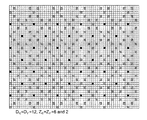
FIG. 25 Basic pattern components (D=6 and Zc=Zr=2 in this example) -
FIG. 26 Acquisition pattern for D=12 and Zc=Zr=2 illustrating the repeating rhombic patterns of the nodes-dark line. Define a unit area as 12 tiles by 12 tiles for this combination of Dc, Dr, Zc and Zr there are two nodes per unit area. -
FIG. 27 Acquisition pattern for D=12 and Zc=Zr=3, illustrating the repeating patterns of the nodes-dark line. Define a unit area as 12 tiles by 12 tiles for this combination of Dc, Dr, Zc and Zr there are five nodes per unit area. -
FIG. 28 Acquisition pattern for D=12 and Zc=Zr=4 illustrating the repeating rhombic pattern of nodes. Define a unit area as 12 tiles by 12 tiles for this combination of Dc, Dr, Zc and Zr there are six nodes per unit area. -
FIG. 29 Acquisition pattern for D=12 and Zc=Zr=6 illustrating the repeating rhombic pattern of nodes. Define a unit area as 12 tiles by 12 tiles for this combination of Dc, Dr, Zc and Zr there are ten nodes per unit area. -
FIG. 30 Acquisition pattern for D=12 and Zc=Zr=6 and 2 illustrating the repeating rhombic pattern of nodes. Define a unit area as 12 tiles by 12 tiles for this combination of Dc, Dr, Zc and Zr there are 12 nodes per unit area. -
FIG. 31 Acquisition pattern for D=4 and Zc=Zr=1 illustrating the repeating square pattern of nodes. Define a unit area as 12 tiles by 12 tiles for this combination of Dc, Dr, Zc and Zr there are nine nodes per unit area. -
FIG. 32 Acquisition pattern for Dc=8, Dr=12, and Zc=Zr=2 illustrating the repeating more complex pattern of nodes. Define a unit area as 12 tiles by 12 tiles for this combination of Dc, Dr, Zc and Zr there are four nodes per unit area. -
FIG. 33 Acquisition pattern for Dc=8, Dr=12, and Zc=Zr=2 with the Continuously Curves sail-lines taking the form of an ellipse -
FIG. 34 Acquisition pattern for Dc=6, Dr=6, and Zc=Zr=2 with continuously curved sail-lines described by a circle ofdiameter 5*Dr, 6*Dr and 7*Dr. And a continuously curved sail-line described by an octagon ofdiameter 6*Dr -
FIG. 35 Acquisition pattern for Dc=6, Dr=6, and Zc=Zr=2 with continuously curved sail-lines described by an ellipse ofdiameter 6*Dc, and 7*Dr -
FIG. 36 Acquisition pattern for Dc=6, Dr=6, and Zc=Zr=2 with a circle ofdiameter 5*Dr centered on a tile that does not contain a node of a continuously curved sail-line. The circumference of this circle intersects 12 (dark) tiles that are nodes of a continuously curved sail-line. Therefore the continuously curved sail-lines that orbit these (dark) nodes all contribute to the coverage within the tile highlighted by the cross in the center. SeeFIG. 37 . -
FIG. 37 Acquisition pattern for Dc=6, Dr=6, and Zc=Zr=2 with a circle ofdiameter 5*Dr centered on a tile that does not contain a node of a continuously curved sail-line. The continuously curved sail-lines that orbit these (dark) nodes all contribute to the coverage within the tile highlighted by the cross in the center. -
FIG. 38 Acquisition pattern for Dc=6, Dr=6, and Zc=Zr=2 Consider a group of tiles bounded by 4 tiles which contain nodes. Center on each of these tiles a circle ofdiameter 5*Dr (in this example). The circumferences of all of these circles intersect 36 (dark) tiles that are nodes of continuously curved sail-lines. Therefore the continuously curved sail-lines that orbit these 36 (dark) nodes all contribute to the coverage of the group of tiles bounded by the 4 nodes.
-
-
- U.S. application Ser. No. 11/114,773, filed Apr. 26, 2005, entitled, “Seismic Streamer System and Method” and filed in the name of the inventors Singh et al., published Oct. 26, 2006, as Patent Publication 2006/0239117 A1;
- U.S. application Ser. No. 11/122,646, filed Mar. 5, 2005, entitled, “Forward looking systems and methods for positioning marine seismic equipment” and filed in the name of the inventors Toennessen et al., published Nov. 16, 2006, as Patent Publication 2006/0256653 A1;
- U.S. Pat. No. 5,668,775, entitled “Methods for determining the position of seismic equipment, and applications of the methods” and issued Sep. 16, 1997, to GECO A. S. in the name of the inventor Kjell Hatteland;
- U.S. Pat. No. 6,671,223, entitled, “Control devices for controlling the position of a marine seismic streamer” and issued Dec. 30, 2003, to WesternGeco, L.L.C. in the name of the inventor Simon H. Bittleston; U.S. patent application Ser. No. 12/121,324, entitled “Methods for Efficiently Acquiring Wide-Azimuth Towed Streamer Seismic Data,” filed May 15, 2008, and filed in the name of the inventors Moldoveanu et al.
Claims (17)
Priority Applications (1)
| Application Number | Priority Date | Filing Date | Title |
|---|---|---|---|
| US13/943,560 US8908469B2 (en) | 2007-05-17 | 2013-07-16 | Acquiring azimuth rich seismic data in the marine environment using a regular sparse pattern of continuously curved sail lines |
Applications Claiming Priority (7)
| Application Number | Priority Date | Filing Date | Title |
|---|---|---|---|
| US93854707P | 2007-05-17 | 2007-05-17 | |
| US96653407P | 2007-08-09 | 2007-08-09 | |
| US96920307P | 2007-08-31 | 2007-08-31 | |
| US12/121,324 US8559265B2 (en) | 2007-05-17 | 2008-05-15 | Methods for efficiently acquiring wide-azimuth towed streamer seismic data |
| US10553508P | 2008-10-15 | 2008-10-15 | |
| US12/351,156 US8488409B2 (en) | 2007-05-17 | 2009-01-09 | Acquiring azimuth rich seismic data in the marine environment using a regular sparse pattern of continuously curved sail lines |
| US13/943,560 US8908469B2 (en) | 2007-05-17 | 2013-07-16 | Acquiring azimuth rich seismic data in the marine environment using a regular sparse pattern of continuously curved sail lines |
Related Parent Applications (1)
| Application Number | Title | Priority Date | Filing Date |
|---|---|---|---|
| US12/351,156 Continuation US8488409B2 (en) | 2007-05-17 | 2009-01-09 | Acquiring azimuth rich seismic data in the marine environment using a regular sparse pattern of continuously curved sail lines |
Publications (2)
| Publication Number | Publication Date |
|---|---|
| US20130301384A1 US20130301384A1 (en) | 2013-11-14 |
| US8908469B2 true US8908469B2 (en) | 2014-12-09 |
Family
ID=42107243
Family Applications (2)
| Application Number | Title | Priority Date | Filing Date |
|---|---|---|---|
| US12/351,156 Expired - Fee Related US8488409B2 (en) | 2007-05-17 | 2009-01-09 | Acquiring azimuth rich seismic data in the marine environment using a regular sparse pattern of continuously curved sail lines |
| US13/943,560 Expired - Fee Related US8908469B2 (en) | 2007-05-17 | 2013-07-16 | Acquiring azimuth rich seismic data in the marine environment using a regular sparse pattern of continuously curved sail lines |
Family Applications Before (1)
| Application Number | Title | Priority Date | Filing Date |
|---|---|---|---|
| US12/351,156 Expired - Fee Related US8488409B2 (en) | 2007-05-17 | 2009-01-09 | Acquiring azimuth rich seismic data in the marine environment using a regular sparse pattern of continuously curved sail lines |
Country Status (6)
| Country | Link |
|---|---|
| US (2) | US8488409B2 (en) |
| EP (1) | EP2347286B1 (en) |
| AU (1) | AU2009305692B2 (en) |
| BR (1) | BRPI0919603B1 (en) |
| MX (1) | MX2011004098A (en) |
| WO (1) | WO2010045472A2 (en) |
Cited By (1)
| Publication number | Priority date | Publication date | Assignee | Title |
|---|---|---|---|---|
| US20130188448A1 (en) * | 2012-01-24 | 2013-07-25 | Cggveritas Services Sa | Multi-vessel seismic acquisition with undulating navigation lines |
Families Citing this family (40)
| Publication number | Priority date | Publication date | Assignee | Title |
|---|---|---|---|---|
| US7400552B2 (en) | 2006-01-19 | 2008-07-15 | Westerngeco L.L.C. | Methods and systems for efficiently acquiring towed streamer seismic surveys |
| US8559265B2 (en) | 2007-05-17 | 2013-10-15 | Westerngeco L.L.C. | Methods for efficiently acquiring wide-azimuth towed streamer seismic data |
| US8488409B2 (en) | 2007-05-17 | 2013-07-16 | Westerngeco L.L.C. | Acquiring azimuth rich seismic data in the marine environment using a regular sparse pattern of continuously curved sail lines |
| US9857491B2 (en) | 2008-05-15 | 2018-01-02 | Westerngeco L.L.C. | Multi-vessel coil shooting acquisition |
| US8681580B2 (en) * | 2008-05-15 | 2014-03-25 | Westerngeco L.L.C. | Multi-vessel coil shooting acquisition |
| US8724426B2 (en) | 2008-06-03 | 2014-05-13 | Westerngeco L.L.C. | Marine seismic streamer system configurations, systems, and methods for non-linear seismic survey navigation |
| US9052411B2 (en) | 2008-06-13 | 2015-06-09 | Westerngeco L.L.C. | Method to determine the deviation of seismic equipment from a planned curved path |
| US9594181B2 (en) | 2008-06-13 | 2017-03-14 | Westerngeco L.L.C. | Filtering and presentation of heading observations for coil shooting |
| US8483008B2 (en) * | 2008-11-08 | 2013-07-09 | Westerngeco L.L.C. | Coil shooting mode |
| US8416640B2 (en) * | 2009-04-18 | 2013-04-09 | Global Geophysical Services | Methods for optimizing offset distribution of cross spread 3-D seismic surveys using variable shot line length |
| AU2015203555B2 (en) * | 2009-05-21 | 2017-04-20 | Geco Technology B.V. | Multi-vessel coil shooting acquisition |
| US8711654B2 (en) * | 2009-12-30 | 2014-04-29 | Westerngeco L.L.C. | Random sampling for geophysical acquisitions |
| US8681581B2 (en) * | 2009-12-30 | 2014-03-25 | Westerngeco L.L.C. | Randomization of data acquisition in marine seismic and electromagnetic acquisition |
| US8737163B2 (en) * | 2010-02-17 | 2014-05-27 | Westerngeco L.L.C. | Wide seismic source systems |
| US8374053B2 (en) * | 2010-05-19 | 2013-02-12 | Ion Geophysical Corporation | Seismic streamer shape estimation |
| WO2012010929A1 (en) | 2010-07-20 | 2012-01-26 | Nokia Corporation | A reverberation estimator |
| US9703809B2 (en) | 2011-03-23 | 2017-07-11 | Ion Geophysical Corporation | Method and apparatus for analyzing data in subsequent geophysical surveys |
| WO2012138369A1 (en) * | 2011-03-23 | 2012-10-11 | Ion Geophysical Corporation | Method and apparatus for analyzing data in time -lapse geophysical surveys |
| US9575197B2 (en) | 2011-06-16 | 2017-02-21 | CGGVeritas Services (U.S.) Inc. | Method and device for marine seismic acquisition |
| US9103942B2 (en) | 2011-10-28 | 2015-08-11 | Westerngeco L.L.C. | Methods and systems for survey designs |
| US9001615B2 (en) * | 2011-11-08 | 2015-04-07 | Conocophillips Company | Oscillating flared streamers |
| US8848483B2 (en) | 2011-11-09 | 2014-09-30 | Cggveritas Services Sa | Method and device for marine seismic acquisition |
| US9261619B2 (en) | 2012-01-03 | 2016-02-16 | Cggveritas Services Sa | Method and device for marine seismic acquisition |
| US20140078860A1 (en) * | 2012-09-19 | 2014-03-20 | Cgg Services Sa | Interference noise attenuation method and apparatus |
| EP2909655B1 (en) * | 2012-10-16 | 2017-05-03 | ConocoPhillips Company | Flared pseudo-random spiral marine acquisition |
| EP2981849A4 (en) * | 2013-04-05 | 2017-01-18 | Woodside Energy Technologies Pty Ltd | A magneto-hydrodynamic seismic source and a method of marine seismic surveying |
| US10520623B2 (en) * | 2013-05-31 | 2019-12-31 | Westerngeco L.L.C. | Methods and systems for marine survey acquisition |
| NO337220B1 (en) * | 2014-03-12 | 2016-02-15 | Octio As | Acoustic source system for permanent monitoring of a underground reservoir |
| MX2016016815A (en) * | 2014-06-19 | 2017-03-27 | Schlumberger Technology Bv | System and method to acquire ultra-long offset seismic data for full waveform inversion (fwi) using unmanned marine vehicle (umv). |
| CN104570123B (en) * | 2014-12-31 | 2017-03-08 | 中国石油天然气集团公司 | A kind of offshore exploration track determines method and apparatus |
| US10191165B2 (en) * | 2015-01-13 | 2019-01-29 | Cgg Services Sas | Using an offset vector tile gather to image a subsurface |
| US9945973B2 (en) | 2015-07-07 | 2018-04-17 | Cgg Services Sas | Marine seismic survey pre-plot design |
| US10222497B2 (en) | 2016-02-03 | 2019-03-05 | Cgg Services Sas | Multi-stack (broadband) wavelet estimation method |
| NO343551B1 (en) * | 2017-08-08 | 2019-04-01 | Polarcus Dmcc | Method and vessel steering module for seismic data acquiring and for routing a vessel, by generating a first straight line from a starting point to an end point and generating offset straight lines |
| GB2579854B (en) | 2018-12-18 | 2021-06-16 | Equinor Energy As | Method of analysing seismic data to detect hydrocarbons |
| NO345284B1 (en) * | 2019-02-07 | 2020-11-30 | Idrop As | Method for establishing a consolidated water current velocity profile |
| US11673628B2 (en) | 2019-04-17 | 2023-06-13 | Pgs Geophysical As | Marine survey source route configuration for multi-azimuth acquisition |
| US11644594B2 (en) | 2019-08-16 | 2023-05-09 | Pgs Geophysical As | Surveying with low frequency impulse sources |
| CN110995834B (en) * | 2019-12-02 | 2022-10-21 | 北京应用科学技术研究院 | Social network track following method and system |
| CN113050420B (en) * | 2021-03-04 | 2022-02-18 | 山东大学 | AUV path tracking method and system based on S-plane control and TD3 |
Citations (153)
| Publication number | Priority date | Publication date | Assignee | Title |
|---|---|---|---|---|
| US2404440A (en) | 1941-04-19 | 1946-07-23 | Clarence W Lothrop | Torpedo countermining device |
| US2465696A (en) | 1947-10-11 | 1949-03-29 | Marine Instr Company | Method and means for surveying geological formations |
| US2693862A (en) | 1948-10-11 | 1954-11-09 | Geovision Inc | Method of and apparatus for displaying geophysical data |
| US2823375A (en) | 1951-12-11 | 1958-02-11 | Melpar Inc | Distance measuring systems with compressed returned pulses |
| US3283293A (en) | 1964-02-13 | 1966-11-01 | Sonic Engineering Company | Particle velocity detector and means for canceling the effects of motional disturbances applied thereto |
| US3331050A (en) | 1965-04-16 | 1967-07-11 | Sinclair Research Inc | Method of underwater seismic exploration |
| US3440992A (en) | 1967-12-07 | 1969-04-29 | Teledyne Exploration Co | Streamer cable depth control |
| US3505577A (en) | 1966-04-13 | 1970-04-07 | Tokyo Keiki Kk | Adaptive control for ship steering whereby system is less sensitive in rough sea |
| US3506674A (en) | 1967-07-03 | 1970-04-14 | Gen Electric | Certain pyridyl thio ether silanes |
| US3560912A (en) | 1969-02-03 | 1971-02-02 | Westinghouse Electric Corp | Control system for a towed vehicle |
| US3581273A (en) | 1969-11-10 | 1971-05-25 | Ronald M Hedberg | Marine seismic exploration |
| US3605674A (en) | 1969-09-08 | 1971-09-20 | Dresser Ind | Underwater cable controller |
| US3774570A (en) | 1972-01-25 | 1973-11-27 | Whitehall Electronics Corp | Non-rotating depth controller paravane for seismic cables |
| US3806863A (en) | 1971-11-18 | 1974-04-23 | Chevron Res | Method of collecting seismic data of strata underlying bodies of water |
| US3896756A (en) | 1971-02-02 | 1975-07-29 | Whitehall Electronics Corp | Depth control apparatus for towed underwater cables |
| US3921124A (en) | 1974-03-18 | 1975-11-18 | Continental Oil Co | Marine 3-D seismic method using source position control |
| US3934220A (en) | 1973-07-03 | 1976-01-20 | Avance Oil & Gas Company, Inc. | Method of seismic exploration for penetrating diffraction barriers and/or surveying beneath obstacles |
| US3953827A (en) | 1973-02-21 | 1976-04-27 | Entreprise De Recherches Et D'activites Petrolieres (E.R.A.P.) | Method of determining the angular position of a towed marine seismic cable and apparatus for carrying out said method |
| US4033278A (en) | 1976-02-25 | 1977-07-05 | Continental Oil Company | Apparatus for controlling lateral positioning of a marine seismic cable |
| US4068208A (en) | 1975-07-14 | 1978-01-10 | Texas Instruments Incorporated | Marine streamer position determination system |
| US4074648A (en) | 1976-10-18 | 1978-02-21 | Sperry Rand Corporation | Adaptive autopilot for marine vessels |
| US4086504A (en) | 1973-10-29 | 1978-04-25 | Texas Instruments Incorporated | Distributed data acquisition |
| US4146870A (en) | 1976-07-28 | 1979-03-27 | Mobil Oil Corporation | Seismic exploration for dipping formations |
| US4231111A (en) | 1978-03-13 | 1980-10-28 | Mobil Oil Corporation | Marine cable location system |
| EP0018053A1 (en) | 1979-04-24 | 1980-10-29 | Shell Internationale Researchmaatschappij B.V. | Means for marine seismic exploration and method of operating such means |
| US4290124A (en) | 1978-11-01 | 1981-09-15 | Syntron, Inc. | Remote control cable depth control apparatus |
| GB2093610A (en) | 1980-12-31 | 1982-09-02 | Mobil Oil Corp | System for laterally psitioning a towed marine cable and method of using same |
| US4383259A (en) | 1980-11-24 | 1983-05-10 | World Navigation Electronics Inc. | Marine navigational aid |
| WO1984003153A1 (en) | 1983-02-02 | 1984-08-16 | Kongsberg Vapenfab As | Device in a hydrophone cable for marine seismic surveys |
| US4468663A (en) | 1981-09-08 | 1984-08-28 | Kalt Charles G | Electromechanical reflective display device |
| US4486863A (en) * | 1983-08-11 | 1984-12-04 | Tensor Geophysical Service Corporation | Circular seismic acquisition system |
| US4648080A (en) | 1984-06-15 | 1987-03-03 | Western Geophysical Company | Method for determining the far field signature of a marine seismic source from near-field measurements |
| US4669097A (en) | 1985-10-21 | 1987-05-26 | The Foxboro Company | Data compression for display and storage |
| US4709355A (en) | 1984-06-18 | 1987-11-24 | Syntron, Inc. | Controller for marine seismic cable |
| US4729333A (en) | 1986-07-09 | 1988-03-08 | Exxon Production Research Company | Remotely-controllable paravane |
| US4757482A (en) | 1983-03-15 | 1988-07-12 | Bolt Technology Corporation | Modular airgun array method, apparatus and system |
| US4803668A (en) | 1988-05-27 | 1989-02-07 | Exxon Production Research Company | Method of 3-D seismic imaging for structures with approximate circular symmetry |
| US4834181A (en) | 1987-12-29 | 1989-05-30 | Mobil Oil Corporation | Creation of multi-azimuth permeable hydraulic fractures |
| EP0321705A2 (en) | 1987-12-12 | 1989-06-28 | PRAKLA-SEISMOS GmbH | Method for obtaining seismic data |
| EP0347019A2 (en) | 1988-06-16 | 1989-12-20 | Western Atlas International, Inc. | Simultaneous vertical-seismic profiling and surface seismic acquisition method |
| US4890568A (en) | 1988-08-24 | 1990-01-02 | Exxon Production Research Company | Steerable tail buoy |
| US4912684A (en) | 1988-02-29 | 1990-03-27 | Digicourse, Inc. | Seismic streamer communication system |
| US4942991A (en) | 1989-10-30 | 1990-07-24 | Lyons Robert M | Ammunition container |
| US4960183A (en) | 1985-08-16 | 1990-10-02 | Exxon Production Research Company | Seismic source firing control system |
| US4965773A (en) | 1987-12-09 | 1990-10-23 | Prakla-Seismos Ag | Method for recording seismic data |
| US4970696A (en) * | 1988-07-13 | 1990-11-13 | Atlantic Richfield Company | Method for conducting three-dimensional subsurface and marine seismic surveys |
| US4970697A (en) | 1989-10-06 | 1990-11-13 | Amoco Corporation | Vertical marine seismic array |
| US4992990A (en) | 1988-06-06 | 1991-02-12 | Geco A.S. | Method for determining the position of seismic streamers in a reflection seismic measuring system |
| US4992991A (en) | 1988-10-31 | 1991-02-12 | Exxon Production Research Company | Marine seismic receiving system employing multiple depth hydrostreamer cable |
| US5031159A (en) | 1990-02-21 | 1991-07-09 | Laitram Corporation | Hydroacoustic ranging system |
| US5179905A (en) | 1991-11-19 | 1993-01-19 | Raytheon Company | Adaptive autopilot |
| US5200930A (en) | 1992-01-24 | 1993-04-06 | The Laitram Corporation | Two-wire multi-channel streamer communication system |
| EP0562781A2 (en) | 1992-03-24 | 1993-09-29 | Geco A.S. | Method of and apparatus for operating equipment installed in marine seismic tows |
| US5300929A (en) | 1991-10-04 | 1994-04-05 | Chevron Research And Technology Company | Method for delineating an anomalous geologic structure |
| EP0613025A1 (en) | 1993-02-23 | 1994-08-31 | Geco A.S. | A device and method for positioning of towing systems for use in marine seismic surveys |
| US5353223A (en) | 1992-10-26 | 1994-10-04 | Western Atlas International, Inc. | Marine navigation method for geophysical exploration |
| US5430689A (en) | 1991-07-03 | 1995-07-04 | Atlantic Richfield Company | Method for acquiring marine seismic data having statistically distributed azimuths and offsets |
| US5443027A (en) | 1993-12-20 | 1995-08-22 | The United States Of America As Represented By The Secretary Of The Navy | Lateral force device for underwater towed array |
| USH1490H (en) | 1992-09-28 | 1995-09-05 | Exxon Production Research Company | Marine geophysical prospecting system |
| US5508973A (en) | 1994-06-06 | 1996-04-16 | Western Atlas International, Inc. | Method for determining the principal axes of azimuthal anisotropy from seismic P-wave data |
| WO1996021163A1 (en) | 1994-12-20 | 1996-07-11 | Geco A.S. | A method for integrity monitoring in position determination |
| US5546882A (en) | 1994-07-13 | 1996-08-20 | Petroleum Geo-Services A/S | Arrangement for towing |
| US5555531A (en) | 1994-12-19 | 1996-09-10 | Shell Oil Company | Method for identification of near-surface drilling hazards |
| WO1997011395A2 (en) | 1995-09-22 | 1997-03-27 | The Laitram Corporation | Coil support device for an underwater cable |
| US5640325A (en) | 1988-09-13 | 1997-06-17 | Litton Systems, Inc. | Sensor array dynamic position and orientation determination system |
| WO1997030361A1 (en) | 1996-02-13 | 1997-08-21 | Thomson-Csf | Method for controlling the navigation of a towed linear acoustic antenna, and devices therefor |
| US5668775A (en) | 1993-11-19 | 1997-09-16 | Geco A.S. | Methods for determining the position of seismic equipment, and applications of the methods |
| US5677893A (en) | 1994-07-07 | 1997-10-14 | Schlumberger Technology Corporation | Method of processing seismic data |
| WO1997045006A1 (en) | 1996-05-28 | 1997-12-04 | Pratt, Dave | Deflector |
| US5761152A (en) | 1996-10-29 | 1998-06-02 | Pgs Exploration (Us), Inc. | Method and system for increasing fold to streamer length ratio |
| WO1998028636A1 (en) | 1996-12-20 | 1998-07-02 | Schlumberger Canada Limited | Control devices for controlling the position of a marine seismic streamer |
| US5790472A (en) | 1996-12-20 | 1998-08-04 | Western Atlas International, Inc. | Adaptive control of marine seismic streamers |
| EP0681193B1 (en) | 1994-05-05 | 1999-08-25 | Western Atlas International, Inc. | Method of attenuating coherent noise in marine seismic data |
| US5973995A (en) | 1994-12-08 | 1999-10-26 | Geco A.S. | Method of and apparatus for marine seismic surveying |
| US5978316A (en) | 1997-09-29 | 1999-11-02 | Western Atlas International, Inc. | Marine seismic source |
| US6011752A (en) | 1998-08-03 | 2000-01-04 | Western Atlas International, Inc. | Seismic streamer position control module |
| US6011753A (en) | 1998-03-19 | 2000-01-04 | Syntron, Inc. | Control and monitoring of devices external to a marine seismic streamer |
| US6044040A (en) | 1998-09-23 | 2000-03-28 | Input/Output, Inc. | Wide-azimuth, radially-directed seismic data acquisition method |
| GB2342081A (en) | 1998-10-01 | 2000-04-05 | Geco As | Controlling a streamer positioning device |
| US6061301A (en) | 1997-06-30 | 2000-05-09 | Atlantic Richfield Company | Filtering of overburden azimuthal anisotropy effects from 3D seismic survey signals |
| US6175809B1 (en) | 1998-02-09 | 2001-01-16 | Institut Francais Du Petrole | Immersible seismic emission device and implementation method |
| US6178381B1 (en) | 1998-01-27 | 2001-01-23 | Shell Oil Company | Method of geophysical exploration |
| WO2001029580A1 (en) | 1999-10-21 | 2001-04-26 | Geco As | Seismic data acquisition and processing method |
| US6285956B1 (en) | 1997-12-30 | 2001-09-04 | Westerngeco, Llc | Marine Seismic tow system |
| US6292754B1 (en) | 1999-11-11 | 2001-09-18 | Bp Corporation North America Inc. | Vector recomposition of seismic 3-D converted-wave data |
| US6343256B1 (en) | 2000-06-12 | 2002-01-29 | Exxonmobil Upstream Research Company | Illumination corrections to reduce geometrical artifacts in seismic data |
| US6418378B1 (en) | 2000-06-26 | 2002-07-09 | Westerngeco, L.L.C. | Neural net prediction of seismic streamer shape |
| US6477111B1 (en) | 1998-10-29 | 2002-11-05 | Schlumberger Technology Corporation | Method of making a marine seismic streamer |
| US20020193947A1 (en) | 2001-06-05 | 2002-12-19 | Geo-X Systems, Ltd. | Seismic data acquisition system |
| US6525992B1 (en) | 1995-09-22 | 2003-02-25 | Input/Output, Inc. | Devices for controlling the position of an underwater cable |
| US6529832B1 (en) | 1997-10-15 | 2003-03-04 | Albin K. Kerekes | Seismic imaging using omni-azimuth seismic energy sources and directional sensing |
| US20030067842A1 (en) | 2001-10-05 | 2003-04-10 | Sukup Dwight V. | Helix streamer acquisition of seismic data |
| US6553315B2 (en) | 1997-10-15 | 2003-04-22 | Albin K. Kerekes | Seismic imaging using omni-azimuth seismic energy sources and directional sensing |
| US20030125878A1 (en) | 2001-12-17 | 2003-07-03 | Schlumberger Technology Corporation | System and method for estimating subsurface principal stresses from seismic reflection data |
| US6590831B1 (en) | 1997-12-30 | 2003-07-08 | Westerngeco L.L.C. | Method and apparatus for controlling and optimizing seismic data acquisition |
| US6629037B1 (en) | 2000-06-26 | 2003-09-30 | Westerngeco, L.L.C. | Optimal paths for marine data collection |
| US6671223B2 (en) | 1996-12-20 | 2003-12-30 | Westerngeco, L.L.C. | Control devices for controlling the position of a marine seismic streamer |
| GB2390902A (en) | 2002-07-17 | 2004-01-21 | Pgs Americas Inc | Firing sequence of multiple sources in a marine seismic survey |
| US6684160B1 (en) | 1998-05-20 | 2004-01-27 | Westerngeco | Marine seismic acquisition system and method |
| US6691038B2 (en) | 2001-06-15 | 2004-02-10 | Westerngeco L.L.C. | Active separation tracking and positioning system for towed seismic arrays |
| US20040042341A1 (en) | 2002-08-30 | 2004-03-04 | Tenghamn Stig Rune Lennart | Apparatus and methods for multicomponent marine geophysical data gathering |
| US20040066707A1 (en) | 2002-10-04 | 2004-04-08 | Tenghamn Stig Rune Lennart | Apparatus and method for bubble sheilding towed marine cable |
| US20040125697A1 (en) * | 2001-03-09 | 2004-07-01 | Fleming Ronald Stephen | Marine surveys |
| WO2004092771A2 (en) | 2003-04-15 | 2004-10-28 | Westerngeco Seismic Holdings Limited | Active steering for marine seismic sources |
| US20040240319A1 (en) * | 2003-05-30 | 2004-12-02 | Carvill Charles V. | Method and apparatus for water velocity decomposition |
| US6837175B1 (en) | 2003-07-24 | 2005-01-04 | The United States Of America As Represented By The Secretary Of The Navy | Asymmetric tow system for multiple linear seismic arrays |
| US6847896B1 (en) | 1998-11-03 | 2005-01-25 | Westerngeco, L.L.C. | Seismic data acquisition method and apparatus |
| US20050018537A1 (en) | 2003-07-21 | 2005-01-27 | Welker Kenneth E. | Cable motion detection |
| US6862531B2 (en) | 2002-01-15 | 2005-03-01 | Westerngeco, L.L.C. | Layer stripping converted reflected waveforms for dipping fractures |
| US6865487B2 (en) | 2002-05-06 | 2005-03-08 | Total Fina Elf S.A. | Method for decimating seismic traces driven by the seismic path |
| WO2005062075A1 (en) | 2003-12-15 | 2005-07-07 | Chevron, U.S.A. Inc. | Methods for acquiring and processing seismic data from quasi-simultaneously activated translating energy sources |
| US20050180263A1 (en) | 2002-05-23 | 2005-08-18 | Lambert Dale J. | Gps-based underwater cable positioning system |
| US20050180260A1 (en) | 2002-03-07 | 2005-08-18 | Sverre Planke | Apparatus for seismic measurements |
| US20050194201A1 (en) | 2004-03-03 | 2005-09-08 | Tenghamn Stig R.L. | Particle motion sensor for marine seismic sensor streamers |
| US6944094B1 (en) | 1997-06-20 | 2005-09-13 | Bp Corporation North America Inc. | High resolution determination of seismic polar anisotropy |
| WO2006014750A2 (en) | 2004-07-23 | 2006-02-09 | Input/Ouput, Inc. | Offset-azimuth binning for migration and velocity analysis |
| US7065449B2 (en) | 2004-03-05 | 2006-06-20 | Bell Geospace, Inc. | Method and system for evaluating geophysical survey data |
| US20060215489A1 (en) | 2005-03-22 | 2006-09-28 | Stig Solheim | Systems and methods for seismic streamer positioning |
| GB2424949A (en) | 2005-04-08 | 2006-10-11 | Westerngeco Seismic Holdings | Controlling the vertical and horizontal positions of streamers in an over/under configuration |
| US20060239117A1 (en) | 2005-04-26 | 2006-10-26 | Rohitashva Singh | Seismic streamer system and method |
| US20060256653A1 (en) | 2005-05-05 | 2006-11-16 | Rune Toennessen | Forward looking systems and methods for positioning marine seismic equipment |
| US20060256654A1 (en) | 2005-05-12 | 2006-11-16 | Paulsen Jens O | Seismic streamer receiver selection systems and methods |
| US20060285435A1 (en) | 2004-05-21 | 2006-12-21 | Robertsson Johan O A | Time lapse marine seismic surveying employing interpolated multicomponent streamer pressure data |
| US20070064526A1 (en) | 2005-08-26 | 2007-03-22 | Holo Andreas T | Automatic systems and methods for positioning marine seismic equipment |
| US7203130B1 (en) | 2006-03-21 | 2007-04-10 | Westerngeco, L.L.C. | Methods for deriving shape of seismic data acquisition cables and streamers employing a force model |
| US20070104028A1 (en) | 2005-11-04 | 2007-05-10 | Dirk-Jan Van Manen | Construction and removal of scattered ground roll using interferometric methods |
| US20070127312A1 (en) | 2005-12-02 | 2007-06-07 | Eskild Storteig | Current prediction in seismic surveys |
| WO2007070499A2 (en) | 2005-12-12 | 2007-06-21 | Bp Corporation North America Inc. | Method of wide azimuth seismic aquisition |
| US20070165486A1 (en) | 2006-01-19 | 2007-07-19 | Nicolae Moldoveanu | Methods and systems for efficiently acquiring towed streamer seismic surveys |
| US20070274153A1 (en) | 2004-04-07 | 2007-11-29 | Westerngeco, L.L.C. | Fast 3-D Surface Multiple Prediction |
| US20080008037A1 (en) | 2006-07-07 | 2008-01-10 | Welker Kenneth E | Acoustic propagation velocity modeling methods, apparatus and systems |
| US7377224B2 (en) | 2005-05-12 | 2008-05-27 | Western Geco L.L.C. | Apparatus and methods for seismic streamer positioning |
| US7403448B2 (en) | 2005-06-03 | 2008-07-22 | Westerngeco L.L.C. | Streamer steering device orientation determination apparatus and methods |
| US20080239875A1 (en) | 2007-03-29 | 2008-10-02 | Schlumberger Technology Corporation | Surveying Method Using an Arrangement of Plural Signal Sources |
| US20080285381A1 (en) | 2007-05-17 | 2008-11-20 | Nicolae Moldoveanu | Methods for Efficiently Acquiring Wide-Azimuth Towed Streamer Seismic Data |
| US20080285380A1 (en) | 2007-05-18 | 2008-11-20 | Input/Output, Inc. | Seismic streamer with irregularly spaced hydrophones |
| WO2008144492A2 (en) | 2007-05-17 | 2008-11-27 | Schlumberger Canada Limited | Methods for efficiently acquiring wide-azimuth towed streamer seismic data |
| US20090122640A1 (en) | 2007-05-17 | 2009-05-14 | David Ian Hill | Acquiring azimuth rich seismic data in the marine environment using a regular sparse pattern of continuously curved sail lines |
| US20090245019A1 (en) | 2008-03-31 | 2009-10-01 | Jon Falkenberg | Method and system for determining geodetic positions of towed marine sensor array components |
| US20090262601A1 (en) | 2008-04-21 | 2009-10-22 | Oyvind Hillesund | Methods for controlling towed marine sensor array geometry |
| US20090310439A1 (en) | 2008-06-13 | 2009-12-17 | Johan Hauan | Method to determine the deviation of seismic equipment from a planned curved path |
| US20090310440A1 (en) | 2008-06-13 | 2009-12-17 | Stig Solheim | Filtering and presentation of heading observations for coil shooting |
| US20090316525A1 (en) | 2008-06-03 | 2009-12-24 | Welker Kenneth E | Marine seismic streamer system configurations, systems, and methods for non-linear seismic survey navigation |
| WO2010002600A2 (en) | 2008-07-03 | 2010-01-07 | Conocophillips Company | Marine seismic acquisition with controlled streamer flaring |
| US20100013485A1 (en) | 2008-07-16 | 2010-01-21 | Alumbaugh David L | Surveying using vertical electromagnetic sources that are towed along with survey receivers |
| US20100118645A1 (en) | 2008-11-08 | 2010-05-13 | Kenneth Welker | Coil shooting mode |
| US20100142317A1 (en) | 2008-05-15 | 2010-06-10 | Nicolae Moldoveanu | Multi-vessel coil shooting acquisition |
| US20100238762A1 (en) | 2007-12-12 | 2010-09-23 | Hornbostel Scott C | Method and Apparatus For Evaluating Submarine Formations |
| US7952522B2 (en) | 2006-02-15 | 2011-05-31 | Sony Deutschland Gmbh | Relative 3D positioning in an ad-hoc network based on distances |
| US7965583B2 (en) | 2005-04-07 | 2011-06-21 | Cggveritas Services Sa | Method and apparatus for guiding seismic acquisition equipment |
| US20110158041A1 (en) | 2009-12-30 | 2011-06-30 | Westerngeco L. L. C. | Random Sampling for Geophysical Acquisitions |
| US20110158042A1 (en) | 2009-12-30 | 2011-06-30 | Nicolae Moldoveanu | Randomization of Data Acquisition in Marine Seismic and Electromagnetic Acquisition |
| US8004930B2 (en) | 2008-03-17 | 2011-08-23 | Westerngeco, L.L.C. | Methods and systems for determining coordinates of an underwater seismic component in a reference frame |
Family Cites Families (1)
| Publication number | Priority date | Publication date | Assignee | Title |
|---|---|---|---|---|
| US7264713B2 (en) * | 2003-09-03 | 2007-09-04 | Thomas Kryzak | Apparatus, system and method for remediation of contamination |
-
2009
- 2009-01-09 US US12/351,156 patent/US8488409B2/en not_active Expired - Fee Related
- 2009-10-15 AU AU2009305692A patent/AU2009305692B2/en not_active Ceased
- 2009-10-15 MX MX2011004098A patent/MX2011004098A/en active IP Right Grant
- 2009-10-15 WO PCT/US2009/060864 patent/WO2010045472A2/en active Application Filing
- 2009-10-15 BR BRPI0919603 patent/BRPI0919603B1/en not_active IP Right Cessation
- 2009-10-15 EP EP09821262.4A patent/EP2347286B1/en not_active Not-in-force
-
2013
- 2013-07-16 US US13/943,560 patent/US8908469B2/en not_active Expired - Fee Related
Patent Citations (175)
| Publication number | Priority date | Publication date | Assignee | Title |
|---|---|---|---|---|
| US2404440A (en) | 1941-04-19 | 1946-07-23 | Clarence W Lothrop | Torpedo countermining device |
| US2465696A (en) | 1947-10-11 | 1949-03-29 | Marine Instr Company | Method and means for surveying geological formations |
| US2693862A (en) | 1948-10-11 | 1954-11-09 | Geovision Inc | Method of and apparatus for displaying geophysical data |
| US2823375A (en) | 1951-12-11 | 1958-02-11 | Melpar Inc | Distance measuring systems with compressed returned pulses |
| US3283293A (en) | 1964-02-13 | 1966-11-01 | Sonic Engineering Company | Particle velocity detector and means for canceling the effects of motional disturbances applied thereto |
| US3331050A (en) | 1965-04-16 | 1967-07-11 | Sinclair Research Inc | Method of underwater seismic exploration |
| US3505577A (en) | 1966-04-13 | 1970-04-07 | Tokyo Keiki Kk | Adaptive control for ship steering whereby system is less sensitive in rough sea |
| US3506674A (en) | 1967-07-03 | 1970-04-14 | Gen Electric | Certain pyridyl thio ether silanes |
| US3440992A (en) | 1967-12-07 | 1969-04-29 | Teledyne Exploration Co | Streamer cable depth control |
| US3560912A (en) | 1969-02-03 | 1971-02-02 | Westinghouse Electric Corp | Control system for a towed vehicle |
| US3605674A (en) | 1969-09-08 | 1971-09-20 | Dresser Ind | Underwater cable controller |
| US3581273A (en) | 1969-11-10 | 1971-05-25 | Ronald M Hedberg | Marine seismic exploration |
| US3896756A (en) | 1971-02-02 | 1975-07-29 | Whitehall Electronics Corp | Depth control apparatus for towed underwater cables |
| US3806863A (en) | 1971-11-18 | 1974-04-23 | Chevron Res | Method of collecting seismic data of strata underlying bodies of water |
| US3774570A (en) | 1972-01-25 | 1973-11-27 | Whitehall Electronics Corp | Non-rotating depth controller paravane for seismic cables |
| US3953827A (en) | 1973-02-21 | 1976-04-27 | Entreprise De Recherches Et D'activites Petrolieres (E.R.A.P.) | Method of determining the angular position of a towed marine seismic cable and apparatus for carrying out said method |
| US3934220A (en) | 1973-07-03 | 1976-01-20 | Avance Oil & Gas Company, Inc. | Method of seismic exploration for penetrating diffraction barriers and/or surveying beneath obstacles |
| US4086504A (en) | 1973-10-29 | 1978-04-25 | Texas Instruments Incorporated | Distributed data acquisition |
| US3921124A (en) | 1974-03-18 | 1975-11-18 | Continental Oil Co | Marine 3-D seismic method using source position control |
| US4068208A (en) | 1975-07-14 | 1978-01-10 | Texas Instruments Incorporated | Marine streamer position determination system |
| US4033278A (en) | 1976-02-25 | 1977-07-05 | Continental Oil Company | Apparatus for controlling lateral positioning of a marine seismic cable |
| US4146870A (en) | 1976-07-28 | 1979-03-27 | Mobil Oil Corporation | Seismic exploration for dipping formations |
| US4074648A (en) | 1976-10-18 | 1978-02-21 | Sperry Rand Corporation | Adaptive autopilot for marine vessels |
| US4231111A (en) | 1978-03-13 | 1980-10-28 | Mobil Oil Corporation | Marine cable location system |
| US4290124A (en) | 1978-11-01 | 1981-09-15 | Syntron, Inc. | Remote control cable depth control apparatus |
| EP0018053B1 (en) | 1979-04-24 | 1983-12-07 | Shell Internationale Researchmaatschappij B.V. | Means for marine seismic exploration and method of operating such means |
| EP0018053A1 (en) | 1979-04-24 | 1980-10-29 | Shell Internationale Researchmaatschappij B.V. | Means for marine seismic exploration and method of operating such means |
| US4383259A (en) | 1980-11-24 | 1983-05-10 | World Navigation Electronics Inc. | Marine navigational aid |
| US4404664A (en) | 1980-12-31 | 1983-09-13 | Mobil Oil Corporation | System for laterally positioning a towed marine cable and method of using same |
| GB2093610A (en) | 1980-12-31 | 1982-09-02 | Mobil Oil Corp | System for laterally psitioning a towed marine cable and method of using same |
| US4468663A (en) | 1981-09-08 | 1984-08-28 | Kalt Charles G | Electromechanical reflective display device |
| WO1984003153A1 (en) | 1983-02-02 | 1984-08-16 | Kongsberg Vapenfab As | Device in a hydrophone cable for marine seismic surveys |
| US4757482A (en) | 1983-03-15 | 1988-07-12 | Bolt Technology Corporation | Modular airgun array method, apparatus and system |
| US4486863A (en) * | 1983-08-11 | 1984-12-04 | Tensor Geophysical Service Corporation | Circular seismic acquisition system |
| GB2144854A (en) | 1983-08-11 | 1985-03-13 | Tensor Geophysical Service | A method of gathering marine seismic data |
| US4648080A (en) | 1984-06-15 | 1987-03-03 | Western Geophysical Company | Method for determining the far field signature of a marine seismic source from near-field measurements |
| US4709355A (en) | 1984-06-18 | 1987-11-24 | Syntron, Inc. | Controller for marine seismic cable |
| US4960183A (en) | 1985-08-16 | 1990-10-02 | Exxon Production Research Company | Seismic source firing control system |
| US4669097A (en) | 1985-10-21 | 1987-05-26 | The Foxboro Company | Data compression for display and storage |
| US4729333A (en) | 1986-07-09 | 1988-03-08 | Exxon Production Research Company | Remotely-controllable paravane |
| US4965773A (en) | 1987-12-09 | 1990-10-23 | Prakla-Seismos Ag | Method for recording seismic data |
| EP0321705A2 (en) | 1987-12-12 | 1989-06-28 | PRAKLA-SEISMOS GmbH | Method for obtaining seismic data |
| US4834181A (en) | 1987-12-29 | 1989-05-30 | Mobil Oil Corporation | Creation of multi-azimuth permeable hydraulic fractures |
| US4912684A (en) | 1988-02-29 | 1990-03-27 | Digicourse, Inc. | Seismic streamer communication system |
| US4803668A (en) | 1988-05-27 | 1989-02-07 | Exxon Production Research Company | Method of 3-D seismic imaging for structures with approximate circular symmetry |
| US4992990A (en) | 1988-06-06 | 1991-02-12 | Geco A.S. | Method for determining the position of seismic streamers in a reflection seismic measuring system |
| EP0347019A2 (en) | 1988-06-16 | 1989-12-20 | Western Atlas International, Inc. | Simultaneous vertical-seismic profiling and surface seismic acquisition method |
| US4970696A (en) * | 1988-07-13 | 1990-11-13 | Atlantic Richfield Company | Method for conducting three-dimensional subsurface and marine seismic surveys |
| US4890568A (en) | 1988-08-24 | 1990-01-02 | Exxon Production Research Company | Steerable tail buoy |
| US5640325A (en) | 1988-09-13 | 1997-06-17 | Litton Systems, Inc. | Sensor array dynamic position and orientation determination system |
| US4992991A (en) | 1988-10-31 | 1991-02-12 | Exxon Production Research Company | Marine seismic receiving system employing multiple depth hydrostreamer cable |
| US4970697A (en) | 1989-10-06 | 1990-11-13 | Amoco Corporation | Vertical marine seismic array |
| US4942991A (en) | 1989-10-30 | 1990-07-24 | Lyons Robert M | Ammunition container |
| US5031159A (en) | 1990-02-21 | 1991-07-09 | Laitram Corporation | Hydroacoustic ranging system |
| US5430689A (en) | 1991-07-03 | 1995-07-04 | Atlantic Richfield Company | Method for acquiring marine seismic data having statistically distributed azimuths and offsets |
| US5300929A (en) | 1991-10-04 | 1994-04-05 | Chevron Research And Technology Company | Method for delineating an anomalous geologic structure |
| US5179905A (en) | 1991-11-19 | 1993-01-19 | Raytheon Company | Adaptive autopilot |
| US5200930A (en) | 1992-01-24 | 1993-04-06 | The Laitram Corporation | Two-wire multi-channel streamer communication system |
| US5329071A (en) | 1992-03-24 | 1994-07-12 | Geco As | Method and device for operation of equipment installed in marine seismic tows |
| EP0562781A2 (en) | 1992-03-24 | 1993-09-29 | Geco A.S. | Method of and apparatus for operating equipment installed in marine seismic tows |
| USH1490H (en) | 1992-09-28 | 1995-09-05 | Exxon Production Research Company | Marine geophysical prospecting system |
| US5353223A (en) | 1992-10-26 | 1994-10-04 | Western Atlas International, Inc. | Marine navigation method for geophysical exploration |
| EP0613025B1 (en) | 1993-02-23 | 1998-09-02 | Geco A.S. | A device and method for positioning of towing systems for use in marine seismic surveys |
| US5532975A (en) | 1993-02-23 | 1996-07-02 | Geco A.S. | Device and method for positioning of towing systems for use in marine seismic surveys |
| EP0613025A1 (en) | 1993-02-23 | 1994-08-31 | Geco A.S. | A device and method for positioning of towing systems for use in marine seismic surveys |
| US5668775A (en) | 1993-11-19 | 1997-09-16 | Geco A.S. | Methods for determining the position of seismic equipment, and applications of the methods |
| US5443027A (en) | 1993-12-20 | 1995-08-22 | The United States Of America As Represented By The Secretary Of The Navy | Lateral force device for underwater towed array |
| EP0681193B1 (en) | 1994-05-05 | 1999-08-25 | Western Atlas International, Inc. | Method of attenuating coherent noise in marine seismic data |
| US5508973A (en) | 1994-06-06 | 1996-04-16 | Western Atlas International, Inc. | Method for determining the principal axes of azimuthal anisotropy from seismic P-wave data |
| US5677893A (en) | 1994-07-07 | 1997-10-14 | Schlumberger Technology Corporation | Method of processing seismic data |
| US5546882A (en) | 1994-07-13 | 1996-08-20 | Petroleum Geo-Services A/S | Arrangement for towing |
| US5973995A (en) | 1994-12-08 | 1999-10-26 | Geco A.S. | Method of and apparatus for marine seismic surveying |
| US5555531A (en) | 1994-12-19 | 1996-09-10 | Shell Oil Company | Method for identification of near-surface drilling hazards |
| WO1996021163A1 (en) | 1994-12-20 | 1996-07-11 | Geco A.S. | A method for integrity monitoring in position determination |
| WO1997011395A2 (en) | 1995-09-22 | 1997-03-27 | The Laitram Corporation | Coil support device for an underwater cable |
| US6525992B1 (en) | 1995-09-22 | 2003-02-25 | Input/Output, Inc. | Devices for controlling the position of an underwater cable |
| WO1997030361A1 (en) | 1996-02-13 | 1997-08-21 | Thomson-Csf | Method for controlling the navigation of a towed linear acoustic antenna, and devices therefor |
| US6144342A (en) | 1996-02-13 | 2000-11-07 | Thomson-Csf | Method for controlling the navigation of a towed linear acoustic antenna, and devices therefor |
| WO1997045006A1 (en) | 1996-05-28 | 1997-12-04 | Pratt, Dave | Deflector |
| US5761152A (en) | 1996-10-29 | 1998-06-02 | Pgs Exploration (Us), Inc. | Method and system for increasing fold to streamer length ratio |
| WO1998028636A1 (en) | 1996-12-20 | 1998-07-02 | Schlumberger Canada Limited | Control devices for controlling the position of a marine seismic streamer |
| US5790472A (en) | 1996-12-20 | 1998-08-04 | Western Atlas International, Inc. | Adaptive control of marine seismic streamers |
| US6671223B2 (en) | 1996-12-20 | 2003-12-30 | Westerngeco, L.L.C. | Control devices for controlling the position of a marine seismic streamer |
| US6944094B1 (en) | 1997-06-20 | 2005-09-13 | Bp Corporation North America Inc. | High resolution determination of seismic polar anisotropy |
| US6061301A (en) | 1997-06-30 | 2000-05-09 | Atlantic Richfield Company | Filtering of overburden azimuthal anisotropy effects from 3D seismic survey signals |
| US5978316A (en) | 1997-09-29 | 1999-11-02 | Western Atlas International, Inc. | Marine seismic source |
| US6553315B2 (en) | 1997-10-15 | 2003-04-22 | Albin K. Kerekes | Seismic imaging using omni-azimuth seismic energy sources and directional sensing |
| US6529832B1 (en) | 1997-10-15 | 2003-03-04 | Albin K. Kerekes | Seismic imaging using omni-azimuth seismic energy sources and directional sensing |
| US6590831B1 (en) | 1997-12-30 | 2003-07-08 | Westerngeco L.L.C. | Method and apparatus for controlling and optimizing seismic data acquisition |
| US6285956B1 (en) | 1997-12-30 | 2001-09-04 | Westerngeco, Llc | Marine Seismic tow system |
| US6178381B1 (en) | 1998-01-27 | 2001-01-23 | Shell Oil Company | Method of geophysical exploration |
| US6175809B1 (en) | 1998-02-09 | 2001-01-16 | Institut Francais Du Petrole | Immersible seismic emission device and implementation method |
| US6011753A (en) | 1998-03-19 | 2000-01-04 | Syntron, Inc. | Control and monitoring of devices external to a marine seismic streamer |
| US6684160B1 (en) | 1998-05-20 | 2004-01-27 | Westerngeco | Marine seismic acquisition system and method |
| US6011752A (en) | 1998-08-03 | 2000-01-04 | Western Atlas International, Inc. | Seismic streamer position control module |
| US6044040A (en) | 1998-09-23 | 2000-03-28 | Input/Output, Inc. | Wide-azimuth, radially-directed seismic data acquisition method |
| US6932017B1 (en) | 1998-10-01 | 2005-08-23 | Westerngeco, L.L.C. | Control system for positioning of marine seismic streamers |
| US7080607B2 (en) | 1998-10-01 | 2006-07-25 | Westerngeco, L.L.C. | Seismic data acquisiton equipment control system |
| WO2000020895A1 (en) | 1998-10-01 | 2000-04-13 | Schlumberger Holdings Limited | Control system for positioning of marine seismic streamers |
| GB2342081A (en) | 1998-10-01 | 2000-04-05 | Geco As | Controlling a streamer positioning device |
| US7293520B2 (en) | 1998-10-01 | 2007-11-13 | Westerngeco, L.L.C. | Control system for positioning of a marine seismic streamers |
| US6477111B1 (en) | 1998-10-29 | 2002-11-05 | Schlumberger Technology Corporation | Method of making a marine seismic streamer |
| US6847896B1 (en) | 1998-11-03 | 2005-01-25 | Westerngeco, L.L.C. | Seismic data acquisition method and apparatus |
| WO2001029580A1 (en) | 1999-10-21 | 2001-04-26 | Geco As | Seismic data acquisition and processing method |
| US6292754B1 (en) | 1999-11-11 | 2001-09-18 | Bp Corporation North America Inc. | Vector recomposition of seismic 3-D converted-wave data |
| US6343256B1 (en) | 2000-06-12 | 2002-01-29 | Exxonmobil Upstream Research Company | Illumination corrections to reduce geometrical artifacts in seismic data |
| US6629037B1 (en) | 2000-06-26 | 2003-09-30 | Westerngeco, L.L.C. | Optimal paths for marine data collection |
| US6418378B1 (en) | 2000-06-26 | 2002-07-09 | Westerngeco, L.L.C. | Neural net prediction of seismic streamer shape |
| US20040125697A1 (en) * | 2001-03-09 | 2004-07-01 | Fleming Ronald Stephen | Marine surveys |
| US20020193947A1 (en) | 2001-06-05 | 2002-12-19 | Geo-X Systems, Ltd. | Seismic data acquisition system |
| US6691038B2 (en) | 2001-06-15 | 2004-02-10 | Westerngeco L.L.C. | Active separation tracking and positioning system for towed seismic arrays |
| US20030067842A1 (en) | 2001-10-05 | 2003-04-10 | Sukup Dwight V. | Helix streamer acquisition of seismic data |
| US20030125878A1 (en) | 2001-12-17 | 2003-07-03 | Schlumberger Technology Corporation | System and method for estimating subsurface principal stresses from seismic reflection data |
| US6714873B2 (en) | 2001-12-17 | 2004-03-30 | Schlumberger Technology Corporation | System and method for estimating subsurface principal stresses from seismic reflection data |
| US6862531B2 (en) | 2002-01-15 | 2005-03-01 | Westerngeco, L.L.C. | Layer stripping converted reflected waveforms for dipping fractures |
| US20050180260A1 (en) | 2002-03-07 | 2005-08-18 | Sverre Planke | Apparatus for seismic measurements |
| US6865487B2 (en) | 2002-05-06 | 2005-03-08 | Total Fina Elf S.A. | Method for decimating seismic traces driven by the seismic path |
| US20050180263A1 (en) | 2002-05-23 | 2005-08-18 | Lambert Dale J. | Gps-based underwater cable positioning system |
| GB2390902A (en) | 2002-07-17 | 2004-01-21 | Pgs Americas Inc | Firing sequence of multiple sources in a marine seismic survey |
| US20040042341A1 (en) | 2002-08-30 | 2004-03-04 | Tenghamn Stig Rune Lennart | Apparatus and methods for multicomponent marine geophysical data gathering |
| US7239577B2 (en) | 2002-08-30 | 2007-07-03 | Pgs Americas, Inc. | Apparatus and methods for multicomponent marine geophysical data gathering |
| US20040066707A1 (en) | 2002-10-04 | 2004-04-08 | Tenghamn Stig Rune Lennart | Apparatus and method for bubble sheilding towed marine cable |
| WO2004092771A2 (en) | 2003-04-15 | 2004-10-28 | Westerngeco Seismic Holdings Limited | Active steering for marine seismic sources |
| US20040240319A1 (en) * | 2003-05-30 | 2004-12-02 | Carvill Charles V. | Method and apparatus for water velocity decomposition |
| US20050018537A1 (en) | 2003-07-21 | 2005-01-27 | Welker Kenneth E. | Cable motion detection |
| US6837175B1 (en) | 2003-07-24 | 2005-01-04 | The United States Of America As Represented By The Secretary Of The Navy | Asymmetric tow system for multiple linear seismic arrays |
| WO2005062075A1 (en) | 2003-12-15 | 2005-07-07 | Chevron, U.S.A. Inc. | Methods for acquiring and processing seismic data from quasi-simultaneously activated translating energy sources |
| US7679990B2 (en) | 2003-12-15 | 2010-03-16 | Chevron U.S.A. Inc. | Methods for acquiring and processing seismic data from quasi-simultaneously activated translating energy sources |
| US20050194201A1 (en) | 2004-03-03 | 2005-09-08 | Tenghamn Stig R.L. | Particle motion sensor for marine seismic sensor streamers |
| US7065449B2 (en) | 2004-03-05 | 2006-06-20 | Bell Geospace, Inc. | Method and system for evaluating geophysical survey data |
| US20070274153A1 (en) | 2004-04-07 | 2007-11-29 | Westerngeco, L.L.C. | Fast 3-D Surface Multiple Prediction |
| US20060285435A1 (en) | 2004-05-21 | 2006-12-21 | Robertsson Johan O A | Time lapse marine seismic surveying employing interpolated multicomponent streamer pressure data |
| WO2006014750A2 (en) | 2004-07-23 | 2006-02-09 | Input/Ouput, Inc. | Offset-azimuth binning for migration and velocity analysis |
| US20060215489A1 (en) | 2005-03-22 | 2006-09-28 | Stig Solheim | Systems and methods for seismic streamer positioning |
| US7965583B2 (en) | 2005-04-07 | 2011-06-21 | Cggveritas Services Sa | Method and apparatus for guiding seismic acquisition equipment |
| GB2424949A (en) | 2005-04-08 | 2006-10-11 | Westerngeco Seismic Holdings | Controlling the vertical and horizontal positions of streamers in an over/under configuration |
| US20060227657A1 (en) | 2005-04-08 | 2006-10-12 | Tallak Tveide | Apparatus and methods for seismic streamer positioning |
| US20060239117A1 (en) | 2005-04-26 | 2006-10-26 | Rohitashva Singh | Seismic streamer system and method |
| US20060256653A1 (en) | 2005-05-05 | 2006-11-16 | Rune Toennessen | Forward looking systems and methods for positioning marine seismic equipment |
| US20060256654A1 (en) | 2005-05-12 | 2006-11-16 | Paulsen Jens O | Seismic streamer receiver selection systems and methods |
| US7377224B2 (en) | 2005-05-12 | 2008-05-27 | Western Geco L.L.C. | Apparatus and methods for seismic streamer positioning |
| US7403448B2 (en) | 2005-06-03 | 2008-07-22 | Westerngeco L.L.C. | Streamer steering device orientation determination apparatus and methods |
| US20070064526A1 (en) | 2005-08-26 | 2007-03-22 | Holo Andreas T | Automatic systems and methods for positioning marine seismic equipment |
| US20070104028A1 (en) | 2005-11-04 | 2007-05-10 | Dirk-Jan Van Manen | Construction and removal of scattered ground roll using interferometric methods |
| US20070127312A1 (en) | 2005-12-02 | 2007-06-07 | Eskild Storteig | Current prediction in seismic surveys |
| US7391673B2 (en) * | 2005-12-12 | 2008-06-24 | Bp Corporation North America Inc. | Method of wide azimuth seismic acquisition |
| WO2007070499A2 (en) | 2005-12-12 | 2007-06-21 | Bp Corporation North America Inc. | Method of wide azimuth seismic aquisition |
| US20070159921A1 (en) | 2005-12-12 | 2007-07-12 | Carl Regone | Method of wide azimuth seismic aquisition |
| US20070165486A1 (en) | 2006-01-19 | 2007-07-19 | Nicolae Moldoveanu | Methods and systems for efficiently acquiring towed streamer seismic surveys |
| US7400552B2 (en) | 2006-01-19 | 2008-07-15 | Westerngeco L.L.C. | Methods and systems for efficiently acquiring towed streamer seismic surveys |
| US20080267010A1 (en) | 2006-01-19 | 2008-10-30 | Westerngeco L. L. C. | Methods and Systems for Efficiently Acquiring Towed Streamer Seismic Surveys |
| GB2436206A (en) | 2006-01-19 | 2007-09-19 | Westerngeco Seismic Holdings | Split-spread source-streamer configurations |
| US20100027374A1 (en) | 2006-01-19 | 2010-02-04 | Westerngeco, L.L.C. | Methods and Systems for Efficiently Acquiring Towed Streamer Seismic Surveys |
| US7952522B2 (en) | 2006-02-15 | 2011-05-31 | Sony Deutschland Gmbh | Relative 3D positioning in an ad-hoc network based on distances |
| US7203130B1 (en) | 2006-03-21 | 2007-04-10 | Westerngeco, L.L.C. | Methods for deriving shape of seismic data acquisition cables and streamers employing a force model |
| US20080008037A1 (en) | 2006-07-07 | 2008-01-10 | Welker Kenneth E | Acoustic propagation velocity modeling methods, apparatus and systems |
| US20080239875A1 (en) | 2007-03-29 | 2008-10-02 | Schlumberger Technology Corporation | Surveying Method Using an Arrangement of Plural Signal Sources |
| US20080285381A1 (en) | 2007-05-17 | 2008-11-20 | Nicolae Moldoveanu | Methods for Efficiently Acquiring Wide-Azimuth Towed Streamer Seismic Data |
| WO2008144492A2 (en) | 2007-05-17 | 2008-11-27 | Schlumberger Canada Limited | Methods for efficiently acquiring wide-azimuth towed streamer seismic data |
| US20090122640A1 (en) | 2007-05-17 | 2009-05-14 | David Ian Hill | Acquiring azimuth rich seismic data in the marine environment using a regular sparse pattern of continuously curved sail lines |
| US20080285380A1 (en) | 2007-05-18 | 2008-11-20 | Input/Output, Inc. | Seismic streamer with irregularly spaced hydrophones |
| US7616522B2 (en) | 2007-05-18 | 2009-11-10 | Input/Output, Inc. | Seismic streamer with irregularly spaced hydrophones |
| US20100238762A1 (en) | 2007-12-12 | 2010-09-23 | Hornbostel Scott C | Method and Apparatus For Evaluating Submarine Formations |
| US8004930B2 (en) | 2008-03-17 | 2011-08-23 | Westerngeco, L.L.C. | Methods and systems for determining coordinates of an underwater seismic component in a reference frame |
| US20090245019A1 (en) | 2008-03-31 | 2009-10-01 | Jon Falkenberg | Method and system for determining geodetic positions of towed marine sensor array components |
| US20090262601A1 (en) | 2008-04-21 | 2009-10-22 | Oyvind Hillesund | Methods for controlling towed marine sensor array geometry |
| US20100142317A1 (en) | 2008-05-15 | 2010-06-10 | Nicolae Moldoveanu | Multi-vessel coil shooting acquisition |
| US20090316525A1 (en) | 2008-06-03 | 2009-12-24 | Welker Kenneth E | Marine seismic streamer system configurations, systems, and methods for non-linear seismic survey navigation |
| US20090310440A1 (en) | 2008-06-13 | 2009-12-17 | Stig Solheim | Filtering and presentation of heading observations for coil shooting |
| US20090310439A1 (en) | 2008-06-13 | 2009-12-17 | Johan Hauan | Method to determine the deviation of seismic equipment from a planned curved path |
| WO2010002600A2 (en) | 2008-07-03 | 2010-01-07 | Conocophillips Company | Marine seismic acquisition with controlled streamer flaring |
| US20100013485A1 (en) | 2008-07-16 | 2010-01-21 | Alumbaugh David L | Surveying using vertical electromagnetic sources that are towed along with survey receivers |
| US20100118645A1 (en) | 2008-11-08 | 2010-05-13 | Kenneth Welker | Coil shooting mode |
| US20110158041A1 (en) | 2009-12-30 | 2011-06-30 | Westerngeco L. L. C. | Random Sampling for Geophysical Acquisitions |
| US20110158042A1 (en) | 2009-12-30 | 2011-06-30 | Nicolae Moldoveanu | Randomization of Data Acquisition in Marine Seismic and Electromagnetic Acquisition |
Non-Patent Citations (49)
| Title |
|---|
| Austad, et al.; Marine Seismic Cable Streering and Computerized Control Systems; Society of Exploration Geophysicists, Expanded Abstracts; 2000. |
| Bacon, et al.; "3-D Seismic Interpretation"; Cambridge University Press; pp. 18-22 and 25-26; 2003. |
| Beasley, et al.; A New Look at Simultaneous Sources; SEG Expanded Abstracts; 1998. |
| Bittleston, et al; Marine Seismic Cable Streering and Control; EAGE 62nd Conference and Technical Exhibition, Glasgow, Scotland; May-Jun. 2000. |
| Cole et al., "A Circular Seismic Acquisition Technique for Marine Three-Dimensional Surveys," Offshore Technology Conference, OTC 4864, Houston, Texas, May 6-9, 1985, pp. 217-220. * |
| Cole, et al.; "A Circular Seismic Acquisition Technique for Marine Three Dimensional Surveys"; Offshore Technology Conference, 4864; Houston, Texas; May 6-9, 1985. |
| EPO Office Action (Dec. 4, 2013); EP 2008755677.3. |
| EPo Search Report (Mar. 25, 2014); EP 2010778189.0. |
| Hennenfent, et al.; "Random Sampling: New Insights into the Reconstruction of Coarsely-Sampled Wavefields"; SEG Annual Meeting; pp. 2575-2579; Oct. 2007. |
| Hennenfent, et al.; "Simply Denoise: Wavefield Reconstructions via Jittered Undersampling"; Geophysics; vol. 73(2); pp. v19-v28; May-Jun. 2008. |
| IPAU Examination Report (Jun. 21, 2012); AU 2008254856. |
| IPAU Examination Report (May 16, 2008); AU 2006252148. |
| Kalman; A New approach to Linear Filtering and Prediction Problems; Trans of ASME-Journal of Basic Engineering; vol. 82 (Series D); pp. 35-45; 1960. |
| Lee; An Algorithm for Path Connections and its Applications; IRE Transcations on Electronic Computers; pp. 346-365; Sep. 1961. |
| Longobardo; Automatic Controls; Standard Handbook for Mechanical Engineers (Baumeister); pp. 16-33 through 16-34; 1967. |
| Mexican associate reporting dated Jun. 2009 for IMPI Office Action; PA/a/2007/000733. |
| Mexican associate reporting dated Oct. 2013 for IMPI Office Action (Jul. 8, 2013); MX/a/2012/007769. |
| Mexican associate reportings dated Aug. 2012 and Mar. 2012 for IMPI Office Actions; MX/a/2010/013018. |
| Mexican associate reportings dated Jul. 2012, Oct. 2011, and Apr. 2011 for IMPI Office Actions; MX/a/2009/012362. |
| Moldoveanu, et al; Full Azimuth Imaging Using Circular Geometry Acquisition; Leading Edge; vol. 27, No. 7; pp. 908-913; Jul. 2008. |
| Moldoveanu; "Circular Geometry for Wide-Azimuth Towed-Streamer Acquisition"; EAGE; Jun. 2008. |
| Pan; "Single-Sensor Towed Streamer Improves Seismic Acquisition"; Offshore; Apr. 2002. |
| PCT Search Report and Written Opinion; PCT/US2008/063875; Sep. 16, 2009. |
| PCT Search Report and Written Opinion; PCT/US2009/031396; May 14, 2009. |
| PCT Search Report and Written Opinion; PCT/US2009/045261; Dec. 23, 2009. |
| PCT Search Report and Written Opinion; PCT/US2009/047015; Feb. 24, 2010. |
| PCT Search Report and Written Opinion; PCT/US2009/047019; Jan. 7, 2010. |
| PCT Search Report and Written Opinion; PCT/US2009/060864; May 1, 2010. |
| PCT Search Report and Written Opinion; PCT/US2009/063538; Apr. 30, 2010. |
| PCT Search Report and Written Opinion; PCT/US2010/035063; Dec 29, 2010. |
| PCT Search Report and Written Opinion; PCT/US2010/062419; Sep. 26, 2011. |
| Pedersen; A Feasibility Study of the Possibilty to Control the Horizontal Position of Seismic Streamer Cables; Division of Marine Hydrodynamics, The Norwegian Institute of Technology; Mar. 1992. |
| Pedersen; A Nautical Study of Towed Marine Seismic Streamer Cable Configurations; Norwegian University of Science and Technology Doctoral Thesis; 1996. |
| Pedersen; Active 3-D Position Control of Marine Flexible Cylinder Cables with Extremely Large Length/Diameter-Ratio; NTH Department of Marine Hydrodynamics; 1994-1995. |
| Raven; Automatic Control Engineering, 4th Ed.; McGraw-Hill; 1987. |
| Reilly, et al; "Concentric Circle 3D: Optimization of Salt Diapir Flank Imaging UK Central North Sea"; First Break; vol. 12, No. 9; pp. 463-475; Sep. 1994. |
| Shames; Engineering Mechanics-Statics and Dynamics, 3rd Ed.; Prentice Hall; pp. 236-244; 1980. |
| Shames; Mechanics of Fluids, 3rd Ed.; McGraw-Hill; pp. 666-693; 1992. |
| SIPO Office Action (Nov. 19, 2010); CN 200710003980.0. |
| SIPO Reexamination Notice After Final (May 4, 2014); CN 200880021257.8. |
| SIPO Rejection Decision (Jun. 6, 2012) and SIPO Office Actions (Feb. 6, 2012 and Jul. 20, 2011); CN 200880021257.8. |
| Sukup; "Wide Azimuth Marine Acquisition by the Helix Method": The Leading Edge; pp. 791-794; Aug. 2002. |
| UKIPO examination report (Aug. 10, 2009) and search report (Aug. 7, 2009) for GB 0912870.3. |
| UKIPO Examination Report (Jul. 2, 2012); GB 1019201.1. |
| UKIPO Examination Report (Oct. 16, 2012); GB 1216841.5. |
| UKIPO Examination Reports (Jun. 8, 2010,Mar. 17, 2010,Nov. 13, 2009, Aug. 10, 2009, and Feb. 6, 2009) and UKIPO Search Report (Jul. 18, 2007); GB 0700970.9. |
| UKIPO Examination Reports (May 18, 2012 and Feb. 13, 2012); GB 1019199.7. |
| WesternGeco Q-Technology URL: http://www.westerngeco.com/content/services/q-technology/index.asp 2006-No Longer Exists. |
| Wong, et al.; "Sampling with Hammersley and Halton Points"; 2 Journal of Graphics Tools; pp. 9-24; 1997. |
Cited By (1)
| Publication number | Priority date | Publication date | Assignee | Title |
|---|---|---|---|---|
| US20130188448A1 (en) * | 2012-01-24 | 2013-07-25 | Cggveritas Services Sa | Multi-vessel seismic acquisition with undulating navigation lines |
Also Published As
| Publication number | Publication date |
|---|---|
| US8488409B2 (en) | 2013-07-16 |
| EP2347286A4 (en) | 2013-08-14 |
| AU2009305692B2 (en) | 2014-09-04 |
| EP2347286B1 (en) | 2016-03-30 |
| BRPI0919603A2 (en) | 2015-12-08 |
| WO2010045472A2 (en) | 2010-04-22 |
| US20090122640A1 (en) | 2009-05-14 |
| BRPI0919603B1 (en) | 2019-12-10 |
| WO2010045472A3 (en) | 2010-07-22 |
| US20130301384A1 (en) | 2013-11-14 |
| EP2347286A2 (en) | 2011-07-27 |
| MX2011004098A (en) | 2011-07-28 |
| AU2009305692A1 (en) | 2010-04-22 |
Similar Documents
| Publication | Publication Date | Title |
|---|---|---|
| US8908469B2 (en) | Acquiring azimuth rich seismic data in the marine environment using a regular sparse pattern of continuously curved sail lines | |
| US8559265B2 (en) | Methods for efficiently acquiring wide-azimuth towed streamer seismic data | |
| AU2008254856B2 (en) | Methods for efficiently acquiring wide-azimuth towed streamer seismic data | |
| US9869787B2 (en) | Methods and systems for efficiently acquiring towed streamer seismic surveys | |
| US10082589B2 (en) | Method to determine the deviation of seismic equipment from a planned curved path | |
| US8483008B2 (en) | Coil shooting mode | |
| WO2009152315A2 (en) | Filtering and presentation of heading observations for coil shooting | |
| WO2009092069A1 (en) | Methods for efficiently acquiring wide-azimuth towed streamer seismic data | |
| US10627534B2 (en) | Reconnaissance marine seismic surveys having reduced density of sail lines | |
| AU2013205494B2 (en) | Methods for efficiently acquiring wide-azimuth towed streamer seismic data |
Legal Events
| Date | Code | Title | Description |
|---|---|---|---|
| STCF | Information on status: patent grant |
Free format text: PATENTED CASE |
|
| MAFP | Maintenance fee payment |
Free format text: PAYMENT OF MAINTENANCE FEE, 4TH YEAR, LARGE ENTITY (ORIGINAL EVENT CODE: M1551) Year of fee payment: 4 |
|
| AS | Assignment |
Owner name: REFLECTION MARINE NORGE AS, NORWAY Free format text: NUNC PRO TUNC ASSIGNMENT;ASSIGNOR:WESTERNGECO L.L.C.;REEL/FRAME:051428/0580 Effective date: 20191205 |
|
| AS | Assignment |
Owner name: REFLECTION MARINE NORGE AS, NORWAY Free format text: CHANGE OF ADDRESS;ASSIGNOR:REFLECTION MARINE NORGE AS;REEL/FRAME:052109/0147 Effective date: 20200117 |
|
| FEPP | Fee payment procedure |
Free format text: MAINTENANCE FEE REMINDER MAILED (ORIGINAL EVENT CODE: REM.); ENTITY STATUS OF PATENT OWNER: LARGE ENTITY |
|
| LAPS | Lapse for failure to pay maintenance fees |
Free format text: PATENT EXPIRED FOR FAILURE TO PAY MAINTENANCE FEES (ORIGINAL EVENT CODE: EXP.); ENTITY STATUS OF PATENT OWNER: LARGE ENTITY |
|
| STCH | Information on status: patent discontinuation |
Free format text: PATENT EXPIRED DUE TO NONPAYMENT OF MAINTENANCE FEES UNDER 37 CFR 1.362 |
|
| FP | Lapsed due to failure to pay maintenance fee |
Effective date: 20221209 |