SUMMARY
This is AI generated summarization, which may have errors. For context, always refer to the full article.
What’s the weather like in your area? Report the situation through Rappler’s Agos or tweet us at @rapplerdotcom.
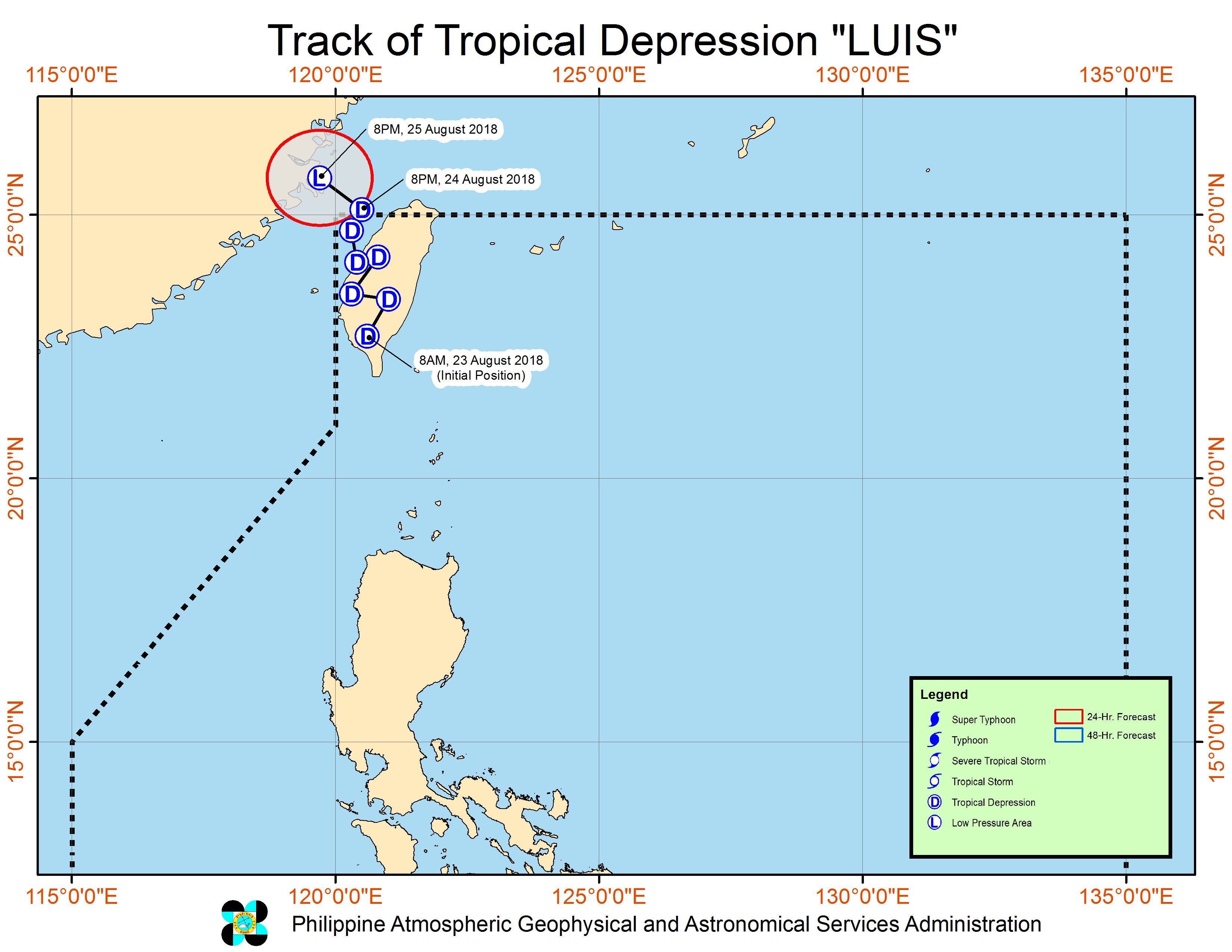
MANILA, Philippines – Tropical Depression Luis left the Philippine Area of Responsibility (PAR) on Friday evening, August 24, but it will continue to enhance the southwest monsoon or hanging habagat.
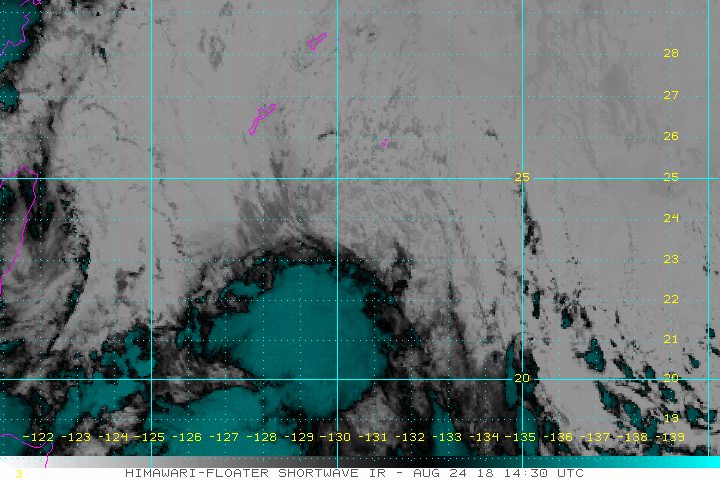
In a bulletin issued 11 pm on Friday, the Philippine Atmospheric, Geophysical, and Astronomical Services Administration (PAGASA) said Luis is now 555 kilometers north northwest of Basco, Batanes, moving north northeast at a slightly slower 8 kilometers per hour (km/h) from the previous 10 km/h.
The tropical depression has maximum winds of 45 km/h near the center and gustiness of up to 70 km/h.
While it was inside PAR, Luis did not directly affect the Philippines, and there were no areas placed under tropical cyclone warning signals. It made landfall on Thursday, August 23, in Taiwan, which is still within PAR due to its proximity to the Philippines.
But Luis did enhance the southwest monsoon, and will continue to do so even after its exit.
The southwest monsoon will trigger moderate to heavy rain in the Ilocos Region, the Cordillera Administrative Region, Batanes, and the Babuyan Group of Islands until this weekend.
Residents of those areas should stay on alert for possible flash floods and landslides. (READ: FAST FACTS: Tropical cyclones, rainfall advisories)
The rest of the country, not affected by the southwest monsoon, will only have localized thunderstorms on Saturday, August 25. But flash floods and landslides are possible, too, if the rain becomes heavy.
A gale warning was also issued at 5 pm on Friday for Batanes, the Babuyan Group of Islands, the northern coast of Cagayan, Ilocos Norte, Ilocos Sur, La Union, Pangasinan, Zambales, Bataan, the eastern coast of Cagayan, Isabela, and Aurora.
This means seas off these areas are rough to very rough, with wave heights reaching 2.6 meters to 4.5 meters.
Fishermen and others with small vessels were advised not to set sail in areas covered by the gale warning. Larger vessels should watch out for big waves.
Meanwhile, PAGASA continues to monitor a low pressure area (LPA) which is already 955 kilometers east northeast of Basco, Batanes.
This LPA has a slim chance of developing into a tropical depression within the next 24 to 48 hours. If it becomes a tropical depression, it would be named Maymay. (READ: LIST: PAGASA’s names for tropical cyclones in 2018)
Luis was the Philippines’ 12th tropical cyclone for 2018. The Philippines usually gets an average of 20 tropical cyclones per year.
PAGASA declared the start of the rainy season last June 8. – Rappler.com
Add a comment
How does this make you feel?
There are no comments yet. Add your comment to start the conversation.